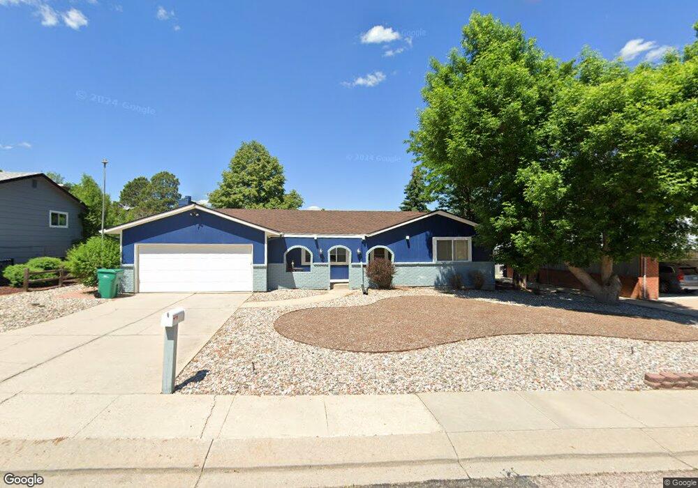
6362 Altman Dr Colorado Springs, CO 80918
Pulpit Rock NeighborhoodEstimated Value: $442,182 - $496,000
3
Beds
2
Baths
1,624
Sq Ft
$288/Sq Ft
Est. Value
About This Home
This home is located at 6362 Altman Dr, Colorado Springs, CO 80918 and is currently estimated at $467,296, approximately $287 per square foot. 6362 Altman Dr is a home located in El Paso County with nearby schools including King Elementary School, Russell Middle School, and Coronado High School.
Ownership History
Date
Name
Owned For
Owner Type
Purchase Details
Closed on
Feb 20, 2021
Sold by
Glese Janet M
Bought by
Giese Ralph G
Current Estimated Value
Home Financials for this Owner
Home Financials are based on the most recent Mortgage that was taken out on this home.
Original Mortgage
$242,000
Outstanding Balance
$216,442
Interest Rate
2.7%
Mortgage Type
New Conventional
Estimated Equity
$250,854
Purchase Details
Closed on
Jun 26, 2017
Sold by
Miller Dan H
Bought by
Giese Ralph G and Giese Janet M
Home Financials for this Owner
Home Financials are based on the most recent Mortgage that was taken out on this home.
Original Mortgage
$199,200
Interest Rate
4.02%
Mortgage Type
New Conventional
Purchase Details
Closed on
Apr 28, 2017
Sold by
Dill Family Trust
Bought by
Miller Dan H
Home Financials for this Owner
Home Financials are based on the most recent Mortgage that was taken out on this home.
Original Mortgage
$199,200
Interest Rate
4.02%
Mortgage Type
New Conventional
Purchase Details
Closed on
Mar 28, 2016
Sold by
Dill Carl
Bought by
Dill Family Trust
Purchase Details
Closed on
Apr 13, 2007
Sold by
Dill Edgar and Dill Donna D
Bought by
Dill Carl and Dill Donna D
Home Financials for this Owner
Home Financials are based on the most recent Mortgage that was taken out on this home.
Original Mortgage
$60,000
Interest Rate
6.15%
Mortgage Type
New Conventional
Purchase Details
Closed on
Feb 12, 1997
Sold by
Dill Carl E and Dill Donna D
Bought by
Dill Edgar and Dill Donna D
Purchase Details
Closed on
Jan 4, 1996
Sold by
Dunham Mildred E
Bought by
Dill Carl E and Dill Donna D
Home Financials for this Owner
Home Financials are based on the most recent Mortgage that was taken out on this home.
Original Mortgage
$93,000
Interest Rate
7.34%
Purchase Details
Closed on
Mar 12, 1984
Bought by
Giese Ralph G
Purchase Details
Closed on
Feb 20, 1976
Bought by
Giese Ralph G
Purchase Details
Closed on
Feb 9, 1976
Bought by
Giese Ralph G
Purchase Details
Closed on
Mar 25, 1974
Bought by
Giese Ralph G
Purchase Details
Closed on
Oct 28, 1966
Bought by
Giese Ralph G
Create a Home Valuation Report for This Property
The Home Valuation Report is an in-depth analysis detailing your home's value as well as a comparison with similar homes in the area
Home Values in the Area
Average Home Value in this Area
Purchase History
| Date | Buyer | Sale Price | Title Company |
|---|---|---|---|
| Giese Ralph G | -- | Homestead Title & Escrow | |
| Giese Ralph G | $249,000 | None Available | |
| Miller Dan H | $230,000 | None Available | |
| Dill Family Trust | $500 | None Available | |
| Dill Carl | -- | -- | |
| Dill Edgar | -- | -- | |
| Dill Carl E | $124,000 | Security Title | |
| Giese Ralph G | -- | -- | |
| Giese Ralph G | -- | -- | |
| Giese Ralph G | -- | -- | |
| Giese Ralph G | -- | -- | |
| Giese Ralph G | -- | -- |
Source: Public Records
Mortgage History
| Date | Status | Borrower | Loan Amount |
|---|---|---|---|
| Open | Giese Ralph G | $242,000 | |
| Previous Owner | Giese Ralph G | $199,200 | |
| Previous Owner | Dill Carl | $60,000 | |
| Previous Owner | Dill Carl E | $93,000 |
Source: Public Records
Tax History Compared to Growth
Tax History
| Year | Tax Paid | Tax Assessment Tax Assessment Total Assessment is a certain percentage of the fair market value that is determined by local assessors to be the total taxable value of land and additions on the property. | Land | Improvement |
|---|---|---|---|---|
| 2025 | $1,523 | $32,670 | -- | -- |
| 2024 | $1,408 | $31,820 | $5,390 | $26,430 |
| 2023 | $1,408 | $31,820 | $5,390 | $26,430 |
| 2022 | $1,246 | $22,270 | $3,960 | $18,310 |
| 2021 | $1,352 | $22,910 | $4,080 | $18,830 |
| 2020 | $1,342 | $19,770 | $3,150 | $16,620 |
| 2019 | $1,335 | $19,770 | $3,150 | $16,620 |
| 2018 | $1,311 | $17,870 | $2,880 | $14,990 |
| 2017 | $742 | $17,870 | $2,880 | $14,990 |
| 2016 | $544 | $17,350 | $3,020 | $14,330 |
| 2015 | $542 | $17,350 | $3,020 | $14,330 |
| 2014 | $516 | $16,530 | $3,020 | $13,510 |
Source: Public Records
Map
Nearby Homes
- 6438 Village Ln Unit 6438
- 6320 Lemonwood Dr
- 6515 Wicklow Cir E
- 6550 Turret Dr
- 6272 Village Ln
- 6170 Castlewood Ln
- 6678 Bethesda Point Unit C
- 6415 Garlock Way
- 6699 Bethesda Point Unit B
- 6180 Garlock Way
- 1725 Applewood Ridge Ct
- 6485 Nanette Way
- 6075 Castlewood Ln
- 6450 Nanette Way
- 1263 York Rd
- 6119 Pine Hill Dr
- 1131 Willow Bend Cir Unit 2
- 1892 Brookdale Dr
- 1510 York Rd Unit 101
- 1510 York Rd Unit 100
- 6346 Altman Dr
- 6378 Altman Dr
- 6357 Ashcroft Dr
- 6373 Ashcroft Dr
- 6341 Ashcroft Dr
- 6392 Altman Dr
- 6328 Altman Dr
- 6359 Altman Dr
- 6387 Ashcroft Dr
- 6371 Altman Dr
- 6347 Altman Dr
- 6383 Altman Dr
- 6327 Ashcroft Dr
- 6335 Altman Dr
- 6403 Ashcroft Dr
- 6418 Altman Dr
- 6304 Altman Dr
- 6395 Altman Dr
- 6370 Lemonwood Dr
- 6360 Lemonwood Dr