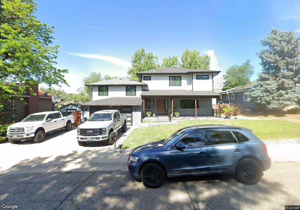
6363 Depew St Arvada, CO 80003
Lamar Heights NeighborhoodEstimated Value: $545,958 - $648,000
3
Beds
5
Baths
1,507
Sq Ft
$388/Sq Ft
Est. Value
About This Home
This home is located at 6363 Depew St, Arvada, CO 80003 and is currently estimated at $585,240, approximately $388 per square foot. 6363 Depew St is a home located in Jefferson County with nearby schools including Swanson Elementary School, North Arvada Middle School, and Arvada High School.
Ownership History
Date
Name
Owned For
Owner Type
Purchase Details
Closed on
Jun 18, 2025
Sold by
Haney Emisha C and Ervin Ruben S
Bought by
Ervin Haney Living Trust and Ervin
Current Estimated Value
Purchase Details
Closed on
Nov 18, 2020
Sold by
Haney Virginia M
Bought by
Haney Emisha C and Ervin Ruben S
Create a Home Valuation Report for This Property
The Home Valuation Report is an in-depth analysis detailing your home's value as well as a comparison with similar homes in the area
Home Values in the Area
Average Home Value in this Area
Purchase History
| Date | Buyer | Sale Price | Title Company |
|---|---|---|---|
| Ervin Haney Living Trust | -- | None Listed On Document | |
| Haney Emisha C | -- | None Available |
Source: Public Records
Tax History Compared to Growth
Tax History
| Year | Tax Paid | Tax Assessment Tax Assessment Total Assessment is a certain percentage of the fair market value that is determined by local assessors to be the total taxable value of land and additions on the property. | Land | Improvement |
|---|---|---|---|---|
| 2024 | $3,367 | $34,709 | $14,056 | $20,653 |
| 2023 | $3,367 | $34,709 | $14,056 | $20,653 |
| 2022 | $2,699 | $27,556 | $12,165 | $15,391 |
| 2021 | $2,743 | $28,349 | $12,515 | $15,834 |
| 2020 | $2,457 | $25,466 | $7,895 | $17,571 |
| 2019 | $2,424 | $25,466 | $7,895 | $17,571 |
| 2018 | $2,107 | $21,516 | $5,645 | $15,871 |
| 2017 | $1,929 | $21,516 | $5,645 | $15,871 |
| 2016 | $1,862 | $19,567 | $5,645 | $13,922 |
| 2015 | $1,565 | $19,567 | $5,645 | $13,922 |
| 2014 | $1,565 | $15,459 | $4,872 | $10,587 |
Source: Public Records
Map
Nearby Homes
- 6373 Depew St
- 5804 W 64th Ave
- 6503 Gray St
- 6185 Sheridan Blvd
- 5320 W 66th Ave
- 6349 Ingalls St
- 6552 Harlan St
- 6080 Fenton St
- 6639 Depew Ct
- 6365 Xavier Ct
- 6581 Harlan St
- 6650 Depew Ct
- 6656 Benton St
- 6367 Xavier St
- 6283 Xavier St
- 5375 W 60th Ave
- 5375 W 60th Ave Unit 2
- 6728 Depew St
- 4964 W 61st Dr
- 6809 Zenobia St Unit 1