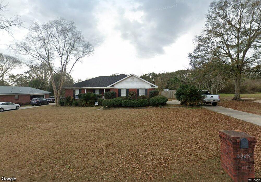
6365 Lauren Dr S Theodore, AL 36582
Westfield NeighborhoodEstimated Value: $213,168 - $251,000
3
Beds
2
Baths
1,845
Sq Ft
$127/Sq Ft
Est. Value
About This Home
This home is located at 6365 Lauren Dr S, Theodore, AL 36582 and is currently estimated at $234,792, approximately $127 per square foot. 6365 Lauren Dr S is a home located in Mobile County with nearby schools including Nan Gray Davis Elementary School, Katherine H Hankins Middle School, and Theodore High School.
Ownership History
Date
Name
Owned For
Owner Type
Purchase Details
Closed on
Jun 29, 2021
Sold by
Davis John Bradley and Miranda Leigh
Bought by
Davis John Bradley and Davis Miranda Leigh
Current Estimated Value
Home Financials for this Owner
Home Financials are based on the most recent Mortgage that was taken out on this home.
Original Mortgage
$131,404
Interest Rate
2.9%
Mortgage Type
New Conventional
Purchase Details
Closed on
Mar 5, 2001
Sold by
Chambers Kenley
Bought by
Davis John B
Create a Home Valuation Report for This Property
The Home Valuation Report is an in-depth analysis detailing your home's value as well as a comparison with similar homes in the area
Home Values in the Area
Average Home Value in this Area
Purchase History
| Date | Buyer | Sale Price | Title Company |
|---|---|---|---|
| Davis John Bradley | -- | Title365 | |
| Davis John B | $14,000 | -- |
Source: Public Records
Mortgage History
| Date | Status | Borrower | Loan Amount |
|---|---|---|---|
| Previous Owner | Davis John Bradley | $131,404 |
Source: Public Records
Tax History Compared to Growth
Tax History
| Year | Tax Paid | Tax Assessment Tax Assessment Total Assessment is a certain percentage of the fair market value that is determined by local assessors to be the total taxable value of land and additions on the property. | Land | Improvement |
|---|---|---|---|---|
| 2024 | $1,085 | $19,900 | $2,800 | $17,100 |
| 2023 | $1,018 | $19,560 | $2,800 | $16,760 |
| 2022 | $770 | $17,260 | $2,800 | $14,460 |
| 2021 | $686 | $15,510 | $2,800 | $12,710 |
| 2020 | $674 | $15,280 | $2,800 | $12,480 |
| 2019 | $768 | $17,220 | $0 | $0 |
| 2018 | $731 | $16,460 | $0 | $0 |
| 2017 | $722 | $16,260 | $0 | $0 |
| 2016 | $696 | $15,740 | $0 | $0 |
| 2013 | $743 | $16,540 | $0 | $0 |
Source: Public Records
Map
Nearby Homes
- 6293 Woodside Dr S
- 6521 Barnes Rd
- 6624 Morgan Jackson Ct
- 6913 Gray Oaks Dr
- 6987 Magnolia Trace
- 6780 Boykin Rd
- 6799 Foxwood Dr
- 6425 Boykin Rd
- 6631 Sandra Dr
- 6795 Browder Dr
- 5950 Theodore Dawes Rd
- 6361 Rester Rd
- 6840 Highmont Dr
- 0 Rester Rd
- 7340 Broadview Dr E
- 7347 Broadview Dr E
- 6551 Tung Ave W
- 6028 Creek Side Trail
- 7432 Havenwood Dr
- 6178 Sperry Rd
- 6355 Lauren Dr S
- 6385 Lauren Dr S
- 6345 Lauren Dr S
- 6360 Lauren Dr S
- 6370 Lauren Dr S
- 6350 Lauren Dr S
- 6742 Barnes Dr W
- 6690 Lauren Dr W
- 6752 Barnes Dr W
- 6730 Barnes Dr W
- 6340 Lauren Dr S
- 6675 Lauren Dr W
- 6680 Lauren Dr W
- 6762 Barnes Dr W
- 6333 Woodside Dr S
- 6330 Lauren Dr S
- 6670 Lauren Dr W
- 6323 Woodside Dr S
- 6313 Woodside Dr S
- 6772 Barnes Dr W