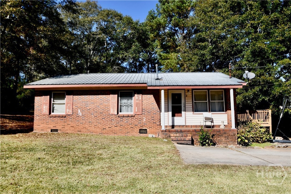
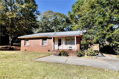
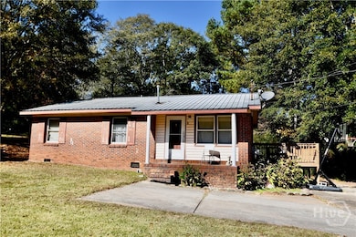
6367 Highway 72 E Carlton, GA 30627
Estimated payment $903/month
Highlights
- No HOA
- Breakfast Area or Nook
- Wood Siding
- Madison County High School Rated A-
- Cooling System Mounted In Outer Wall Opening
- Heat Pump System
About This Home
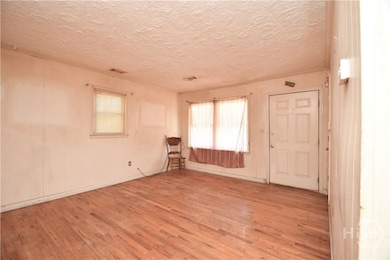
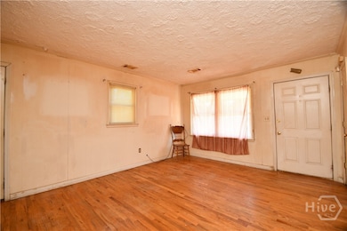
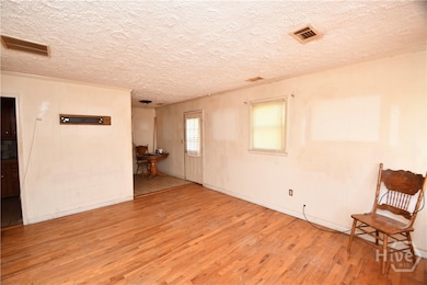
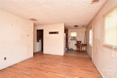
Welcome to this single-level brick residence located just outside of the charming town of Carlton in Madison County. Situated on a generous 1.13-acre lot, this home offers the perfect blend of country tranquility and convenient access to local amenities. Because it's a modest size, this home is ideal for someone looking for a fixer upper!
Listing Agent
Coldwell Banker Upchurch Realty License #168937 Listed on: 11/06/2025

Home Details
Home Type
- Single Family
Est. Annual Taxes
- $1,345
Year Built
- Built in 1973
Lot Details
- 1.13 Acre Lot
- 2 Pads in the community
- Property is zoned CA
Home Design
- Brick Exterior Construction
- Wood Siding
- Concrete Perimeter Foundation
Interior Spaces
- 975 Sq Ft Home
- 1-Story Property
- Crawl Space
- Dryer
Kitchen
- Breakfast Area or Nook
- Oven
- Range
Bedrooms and Bathrooms
- 3 Bedrooms
- 1 Full Bathroom
Utilities
- Cooling System Mounted In Outer Wall Opening
- Heat Pump System
- Private Water Source
- Well
- Electric Water Heater
- Septic Tank
Community Details
- No Home Owners Association
Listing and Financial Details
- Assessor Parcel Number CA02-012
Map
Home Values in the Area
Average Home Value in this Area
Tax History
| Year | Tax Paid | Tax Assessment Tax Assessment Total Assessment is a certain percentage of the fair market value that is determined by local assessors to be the total taxable value of land and additions on the property. | Land | Improvement |
|---|---|---|---|---|
| 2024 | $1,381 | $48,427 | $10,695 | $37,732 |
| 2023 | $1,253 | $43,949 | $8,912 | $35,037 |
| 2022 | $1,080 | $36,557 | $6,128 | $30,429 |
| 2021 | $873 | $25,602 | $6,128 | $19,474 |
| 2020 | $847 | $24,711 | $5,237 | $19,474 |
| 2019 | $596 | $26,639 | $5,761 | $20,878 |
| 2018 | $554 | $25,366 | $5,270 | $20,096 |
| 2017 | $690 | $21,460 | $4,456 | $17,004 |
| 2016 | $280 | $17,989 | $4,050 | $13,939 |
| 2015 | $239 | $17,989 | $4,050 | $13,939 |
| 2014 | $241 | $18,034 | $4,068 | $13,966 |
| 2013 | -- | $18,034 | $4,068 | $13,966 |
Property History
| Date | Event | Price | List to Sale | Price per Sq Ft |
|---|---|---|---|---|
| 11/06/2025 11/06/25 | For Sale | $150,000 | -- | $154 / Sq Ft |
Purchase History
| Date | Type | Sale Price | Title Company |
|---|---|---|---|
| Limited Warranty Deed | $5,000 | -- | |
| Warranty Deed | -- | -- | |
| Warranty Deed | -- | -- | |
| Deed | -- | -- | |
| Deed | -- | -- |
Source: CLASSIC MLS (Athens Area Association of REALTORS®)
MLS Number: CL342770
APN: CA02-012
Disclaimer: Certain information contained herein is derived from information provided by parties other than Homes.com. All information provided is deemed reliable, but is not guaranteed to be accurate and should be independently verified.
![]() IDX information is provided exclusively for personal, non-commercial use, and may not be used for any purpose other than to identify prospective properties consumers may be interested in purchasing. Information is deemed reliable but not guaranteed.
IDX information is provided exclusively for personal, non-commercial use, and may not be used for any purpose other than to identify prospective properties consumers may be interested in purchasing. Information is deemed reliable but not guaranteed.
- 6476 Georgia 72
- 667 Paoli Rd
- 376 Paoli Rd
- 670 S Railroad Ave
- 168 Elm Rd
- 724 Bertha Willis Rd
- 737 Broad River Rd
- 2111 Watson Mill Rd
- 0 Berkley Rd Unit 10545423
- 2110 Watson Mill Rd
- 00 River Rd
- 3614 Georgia 72
- 0 River Rd Unit 10639917
- 730 Osley Mill Rd
- 1163 Nickville Rd
- 600 Piney Grove Rd
- 474 Watson Mill
- 490 Watson Mill
- 5 Watson Mill
- 4 Watson Mill
- 73 E North Ave
- 71 E North Ave
- 69 E North Ave
- 62 Fennell Ln
- 176 Crawford W Long St
- 148 N Upson St
- 157 Beaverdam Creek Rd Unit ID1302838P
- 403 Brown Rd
- 400 Beaver Pointe Dr
- 44 Bond St Unit A
- 204 Breanna Way
- 405 Breanna Way
- 958 Church St
- 359 Railroad St Unit F
- 359 Railroad St Unit B
- 359 Railroad St Unit D
- 159 Brad St
- 163 Brad St
- 310 Weatherly Woods Dr
- 167 Talley Crossing