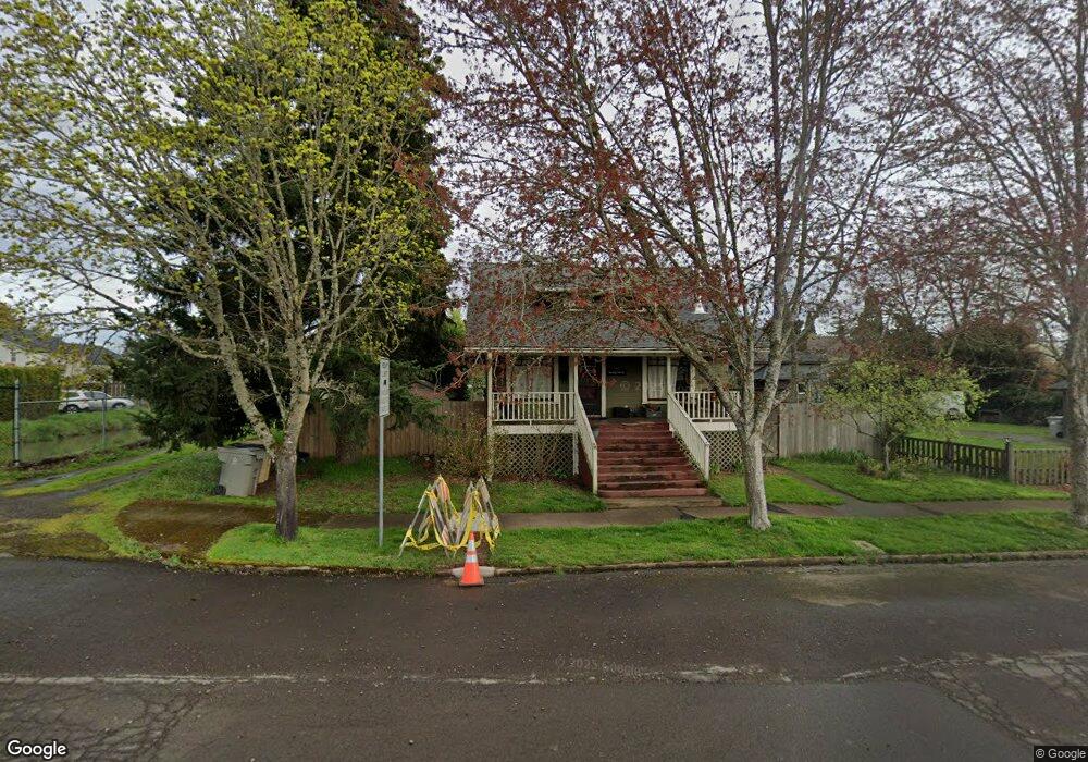
637 10th Ave SW Albany, OR 97321
Central Albany NeighborhoodEstimated Value: $348,145 - $375,000
2
Beds
1
Bath
1,192
Sq Ft
$303/Sq Ft
Est. Value
About This Home
This home is located at 637 10th Ave SW, Albany, OR 97321 and is currently estimated at $361,573, approximately $303 per square foot. 637 10th Ave SW is a home located in Linn County with nearby schools including Central Elementary School, Takena Elementary School, and Memorial Middle School.
Ownership History
Date
Name
Owned For
Owner Type
Purchase Details
Closed on
Aug 30, 2005
Sold by
Holloway Justin D
Bought by
Carlile Donna F
Current Estimated Value
Home Financials for this Owner
Home Financials are based on the most recent Mortgage that was taken out on this home.
Original Mortgage
$131,950
Outstanding Balance
$69,226
Interest Rate
5.64%
Mortgage Type
Fannie Mae Freddie Mac
Estimated Equity
$292,347
Create a Home Valuation Report for This Property
The Home Valuation Report is an in-depth analysis detailing your home's value as well as a comparison with similar homes in the area
Home Values in the Area
Average Home Value in this Area
Purchase History
| Date | Buyer | Sale Price | Title Company |
|---|---|---|---|
| Carlile Donna F | $138,900 | Fidelity Natl Title Ins Co |
Source: Public Records
Mortgage History
| Date | Status | Borrower | Loan Amount |
|---|---|---|---|
| Open | Carlile Donna F | $131,950 |
Source: Public Records
Tax History Compared to Growth
Tax History
| Year | Tax Paid | Tax Assessment Tax Assessment Total Assessment is a certain percentage of the fair market value that is determined by local assessors to be the total taxable value of land and additions on the property. | Land | Improvement |
|---|---|---|---|---|
| 2025 | $3,851 | $193,490 | -- | -- |
| 2024 | $3,739 | $187,860 | -- | -- |
| 2023 | $3,633 | $182,390 | $0 | $0 |
| 2022 | $3,575 | $177,080 | $0 | $0 |
| 2021 | $3,365 | $171,930 | $0 | $0 |
| 2020 | $3,320 | $166,930 | $0 | $0 |
| 2019 | $3,242 | $162,070 | $0 | $0 |
| 2018 | $3,158 | $157,350 | $0 | $0 |
| 2017 | $3,066 | $152,770 | $0 | $0 |
| 2016 | $2,818 | $148,330 | $0 | $0 |
| 2015 | $2,698 | $144,010 | $0 | $0 |
| 2014 | $2,511 | $139,820 | $0 | $0 |
Source: Public Records
Map
Nearby Homes
- 834 9th Ave SW
- 718 Washington St SW
- 516 12th Ave SW
- 821 7th Ave SW
- 618 Washington St SW
- 929 10th Ave SW
- 906 11th Ave SW
- 1220 Walnut St SW
- 700 14th Ave SW
- 1405 Calapooia St SW
- 870 14th Ave SW
- 420 4th (-430 1 2) Ave SW
- 1138 9th Ave SW
- 1510 Walnut St SW
- 1248 Penn St SW
- 520 Pacific Blvd SW
- 515 SW Queen Ave
- 1215 10th Ave SW
- 220 7th Ave SE
- 1420 Park Terrace SW
- 628 9th Ave SW
- 624 9th Ave SW
- 615 10th Ave SW
- 705 10th Ave SW
- 620 9th Ave SW
- 640 10th Ave SW
- 704 9th Ave SW
- 630 10th Ave SW
- 717 10th Ave SW
- 938 Calapooia St SW
- 626 10th Ave SW
- 706 10th Ave SW
- 714 9th Ave SW
- 606 9th Ave SW
- 610 10th Ave SW
- 737 10th Ave SW
- 714 10th Ave SW
- 915 Maple St SW
- 1014 Calapooia St SW
- 651 11th Ave SW