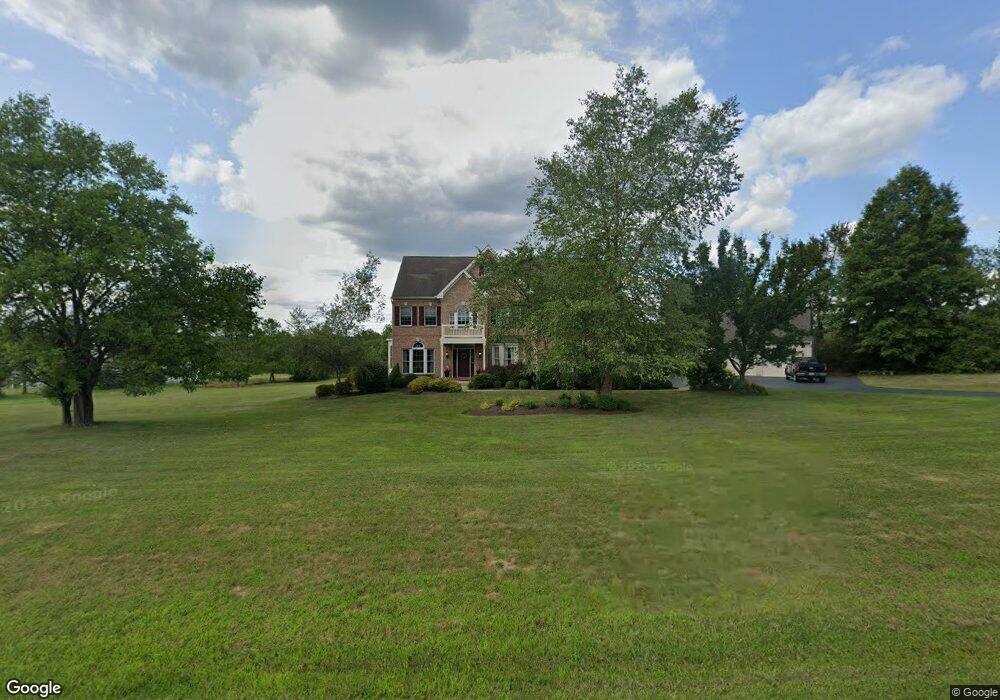
637 Apple Rd Quakertown, PA 18951
Estimated Value: $840,781 - $1,062,000
4
Beds
3
Baths
4,352
Sq Ft
$215/Sq Ft
Est. Value
About This Home
This home is located at 637 Apple Rd, Quakertown, PA 18951 and is currently estimated at $937,445, approximately $215 per square foot. 637 Apple Rd is a home located in Bucks County with nearby schools including Strayer Middle School, Quakertown Community Senior High School, and Quakertown Christian School.
Ownership History
Date
Name
Owned For
Owner Type
Purchase Details
Closed on
Apr 8, 2002
Sold by
Beres Construction Co Inc
Bought by
Cozzi Alfred J and Cozzi Patricia J
Current Estimated Value
Home Financials for this Owner
Home Financials are based on the most recent Mortgage that was taken out on this home.
Original Mortgage
$75,000
Outstanding Balance
$31,158
Interest Rate
6.84%
Estimated Equity
$906,287
Purchase Details
Closed on
Oct 27, 2000
Sold by
Calco Construction Co Inc
Bought by
Beres Construction Co Inc
Purchase Details
Closed on
Aug 7, 2000
Sold by
Moyer Ralph S
Bought by
Calco Construction Co Inc
Home Financials for this Owner
Home Financials are based on the most recent Mortgage that was taken out on this home.
Original Mortgage
$195,000
Interest Rate
8.1%
Create a Home Valuation Report for This Property
The Home Valuation Report is an in-depth analysis detailing your home's value as well as a comparison with similar homes in the area
Home Values in the Area
Average Home Value in this Area
Purchase History
| Date | Buyer | Sale Price | Title Company |
|---|---|---|---|
| Cozzi Alfred J | $395,000 | -- | |
| Beres Construction Co Inc | $69,000 | -- | |
| Calco Construction Co Inc | $225,000 | -- |
Source: Public Records
Mortgage History
| Date | Status | Borrower | Loan Amount |
|---|---|---|---|
| Open | Cozzi Alfred J | $75,000 | |
| Previous Owner | Calco Construction Co Inc | $195,000 |
Source: Public Records
Tax History Compared to Growth
Tax History
| Year | Tax Paid | Tax Assessment Tax Assessment Total Assessment is a certain percentage of the fair market value that is determined by local assessors to be the total taxable value of land and additions on the property. | Land | Improvement |
|---|---|---|---|---|
| 2025 | $11,161 | $54,270 | $5,120 | $49,150 |
| 2024 | $11,161 | $54,270 | $5,120 | $49,150 |
| 2023 | $11,053 | $54,270 | $5,120 | $49,150 |
| 2022 | $10,869 | $54,270 | $5,120 | $49,150 |
| 2021 | $10,869 | $54,270 | $5,120 | $49,150 |
| 2020 | $13,931 | $69,560 | $5,120 | $64,440 |
| 2019 | $13,553 | $69,560 | $5,120 | $64,440 |
| 2018 | $13,093 | $69,560 | $5,120 | $64,440 |
| 2017 | $12,696 | $69,560 | $5,120 | $64,440 |
| 2016 | $12,696 | $69,560 | $5,120 | $64,440 |
| 2015 | -- | $69,560 | $5,120 | $64,440 |
| 2014 | -- | $69,560 | $5,120 | $64,440 |
Source: Public Records
Map
Nearby Homes
- 149 Second St
- 20 N Main St
- 625 Old Bethlehem Rd
- 35 N Linda Ct
- 175 Pullen Station Rd
- 809 Old Bethlehem Rd
- 1142 Apple Rd
- 1107 Hickory Ln
- 1033 Heather Ln
- 325 Pullen Station Rd
- 96 Richlandtown Pike
- 4503 Axe Handle Rd
- 206 Yardley Ct
- 209 Plymouth Ct
- 1136 Red Barn Ln
- 4363 Axe Handle Rd
- 1159 Red Barn Ln
- 1116 School House Ln
- 313 Erie Ave
- 203 N Hellertown Ave