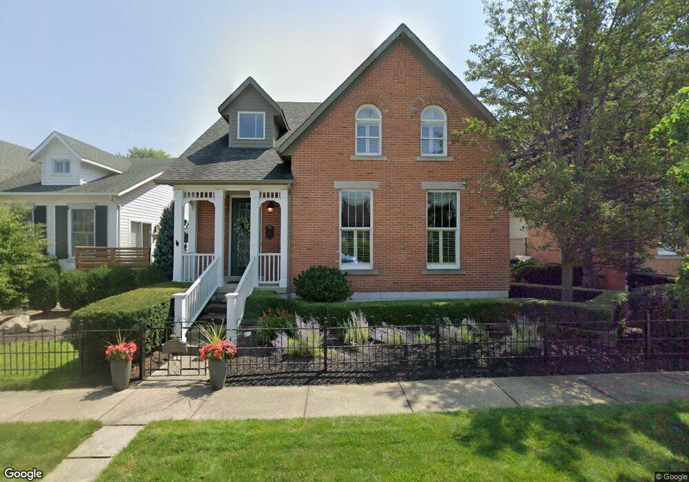
637 Brust Dr Avon Lake, OH 44012
Estimated Value: $595,000 - $655,000
3
Beds
4
Baths
2,287
Sq Ft
$275/Sq Ft
Est. Value
About This Home
This home is located at 637 Brust Dr, Avon Lake, OH 44012 and is currently estimated at $627,848, approximately $274 per square foot. 637 Brust Dr is a home located in Lorain County with nearby schools including Eastview Elementary School, Troy Intermediate Elementary School, and Learwood Middle School.
Ownership History
Date
Name
Owned For
Owner Type
Purchase Details
Closed on
Apr 17, 2017
Sold by
Euller William R and Euller Victoria S
Bought by
Euller Victoria S and Euller 2017 Trust
Current Estimated Value
Purchase Details
Closed on
Dec 29, 2004
Sold by
Sylvester Builders Inc
Bought by
Euller William R and Euller Victoria S
Home Financials for this Owner
Home Financials are based on the most recent Mortgage that was taken out on this home.
Original Mortgage
$175,000
Interest Rate
3.75%
Mortgage Type
Unknown
Create a Home Valuation Report for This Property
The Home Valuation Report is an in-depth analysis detailing your home's value as well as a comparison with similar homes in the area
Home Values in the Area
Average Home Value in this Area
Purchase History
| Date | Buyer | Sale Price | Title Company |
|---|---|---|---|
| Euller Victoria S | -- | First American Title | |
| Euller William R | $434,700 | Multiple | |
| Sylvester Builders Inc | -- | Multiple |
Source: Public Records
Mortgage History
| Date | Status | Borrower | Loan Amount |
|---|---|---|---|
| Previous Owner | Euller William R | $175,000 |
Source: Public Records
Tax History Compared to Growth
Tax History
| Year | Tax Paid | Tax Assessment Tax Assessment Total Assessment is a certain percentage of the fair market value that is determined by local assessors to be the total taxable value of land and additions on the property. | Land | Improvement |
|---|---|---|---|---|
| 2024 | $9,052 | $191,300 | $43,505 | $147,795 |
| 2023 | $7,763 | $145,943 | $29,953 | $115,990 |
| 2022 | $7,664 | $145,611 | $29,953 | $115,658 |
| 2021 | $7,647 | $145,611 | $29,953 | $115,658 |
| 2020 | $7,238 | $127,690 | $26,250 | $101,440 |
| 2019 | $7,200 | $127,690 | $26,250 | $101,440 |
Source: Public Records
Map
Nearby Homes
- 717 Schiller Ct
- 725 Rock Harbor
- 588 S Port Dr
- 544 Port Side Dr
- 742 Brookside Cir
- 0 Lear Rd Unit 5155467
- 32000 Liberty Rose Dr
- Castleton Plan at Port Side - Estates
- Oakmont Plan at Port Side - Reserve
- Continental II Plan at Port Side - Crossings
- Willwood Plan at Port Side - Estates
- Pebble Beach Plan at Port Side - Reserve
- Mercer II Plan at Port Side - Crossings
- Waverly Plan at Port Side - Crossings
- Augusta Plan at Port Side - Reserve
- Newberry II Plan at Port Side - Crossings
- Allison II Plan at Port Side - Estates
- Woodside Plan at Port Side - Estates
- 510 Port Side Dr
- 502 Port Side Dr
- 641 Brust Dr
- 633 Brust Dr
- 629 Brust Dr
- 645 Brust Dr
- 32037 Kossuth Dr
- 32037 Kossuth Dr
- 32037 Kossuth Dr
- 32037 Kossuth Dr
- 32037 Kossuth Dr
- 649 Brust Dr
- 625 Brust Dr
- 32041 Kossuth Dr
- 621 Brust Dr
- 653 Brust Dr
- 32038 Kossuth Dr
- 32038 Handford Blvd
- 32045 Kossuth Dr
- 617 Brust Dr
- 32042 Handford Blvd
- 32042 Kossuth Dr