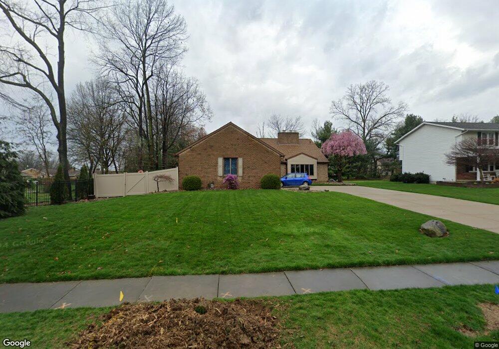
637 Clark Dr Tallmadge, OH 44278
Estimated Value: $335,000 - $453,000
4
Beds
3
Baths
2,042
Sq Ft
$186/Sq Ft
Est. Value
About This Home
This home is located at 637 Clark Dr, Tallmadge, OH 44278 and is currently estimated at $379,962, approximately $186 per square foot. 637 Clark Dr is a home located in Summit County with nearby schools including Tallmadge Middle School, Tallmadge High School, and Steel Academy.
Ownership History
Date
Name
Owned For
Owner Type
Purchase Details
Closed on
Feb 23, 2005
Sold by
Christian R Michael
Bought by
Parry David S and Parry Maureen K
Current Estimated Value
Home Financials for this Owner
Home Financials are based on the most recent Mortgage that was taken out on this home.
Original Mortgage
$132,900
Outstanding Balance
$67,773
Interest Rate
5.8%
Mortgage Type
Purchase Money Mortgage
Estimated Equity
$312,189
Create a Home Valuation Report for This Property
The Home Valuation Report is an in-depth analysis detailing your home's value as well as a comparison with similar homes in the area
Home Values in the Area
Average Home Value in this Area
Purchase History
| Date | Buyer | Sale Price | Title Company |
|---|---|---|---|
| Parry David S | $233,900 | American Certified Title |
Source: Public Records
Mortgage History
| Date | Status | Borrower | Loan Amount |
|---|---|---|---|
| Open | Parry David S | $132,900 |
Source: Public Records
Tax History Compared to Growth
Tax History
| Year | Tax Paid | Tax Assessment Tax Assessment Total Assessment is a certain percentage of the fair market value that is determined by local assessors to be the total taxable value of land and additions on the property. | Land | Improvement |
|---|---|---|---|---|
| 2025 | $5,075 | $101,770 | $28,921 | $72,849 |
| 2024 | $5,075 | $101,770 | $28,921 | $72,849 |
| 2023 | $5,075 | $101,770 | $28,921 | $72,849 |
| 2022 | $5,307 | $86,986 | $24,721 | $62,265 |
| 2021 | $5,330 | $86,986 | $24,721 | $62,265 |
| 2020 | $5,288 | $86,990 | $24,720 | $62,270 |
| 2019 | $5,373 | $79,020 | $12,860 | $66,160 |
| 2018 | $4,733 | $79,020 | $12,860 | $66,160 |
| 2017 | $3,995 | $79,020 | $12,860 | $66,160 |
| 2016 | $4,309 | $66,120 | $12,860 | $53,260 |
| 2015 | $3,995 | $66,120 | $12,860 | $53,260 |
| 2014 | $3,968 | $66,120 | $12,860 | $53,260 |
| 2013 | $4,106 | $69,680 | $12,860 | $56,820 |
Source: Public Records
Map
Nearby Homes
- 617 Northeast Ave
- 557 Wring Dr
- 0 Northeast Ave Unit 5114314
- 313 Whittlesey Dr
- 185 Reserve Dr
- 0 East Ave
- 532 Beverly Dr
- 1072 Carol Ln
- 368 Knollwood Ave
- 0 North Ave Unit 5116540
- 213 Green Hill Dr
- 617 North Ave
- 243 S Munroe Rd
- 528 Fernwood Ave
- 206 Fawnwood Dr
- 313 Southeast Ave
- 288 S Munroe Rd
- 779 Atwood Dr
- 353 Southeast Ave
- 736 Craig Dr
- 647 Clark Dr
- 360 Willson Ave
- 378 Willson Ave
- 638 Sydney Place
- 657 Clark Dr
- 648 Sydney Place
- 388 Willson Ave
- 638 Clark Dr
- 369 Regency Park Dr
- 240 Willson Ave
- 658 Sydney Place
- 667 Clark Dr
- 398 Willson Ave
- 342 Willson Ave
- 367 Willson Ave
- 664 Clark Dr
- 668 Sydney Place
- 677 Clark Dr
- 379 Regency Park Dr
- 387 Willson Ave