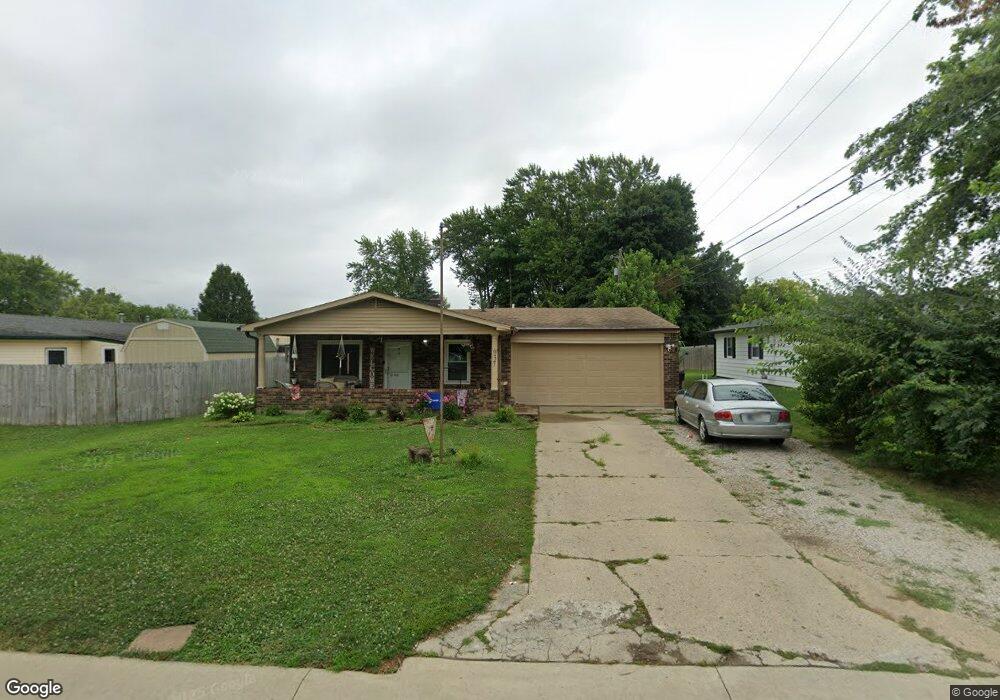
637 Delbrook Dr Whiteland, IN 46184
Estimated Value: $173,000 - $223,000
4
Beds
1
Bath
1,200
Sq Ft
$173/Sq Ft
Est. Value
About This Home
This home is located at 637 Delbrook Dr, Whiteland, IN 46184 and is currently estimated at $207,300, approximately $172 per square foot. 637 Delbrook Dr is a home located in Johnson County with nearby schools including Break-O-Day Elementary School, Clark-Pleasant Middle School, and Whiteland Community High School.
Ownership History
Date
Name
Owned For
Owner Type
Purchase Details
Closed on
Jun 8, 2020
Sold by
Freels Dolores A
Bought by
Clark Leslie A
Current Estimated Value
Home Financials for this Owner
Home Financials are based on the most recent Mortgage that was taken out on this home.
Original Mortgage
$97,185
Outstanding Balance
$86,147
Interest Rate
3.2%
Mortgage Type
VA
Estimated Equity
$121,153
Create a Home Valuation Report for This Property
The Home Valuation Report is an in-depth analysis detailing your home's value as well as a comparison with similar homes in the area
Home Values in the Area
Average Home Value in this Area
Purchase History
| Date | Buyer | Sale Price | Title Company |
|---|---|---|---|
| Clark Leslie A | -- | None Available |
Source: Public Records
Mortgage History
| Date | Status | Borrower | Loan Amount |
|---|---|---|---|
| Open | Clark Leslie A | $97,185 |
Source: Public Records
Tax History Compared to Growth
Tax History
| Year | Tax Paid | Tax Assessment Tax Assessment Total Assessment is a certain percentage of the fair market value that is determined by local assessors to be the total taxable value of land and additions on the property. | Land | Improvement |
|---|---|---|---|---|
| 2025 | $1,620 | $178,600 | $42,000 | $136,600 |
| 2024 | $1,620 | $169,600 | $42,000 | $127,600 |
| 2023 | $1,605 | $162,500 | $42,000 | $120,500 |
| 2022 | $1,551 | $150,500 | $35,000 | $115,500 |
| 2021 | $1,366 | $132,500 | $35,000 | $97,500 |
| 2020 | $731 | $94,500 | $19,600 | $74,900 |
| 2019 | $1,441 | $88,500 | $14,900 | $73,600 |
| 2018 | $1,467 | $90,100 | $12,600 | $77,500 |
| 2017 | $10 | $89,100 | $12,600 | $76,500 |
| 2016 | -- | $80,500 | $12,600 | $67,900 |
| 2014 | -- | $72,500 | $12,500 | $60,000 |
| 2013 | -- | $74,100 | $12,500 | $61,600 |
Source: Public Records
Map
Nearby Homes
- 0 E 700 N Unit MBR22036500
- 539 Delbrook Dr
- 239 Shelton Place
- 230 Parkview Dr
- 250 Southlane Dr
- 624 Sweetbriar Ave
- 821 Princeton Dr
- 840 Sweetbriar Ave
- 241 Mooreland Dr
- 269 Switchgrass Ln
- 287 Bluestem Ln
- 144 Bluestem Ln
- 12 Rypma Row
- 229 Arlington St
- 135 Bradford Place
- 389 Parkway St
- 409 Parkway St
- 50 Meadow Creek Blvd
- 111 Meadow Creek Blvd
- 131 Belaire Dr
- 631 Delbrook Dr
- 311 Pleasant Dr
- 319 Pleasant Dr
- 312 Granada Place
- 328 Granada Place
- 636 Delbrook Dr
- 630 Delbrook Dr
- 325 Pleasant Dr
- 336 Granada Place
- 644 Delbrook Dr
- 607 Circle Ct
- 650 Delbrook Dr
- 320 Pleasant Dr
- 342 Granada Place
- 705 Delbrook Dr
- 325 Granada Place
- 311 Granada Place
- 333 Pleasant Dr
- 702 Delbrook Dr
- 631 Circle Ct