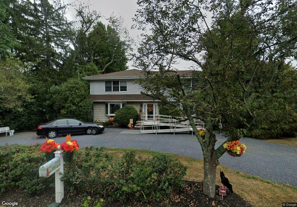
637 Locust Point Rd Rumson, NJ 07760
Estimated Value: $727,000
3
Beds
4
Baths
3,064
Sq Ft
$237/Sq Ft
Est. Value
About This Home
This home is located at 637 Locust Point Rd, Rumson, NJ 07760 and is currently priced at $727,000, approximately $237 per square foot. 637 Locust Point Rd is a home located in Monmouth County with nearby schools including Navesink Elementary School, Bayshore Middle School, and Middletown - South High School.
Ownership History
Date
Name
Owned For
Owner Type
Purchase Details
Closed on
Dec 10, 2020
Sold by
Klein Janet D
Bought by
Klein-Macadam Janet D and Macadam Andrew K
Current Estimated Value
Purchase Details
Closed on
Apr 25, 1985
Bought by
Klein Janet D
Create a Home Valuation Report for This Property
The Home Valuation Report is an in-depth analysis detailing your home's value as well as a comparison with similar homes in the area
Home Values in the Area
Average Home Value in this Area
Purchase History
| Date | Buyer | Sale Price | Title Company |
|---|---|---|---|
| Klein-Macadam Janet D | -- | Trident Abstract Title | |
| Klein Janet D | $83,500 | -- |
Source: Public Records
Tax History
| Year | Tax Paid | Tax Assessment Tax Assessment Total Assessment is a certain percentage of the fair market value that is determined by local assessors to be the total taxable value of land and additions on the property. | Land | Improvement |
|---|---|---|---|---|
| 2025 | -- | $1,165,600 | $665,500 | $500,100 |
| 2024 | -- | $963,700 | $472,800 | $490,900 |
| 2023 | -- | $951,700 | $391,800 | $559,900 |
| 2022 | $0 | $778,000 | $244,900 | $533,100 |
| 2021 | $14,829 | $705,600 | $231,400 | $474,200 |
| 2020 | $14,829 | $693,600 | $230,100 | $463,500 |
| 2019 | $14,592 | $690,900 | $230,100 | $460,800 |
| 2018 | $15,022 | $693,200 | $253,800 | $439,400 |
| 2017 | $15,290 | $698,500 | $264,500 | $434,000 |
| 2016 | $14,365 | $674,100 | $251,000 | $423,100 |
| 2015 | $14,701 | $666,100 | $251,000 | $415,100 |
| 2014 | $11,802 | $521,500 | $228,500 | $293,000 |
Source: Public Records
Map
Nearby Homes
- 96 East Ave Unit 82
- 96 East Ave Unit 76
- 96 East Ave Unit 97
- 26 King James Ln
- 498 Central Ave
- 502 Central Ave
- 96 E East Ave Unit 37
- 500 Central Ave
- 7100 Prospect Ave
- 6998 Prospect Ave
- 114 Memorial Pkwy
- 254 1st Ave
- 50 Memorial Pkwy
- 19 Summit Ave
- 48 Starr Ct
- 119 Chestnut Ave
- 104 E Washington Ave
- 20 Brianna Ct Unit 20
- 16 E Garfield Ave
- 12 E Garfield Ave
- 641 Locust Point Rd
- 633 Locust Point Rd
- 645 Locust Point Rd
- 638 Locust Point Rd
- 629 Locust Point Rd
- 642 Locust Point Rd
- 634 Locust Point Rd
- 649 Locust Point Rd
- 650 Locust Point Rd
- 625 Locust Point Rd
- 628 Locust Point Rd
- 653 Locust Point Rd
- 621 Locust Point Rd
- 35 Latham Ave
- 654 Locust Point Rd
- 617 Locust Point Rd
- 657 Locust Point Rd
- 1 Trovillo Ct
- 7 Trovillo Ct
- 27 Latham Ave
Your Personal Tour Guide
Ask me questions while you tour the home.