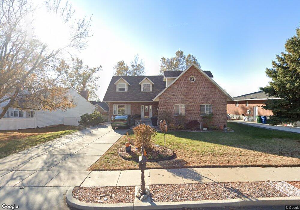
637 N 200 E Kaysville, UT 84037
Estimated Value: $594,000 - $742,000
5
Beds
4
Baths
3,887
Sq Ft
$179/Sq Ft
Est. Value
About This Home
This home is located at 637 N 200 E, Kaysville, UT 84037 and is currently estimated at $695,514, approximately $178 per square foot. 637 N 200 E is a home located in Davis County with nearby schools including Kaysville Elementary School, Kaysville Junior High School, and Davis High School.
Ownership History
Date
Name
Owned For
Owner Type
Purchase Details
Closed on
Feb 21, 2011
Sold by
Mckinnon Todd S and Mckinnon Karen N
Bought by
Mckinnon Todd Stuart and Mckinnon Karen Nelson
Current Estimated Value
Purchase Details
Closed on
Dec 15, 1998
Sold by
Harrison Rick D and Harrison Carla A
Bought by
Mckinnon Todd S and Mckinnon Karen N
Home Financials for this Owner
Home Financials are based on the most recent Mortgage that was taken out on this home.
Original Mortgage
$157,600
Outstanding Balance
$35,218
Interest Rate
6.86%
Estimated Equity
$660,296
Purchase Details
Closed on
Nov 3, 1998
Sold by
Lyon Margie T
Bought by
Harrison Rick D and Harrison Carla A
Home Financials for this Owner
Home Financials are based on the most recent Mortgage that was taken out on this home.
Original Mortgage
$157,600
Outstanding Balance
$35,218
Interest Rate
6.86%
Estimated Equity
$660,296
Create a Home Valuation Report for This Property
The Home Valuation Report is an in-depth analysis detailing your home's value as well as a comparison with similar homes in the area
Home Values in the Area
Average Home Value in this Area
Purchase History
| Date | Buyer | Sale Price | Title Company |
|---|---|---|---|
| Mckinnon Todd Stuart | -- | None Available | |
| Mckinnon Todd S | -- | Associated Title Company | |
| Harrison Rick D | -- | Associated Title Company |
Source: Public Records
Mortgage History
| Date | Status | Borrower | Loan Amount |
|---|---|---|---|
| Open | Mckinnon Todd S | $157,600 |
Source: Public Records
Tax History Compared to Growth
Tax History
| Year | Tax Paid | Tax Assessment Tax Assessment Total Assessment is a certain percentage of the fair market value that is determined by local assessors to be the total taxable value of land and additions on the property. | Land | Improvement |
|---|---|---|---|---|
| 2025 | $3,067 | $334,950 | $162,522 | $172,428 |
| 2024 | $3,067 | $323,400 | $131,676 | $191,724 |
| 2023 | $3,058 | $571,000 | $227,732 | $343,268 |
| 2022 | $3,097 | $324,500 | $122,623 | $201,877 |
| 2021 | $2,942 | $462,000 | $167,630 | $294,370 |
| 2020 | $2,557 | $391,000 | $139,479 | $251,521 |
| 2019 | $2,531 | $380,000 | $164,800 | $215,200 |
| 2018 | $2,291 | $343,000 | $144,296 | $198,704 |
| 2016 | $2,054 | $161,590 | $35,211 | $126,379 |
| 2015 | $1,967 | $146,960 | $35,211 | $111,749 |
| 2014 | $2,075 | $157,841 | $34,772 | $123,069 |
| 2013 | -- | $129,009 | $19,031 | $109,978 |
Source: Public Records
Map
Nearby Homes
- 285 E 500 N
- 457 N 150 E
- 400 N 100 E
- 425 E 500 N
- 250 E 950 N
- 593 N 150 W
- 272 Pin Oak Ln
- 680 N Stonne Ln
- 80 E Center St
- 289 N 700 E
- 1199 E Pheasant View Dr
- 694 S Pheasant View Dr
- 331 E 100 S
- 298 S Bing Cherry Way
- 928 E Mutton Hollow Rd
- 87 E 100 S
- 309 E 100 S
- 772 N Crimson Ln
- 1578 E Maple Way
- 636 E 100 N
- 649 N 200 E
- 200 E 600 N Unit 24
- 200 E 600 N Unit 23
- 200 E 600 N Unit 22
- 200 E 600 N Unit 21
- 642 N 200 E
- 659 N 200 E
- 630 N 200 E
- 150 E 600 N Unit 1
- 150 E 600 N Unit 2
- 150 E 600 N Unit 3
- 150 E 600 N Unit 4
- 150 E 600 N Unit 5
- 150 E 600 N Unit 6
- 150 E 600 N Unit 20
- 150 E 600 N Unit 18
- 150 E 600 N Unit 17
- 150 E 600 N Unit 16
- 150 E 600 N Unit 15
- 150 E 600 N Unit 14