Estimated Value: $602,000 - $829,000
2
Beds
2
Baths
1,440
Sq Ft
$505/Sq Ft
Est. Value
About This Home
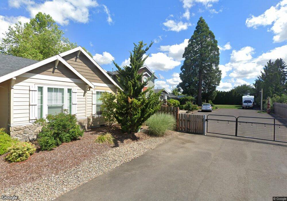
This home is located at 637 NW Territorial Rd, Canby, OR 97013 and is currently estimated at $726,484, approximately $504 per square foot. 637 NW Territorial Rd is a home located in Clackamas County with nearby schools including Josefa L. Sambrano Elementary School, Baker Prairie Middle School, and Canby High School.
Ownership History
Date
Name
Owned For
Owner Type
Purchase Details
Closed on
Jun 16, 2006
Sold by
Arthur David James
Bought by
Vian Jeffery B and Vian Tonya M
Current Estimated Value
Home Financials for this Owner
Home Financials are based on the most recent Mortgage that was taken out on this home.
Original Mortgage
$223,200
Outstanding Balance
$131,838
Interest Rate
6.75%
Mortgage Type
Purchase Money Mortgage
Estimated Equity
$594,646
Purchase Details
Closed on
Sep 11, 1997
Sold by
Arthur David J and Arthur Glen W
Bought by
Arthur David James
Home Financials for this Owner
Home Financials are based on the most recent Mortgage that was taken out on this home.
Original Mortgage
$75,750
Interest Rate
7.34%
Create a Home Valuation Report for This Property
The Home Valuation Report is an in-depth analysis detailing your home's value as well as a comparison with similar homes in the area
Home Values in the Area
Average Home Value in this Area
Purchase History
| Date | Buyer | Sale Price | Title Company |
|---|---|---|---|
| Vian Jeffery B | $279,000 | Chicago Title Insurance Co | |
| Arthur David James | -- | Transnation Title Insurance |
Source: Public Records
Mortgage History
| Date | Status | Borrower | Loan Amount |
|---|---|---|---|
| Open | Vian Jeffery B | $223,200 | |
| Previous Owner | Arthur David James | $75,750 |
Source: Public Records
Tax History Compared to Growth
Tax History
| Year | Tax Paid | Tax Assessment Tax Assessment Total Assessment is a certain percentage of the fair market value that is determined by local assessors to be the total taxable value of land and additions on the property. | Land | Improvement |
|---|---|---|---|---|
| 2025 | $8,343 | $470,924 | -- | -- |
| 2024 | $8,109 | $457,208 | -- | -- |
| 2023 | $8,109 | $443,892 | $0 | $0 |
| 2022 | $7,459 | $430,964 | $0 | $0 |
| 2021 | $7,183 | $418,412 | $0 | $0 |
| 2020 | $7,054 | $406,226 | $0 | $0 |
| 2019 | $6,717 | $394,395 | $0 | $0 |
| 2018 | $6,568 | $382,908 | $0 | $0 |
| 2017 | $6,401 | $371,755 | $0 | $0 |
| 2016 | $6,187 | $360,927 | $0 | $0 |
| 2015 | $5,975 | $350,415 | $0 | $0 |
| 2014 | $5,803 | $340,209 | $0 | $0 |
Source: Public Records
Map
Nearby Homes
- 0 NW 10th Ave
- 960 N Aspen Ct
- 1614 NW 16th Ave
- 1721 N Hyssop St
- 187 NE 14th Ave
- 184 NE 10th Ave
- 312 NE 14th Ave
- 580 N Grant St
- 318 NE 9th Ave
- 1751 N Laurelwood Loop
- 1165 NW 22nd Ave
- 1199 NW 22nd Ave
- 1151 NW 22nd Ave
- 442 NW 4th Ave
- 2152 N Laurelwood St
- 589 NW 3rd Ave
- 660 NE 20th Ave
- 812 NW 3rd Ave
- 850 NW 3rd Ave
- 860 NE 14th Ave
- 659 NW Territorial Rd
- 715 NW Territorial Rd
- 657 NW Territorial Rd
- 615 NW Territorial Rd
- 644 NW 13th Ave
- 664 NW 13th Ave
- 606 NW 13th Ave
- 1403 N Elm St
- 1411 N Elm St
- 655 NW Territorial Rd
- 686 NW 13th Ave
- 1387 N Elm St
- 1453 N Elm St
- 600 NW 13th Ave
- 1370 N Birch St
- 1360 N Birch St
- 735 NW Territorial Rd
- 611 NW Territorial Rd
- 1353 N Elm St
- 1479 N Elm St