Estimated Value: $166,000 - $194,295
3
Beds
3
Baths
1,677
Sq Ft
$108/Sq Ft
Est. Value
About This Home
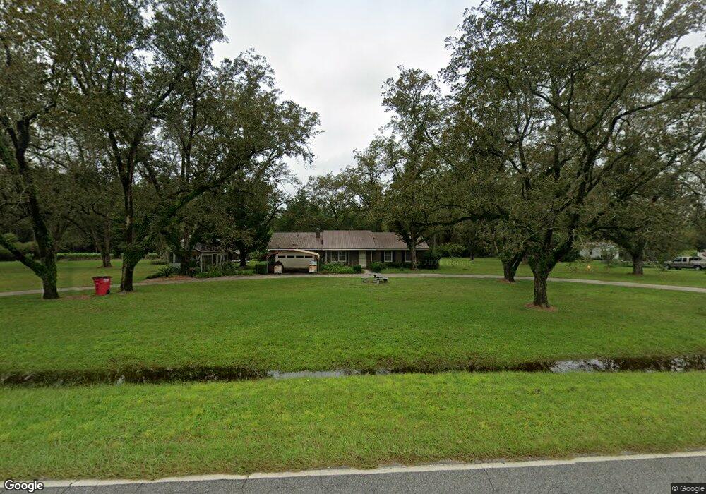
This home is located at 637 Radio Station Rd, Alma, GA 31510 and is currently estimated at $181,574, approximately $108 per square foot. 637 Radio Station Rd is a home located in Bacon County with nearby schools including Bacon County Primary School, Bacon County Elementary School, and Bacon County Middle School.
Ownership History
Date
Name
Owned For
Owner Type
Purchase Details
Closed on
May 19, 2023
Sold by
Wells John
Bought by
Palomares Guadalupe and Morales Asucena Cisneros
Current Estimated Value
Home Financials for this Owner
Home Financials are based on the most recent Mortgage that was taken out on this home.
Original Mortgage
$130,498
Outstanding Balance
$116,808
Interest Rate
5.76%
Mortgage Type
New Conventional
Estimated Equity
$64,766
Purchase Details
Closed on
Mar 24, 1997
Sold by
Sr Abney W and Sr Sr
Bought by
Wells John W and Wells Cora
Create a Home Valuation Report for This Property
The Home Valuation Report is an in-depth analysis detailing your home's value as well as a comparison with similar homes in the area
Home Values in the Area
Average Home Value in this Area
Purchase History
| Date | Buyer | Sale Price | Title Company |
|---|---|---|---|
| Palomares Guadalupe | $162,500 | -- | |
| Wells John W | $50,000 | -- |
Source: Public Records
Mortgage History
| Date | Status | Borrower | Loan Amount |
|---|---|---|---|
| Open | Palomares Guadalupe | $130,498 |
Source: Public Records
Tax History Compared to Growth
Tax History
| Year | Tax Paid | Tax Assessment Tax Assessment Total Assessment is a certain percentage of the fair market value that is determined by local assessors to be the total taxable value of land and additions on the property. | Land | Improvement |
|---|---|---|---|---|
| 2024 | $1,696 | $66,756 | $5,280 | $61,476 |
| 2023 | $1,664 | $61,076 | $4,960 | $56,116 |
| 2022 | $1,174 | $43,076 | $4,960 | $38,116 |
| 2021 | $1,100 | $40,356 | $4,960 | $35,396 |
| 2020 | $1,042 | $36,453 | $4,160 | $32,293 |
| 2019 | $1,239 | $36,453 | $4,160 | $32,293 |
| 2018 | $795 | $34,824 | $4,160 | $30,664 |
| 2017 | $1,000 | $34,824 | $4,160 | $30,664 |
| 2016 | $795 | $34,824 | $4,160 | $30,664 |
| 2015 | $783 | $34,473 | $4,160 | $30,312 |
| 2014 | $654 | $34,473 | $4,160 | $30,312 |
| 2013 | $654 | $29,845 | $4,071 | $25,774 |
Source: Public Records
Map
Nearby Homes
- 301 Taylor Rd
- 403 S Ware St
- 122 Grace Loop Unit 1
- 118 Grace Loop Unit 1
- 117 Grace Loop Unit 1
- 9TH E 417
- 1348 U S 1
- 314 W 16th St
- 0 E 6th St Unit 114222
- 113 Brite Blue Dr
- 166 Grace Loop Unit 1
- 907 N Pierce St
- 0 Oriole Rd Unit 160930
- 0 Oriole Rd Unit 23852171
- 0 Oriole Rd Unit 1654653
- 0 Oriole Rd Unit 10543585
- 401 Lee St
- 245 Starling Rd
- 118 Morris Dr
- 1109 W 4th Street Extension
- 629 Radio Station Rd
- 653 Radio Station Rd
- 636 Radio Station Rd
- 623 Radio Station Rd
- 619 Radio Station Rd
- 613 Radio Station Rd
- 667 Radio Station Rd
- 607 Radio Station Rd
- 507 Townsend Ln
- 603 Radio Station Rd
- 505 Townsend Ln
- 0 Townsend Ln
- 632 Radio Station Rd
- 679 Radio Station Rd
- 310 Crosby Rd
- 511 Radio Station Rd
- 506 Townsend Ln
- 0 Rd
- 308 Crosby Rd
- 510 Radio Station Rd