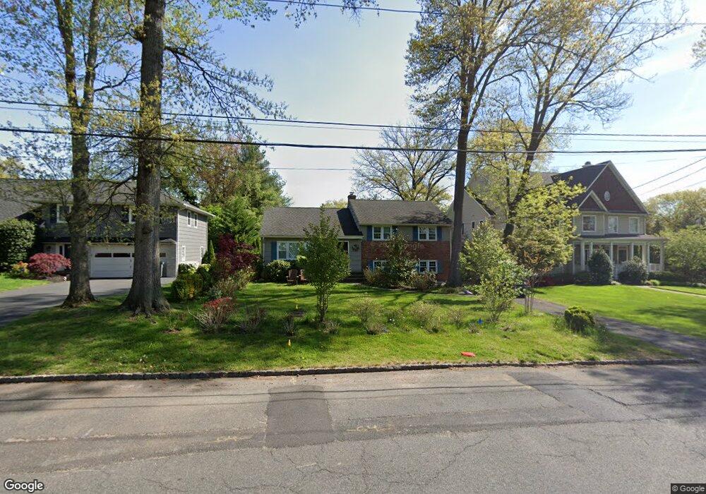
637 S Chestnut St Westfield, NJ 07090
Estimated Value: $1,106,000 - $1,153,000
--
Bed
--
Bath
2,318
Sq Ft
$487/Sq Ft
Est. Value
About This Home
This home is located at 637 S Chestnut St, Westfield, NJ 07090 and is currently estimated at $1,128,356, approximately $486 per square foot. 637 S Chestnut St is a home located in Union County with nearby schools including Washington Elementary School, Roosevelt Intermediate School, and Westfield Senior High School.
Ownership History
Date
Name
Owned For
Owner Type
Purchase Details
Closed on
Aug 21, 2009
Sold by
Gale Judith A
Bought by
Rodriguez Justin A and Milan Melanie A
Current Estimated Value
Home Financials for this Owner
Home Financials are based on the most recent Mortgage that was taken out on this home.
Original Mortgage
$417,000
Interest Rate
4.65%
Mortgage Type
New Conventional
Purchase Details
Closed on
Dec 6, 1999
Sold by
Reidenberg Joel R and Reidenberg Pascale
Bought by
Gale Michael B and Gale Judith A
Home Financials for this Owner
Home Financials are based on the most recent Mortgage that was taken out on this home.
Original Mortgage
$45,000
Interest Rate
7.87%
Mortgage Type
Stand Alone First
Purchase Details
Closed on
Sep 23, 1993
Sold by
Mendoza Robt E
Bought by
Reidenberg Joel R and Riedenberg Pascale
Home Financials for this Owner
Home Financials are based on the most recent Mortgage that was taken out on this home.
Original Mortgage
$203,000
Interest Rate
6.73%
Create a Home Valuation Report for This Property
The Home Valuation Report is an in-depth analysis detailing your home's value as well as a comparison with similar homes in the area
Home Values in the Area
Average Home Value in this Area
Purchase History
| Date | Buyer | Sale Price | Title Company |
|---|---|---|---|
| Rodriguez Justin A | $524,000 | None Available | |
| Gale Michael B | $353,000 | Chicago Title Insurance Co | |
| Reidenberg Joel R | $275,000 | -- |
Source: Public Records
Mortgage History
| Date | Status | Borrower | Loan Amount |
|---|---|---|---|
| Closed | Rodriguez Justin A | $417,000 | |
| Previous Owner | Gale Michael B | $45,000 | |
| Previous Owner | Reidenberg Joel R | $203,000 |
Source: Public Records
Tax History Compared to Growth
Tax History
| Year | Tax Paid | Tax Assessment Tax Assessment Total Assessment is a certain percentage of the fair market value that is determined by local assessors to be the total taxable value of land and additions on the property. | Land | Improvement |
|---|---|---|---|---|
| 2025 | $14,003 | $621,800 | $436,700 | $185,100 |
| 2024 | $13,717 | $621,800 | $436,700 | $185,100 |
| 2023 | $13,717 | $621,800 | $436,700 | $185,100 |
| 2022 | $13,431 | $621,800 | $436,700 | $185,100 |
| 2021 | $13,450 | $621,800 | $436,700 | $185,100 |
| 2020 | $13,418 | $621,800 | $436,700 | $185,100 |
| 2019 | $13,369 | $621,800 | $436,700 | $185,100 |
| 2018 | $15,359 | $165,200 | $76,300 | $88,900 |
| 2017 | $15,274 | $165,200 | $76,300 | $88,900 |
| 2016 | $14,916 | $165,200 | $76,300 | $88,900 |
| 2015 | $14,619 | $165,200 | $76,300 | $88,900 |
| 2014 | $14,136 | $165,200 | $76,300 | $88,900 |
Source: Public Records
Map
Nearby Homes
- 105 Chestnut Ct Unit 3
- 519 3rd Ave
- 529 Benson Place
- 500 Maple Ct Unit 500
- 629 Tremont Ave
- 565 Willow Ave
- 806 Saint Marks Ave
- 401 Brookside Place
- 7 Folkstone Dr
- 764 Fairacres Ave
- 339 2nd Ave
- 305 Cedar St
- 4 Cedar St
- 343 South Ave
- 131 Wells St
- 534 E Broad St
- 112 Linden Ave
- 410 Lenox Ave
- 820 E Broad St
- 928 Columbus Ave
- 631 S Chestnut St
- 643 S Chestnut St
- 625 S Chestnut St
- 622 Salter Place
- 624 Salter Place
- 619 S Chestnut St
- 0 Brandt Ct Unit 3757983
- 0 Brandt Ct Unit 3591801
- 0 Brandt Ct Unit 3487414
- 618 Salter Place
- 620 S Chestnut St
- 618 S Chestnut St
- 613 S Chestnut St
- 612 Salter Place
- 608 Salter Place
- 614 S Chestnut St
- 635 Salter Place
- 629 Salter Place
- 607 S Chestnut St
- 639 Salter Place