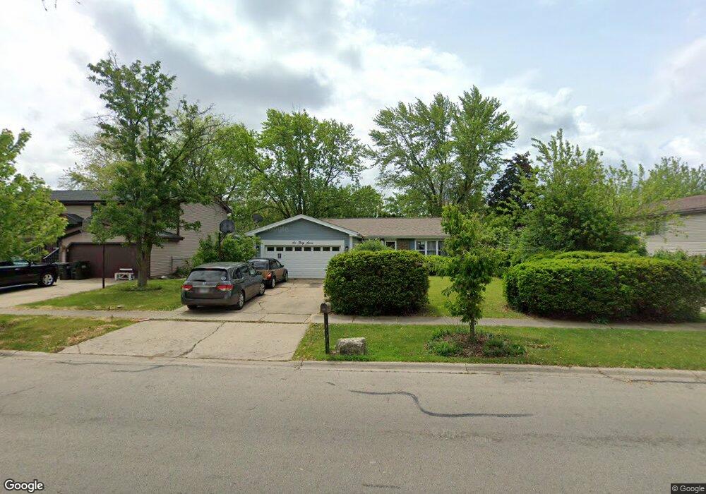
637 W Briarcliff Rd Bolingbrook, IL 60440
East Bolingbrook NeighborhoodEstimated Value: $326,366 - $377,000
4
Beds
2
Baths
1,656
Sq Ft
$211/Sq Ft
Est. Value
About This Home
This home is located at 637 W Briarcliff Rd, Bolingbrook, IL 60440 and is currently estimated at $349,342, approximately $210 per square foot. 637 W Briarcliff Rd is a home located in Will County with nearby schools including Oak View Elementary School, Bolingbrook High School, and Furqaan Academy.
Ownership History
Date
Name
Owned For
Owner Type
Purchase Details
Closed on
Mar 21, 1994
Sold by
Hamer Geraldine
Bought by
Nail Larry R and Nail Twila A
Current Estimated Value
Home Financials for this Owner
Home Financials are based on the most recent Mortgage that was taken out on this home.
Original Mortgage
$113,763
Interest Rate
7.17%
Create a Home Valuation Report for This Property
The Home Valuation Report is an in-depth analysis detailing your home's value as well as a comparison with similar homes in the area
Home Values in the Area
Average Home Value in this Area
Purchase History
| Date | Buyer | Sale Price | Title Company |
|---|---|---|---|
| Nail Larry R | $115,000 | -- |
Source: Public Records
Mortgage History
| Date | Status | Borrower | Loan Amount |
|---|---|---|---|
| Closed | Nail Larry R | $113,763 |
Source: Public Records
Tax History Compared to Growth
Tax History
| Year | Tax Paid | Tax Assessment Tax Assessment Total Assessment is a certain percentage of the fair market value that is determined by local assessors to be the total taxable value of land and additions on the property. | Land | Improvement |
|---|---|---|---|---|
| 2024 | $8,525 | $100,303 | $20,374 | $79,929 |
| 2023 | $8,525 | $90,249 | $18,332 | $71,917 |
| 2022 | $7,215 | $78,995 | $16,046 | $62,949 |
| 2021 | $6,832 | $73,861 | $15,003 | $58,858 |
| 2020 | $6,618 | $71,433 | $14,510 | $56,923 |
| 2019 | $6,400 | $68,031 | $13,819 | $54,212 |
| 2018 | $6,007 | $63,837 | $12,967 | $50,870 |
| 2017 | $5,713 | $60,509 | $12,291 | $48,218 |
| 2016 | $5,541 | $57,600 | $11,700 | $45,900 |
| 2015 | $4,911 | $55,200 | $11,200 | $44,000 |
| 2014 | $4,911 | $55,200 | $11,200 | $44,000 |
| 2013 | $4,911 | $51,600 | $10,500 | $41,100 |
Source: Public Records
Map
Nearby Homes
- 118 Springleaf Dr Unit 5
- 117 Galewood Dr
- 129 Galewood Dr
- 565 Cottonwood Cir
- 164 Galewood Dr
- 207 Hampdon Ct
- 534 Cottonwood Cir
- 530 Cottonwood Cir
- 112 S Orchard Dr
- 157 N Orchard Dr
- 261 Bryant Way
- 210 Mill Stream Dr
- 224 Radcliff Dr
- 228 Elkhorn Ct Unit B
- 545 Old Stone Rd
- 461 Cumberland Ln
- 621 Sundance Dr
- 234 Dakota Ct Unit C
- 206 Christine Way Unit 2
- 650 Sundance Dr
- 641 W Briarcliff Rd
- 633 W Briarcliff Rd
- 637 Ponderosa Dr
- 633 Ponderosa Dr
- 645 W Briarcliff Rd
- 641 Ponderosa Dr
- 629 W Briarcliff Rd
- 629 Ponderosa Dr
- 645 Ponderosa Dr
- 636 W Briarcliff Rd
- 640 W Briarcliff Rd
- 649 W Briarcliff Rd
- 625 Ponderosa Dr
- 644 W Briarcliff Rd
- 632 W Briarcliff Rd
- 648 W Briarcliff Rd
- 628 W Briarcliff Rd
- 621 Ponderosa Dr
- 653 W Briarcliff Rd Unit 7