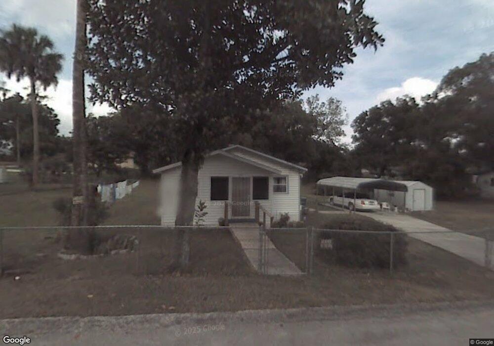
637 W Hubbard Ave Deland, FL 32720
Estimated Value: $147,000 - $206,000
2
Beds
1
Bath
852
Sq Ft
$212/Sq Ft
Est. Value
About This Home
This home is located at 637 W Hubbard Ave, Deland, FL 32720 and is currently estimated at $180,228, approximately $211 per square foot. 637 W Hubbard Ave is a home located in Volusia County with nearby schools including Edith I. Starke Elementary School, Deland High School, and Southwestern Middle School.
Ownership History
Date
Name
Owned For
Owner Type
Purchase Details
Closed on
Aug 11, 2015
Sold by
Cr Properties 2015 Llc
Bought by
Dilligard Terry and Dilligard Jeannine
Current Estimated Value
Purchase Details
Closed on
Jul 13, 2015
Sold by
Deutsche Bank National Trust Company
Bought by
Cr Properties 2015 Llc
Purchase Details
Closed on
Apr 1, 2014
Sold by
Bivins Josephine and Bivins Harvey L
Bought by
Deutsche Bank National Trust Company
Purchase Details
Closed on
Sep 28, 2007
Sold by
Bivins Arthur L
Bought by
Harvey L G
Purchase Details
Closed on
Jun 6, 1994
Sold by
Bivins Josephine
Bought by
Bivins Arthur L and Bivins Josephine
Create a Home Valuation Report for This Property
The Home Valuation Report is an in-depth analysis detailing your home's value as well as a comparison with similar homes in the area
Home Values in the Area
Average Home Value in this Area
Purchase History
| Date | Buyer | Sale Price | Title Company |
|---|---|---|---|
| Dilligard Terry | $25,000 | Ability Title Inc | |
| Cr Properties 2015 Llc | $8,800 | Premium Title Services Inc | |
| Deutsche Bank National Trust Company | -- | None Available | |
| Harvey L G | -- | None Available | |
| Bivins Arthur L | -- | -- |
Source: Public Records
Tax History Compared to Growth
Tax History
| Year | Tax Paid | Tax Assessment Tax Assessment Total Assessment is a certain percentage of the fair market value that is determined by local assessors to be the total taxable value of land and additions on the property. | Land | Improvement |
|---|---|---|---|---|
| 2025 | $1,424 | $126,365 | $31,460 | $94,905 |
| 2024 | $1,424 | $127,144 | $31,460 | $95,684 |
| 2023 | $1,424 | $112,823 | $21,736 | $91,087 |
| 2022 | $1,321 | $103,243 | $21,736 | $81,507 |
| 2021 | $1,219 | $82,087 | $17,160 | $64,927 |
| 2020 | $1,109 | $73,672 | $13,442 | $60,230 |
| 2019 | $1,053 | $66,904 | $11,609 | $55,295 |
| 2018 | $931 | $50,354 | $9,776 | $40,578 |
| 2017 | $832 | $38,832 | $9,152 | $29,680 |
| 2016 | $719 | $31,298 | $0 | $0 |
| 2015 | $782 | $32,944 | $0 | $0 |
| 2014 | -- | $26,383 | $0 | $0 |
Source: Public Records
Map
Nearby Homes
- 632 W Hubbard Ave
- 624 W Euclid Ave
- 526 W Hubbard Ave
- 536 W Hubbard Ave
- 800 W Hubbard Ave
- 736 S Stone St
- 534 S Adelle Ave
- 706 W Franklin Ave
- 817 W Euclid Ave
- 305 S Stone St
- 816 W Franklin Ave
- 705 W Beresford Ave
- 647 S Delaware Ave
- 406 S Delaware Ave
- 247 S Marydell Ave
- 412 W Beresford Ave
- 430 S Parsons Ave
- 241 S Marydell Ave
- 709 S Parsons Ave
- 540 W Mathis St
- 647 W Hubbard Ave
- 635 W Hubbard Ave
- 632 W Division St
- 626 W Division St
- 636 W Hubbard Ave
- 630 W Division St
- 701 S Stone St
- 624 W Division St
- 721 S Stone St
- 716 W Hubbard Ave
- 621 W Hubbard Ave
- 630 W Hubbard Ave
- 716 S Stone St
- 631 W Division St
- 635 W Division St
- 627 W Division St
- 515 Hemingway Ct
- 624 W Hubbard Ave
- 609 W Hubbard Ave
- 519 Hemingway Ct