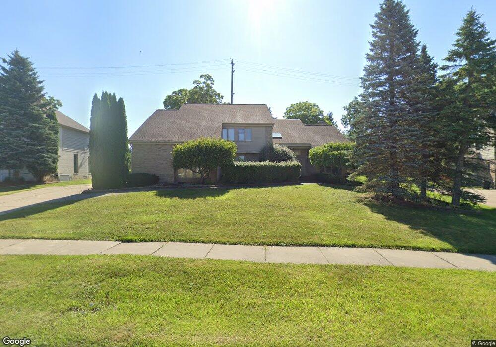
6373 Royal Pointe Dr West Bloomfield, MI 48322
Estimated Value: $518,803 - $715,000
3
Beds
3
Baths
3,362
Sq Ft
$187/Sq Ft
Est. Value
About This Home
This home is located at 6373 Royal Pointe Dr, West Bloomfield, MI 48322 and is currently estimated at $628,451, approximately $186 per square foot. 6373 Royal Pointe Dr is a home located in Oakland County with nearby schools including Sheiko Elementary School, West Bloomfield Middle School, and Bloomfield Maples Montessori.
Ownership History
Date
Name
Owned For
Owner Type
Purchase Details
Closed on
Dec 30, 2022
Sold by
Petrous Sumer
Bought by
Petrous Sumer and Petrous Sabah
Current Estimated Value
Purchase Details
Closed on
Oct 7, 2016
Sold by
Petrous Sumer and Petrous Samer
Bought by
Petrous Sumer
Home Financials for this Owner
Home Financials are based on the most recent Mortgage that was taken out on this home.
Original Mortgage
$296,000
Interest Rate
3.44%
Mortgage Type
New Conventional
Purchase Details
Closed on
Jul 7, 2014
Sold by
Petrous Sumer
Bought by
Petrous Sumer
Purchase Details
Closed on
Feb 10, 2014
Sold by
Dally Balsam N and Dally Faraj
Bought by
Petrous Sumer
Home Financials for this Owner
Home Financials are based on the most recent Mortgage that was taken out on this home.
Original Mortgage
$297,000
Interest Rate
4.54%
Mortgage Type
New Conventional
Create a Home Valuation Report for This Property
The Home Valuation Report is an in-depth analysis detailing your home's value as well as a comparison with similar homes in the area
Home Values in the Area
Average Home Value in this Area
Purchase History
| Date | Buyer | Sale Price | Title Company |
|---|---|---|---|
| Petrous Sumer | -- | -- | |
| Petrous Sumer | -- | Coretitle Llc | |
| Petrous Sumer | -- | None Available | |
| Petrous Sumer | $330,000 | Continental Title Agency Llc |
Source: Public Records
Mortgage History
| Date | Status | Borrower | Loan Amount |
|---|---|---|---|
| Previous Owner | Petrous Sumer | $296,000 | |
| Previous Owner | Petrous Sumer | $297,000 |
Source: Public Records
Tax History Compared to Growth
Tax History
| Year | Tax Paid | Tax Assessment Tax Assessment Total Assessment is a certain percentage of the fair market value that is determined by local assessors to be the total taxable value of land and additions on the property. | Land | Improvement |
|---|---|---|---|---|
| 2024 | $4,664 | $212,060 | $0 | $0 |
| 2022 | $4,461 | $174,480 | $26,490 | $147,990 |
| 2021 | $6,677 | $163,580 | $0 | $0 |
| 2020 | $4,174 | $164,870 | $26,490 | $138,380 |
| 2018 | $6,526 | $158,980 | $26,490 | $132,490 |
| 2015 | -- | $152,440 | $0 | $0 |
| 2014 | -- | $142,080 | $0 | $0 |
| 2011 | -- | $144,420 | $0 | $0 |
Source: Public Records
Map
Nearby Homes
- 5727 Royal Wood
- 6265 Potomac Cir
- 5353 Wright Way W
- 6684 Stonebridge E
- 5106 Rock Run
- 5216 Brett Ct Unit 53
- 5965 Crestwood Dr
- 5835 Drake Rd
- 6783 Burtonwood Dr
- 6323 Potomac Cir Unit 22
- 6880 Burtonwood Dr
- 6121 Westbrooke Dr Unit 7
- 6607 Westbrooke Ct
- 5015 Langlewood Dr
- 6693 Maple Lakes Dr Unit 62
- 6677 Maple Lakes Dr
- 6716 Maple Lakes Dr
- 6715 Maple Lakes Dr Unit 70
- 6740 Ridgefield Cir Unit 103
- 5428 Hammersmith Dr
- 6391 Royal Pointe Dr
- 6355 Royal Pointe Dr
- 6372 Royal Pointe Dr
- 6337 Royal Pointe Dr
- 6409 Royal Pointe Dr
- 6400 Royal Pointe Dr
- 6346 Royal Pointe Dr
- 6319 Royal Pointe Dr
- 6427 Royal Pointe Dr
- 6428 Royal Pointe Dr
- 5537 Silver Pond
- 5520 Silver
- 5520 Silver Pond
- 6301 Royal Pointe Dr
- 6445 Royal Pointe Dr
- 5555 Silver Pond
- 6446 Royal Pointe Dr
- 5538 Silver Pond Unit Bldg-Unit
- 5538 Silver Pond
- 5556 Silver Pond