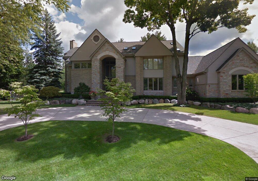
6379 Muirfield Dr Unit Bldg-Unit Bloomfield Hills, MI 48301
Estimated Value: $1,788,000 - $1,927,000
4
Beds
7
Baths
5,554
Sq Ft
$339/Sq Ft
Est. Value
About This Home
This home is located at 6379 Muirfield Dr Unit Bldg-Unit, Bloomfield Hills, MI 48301 and is currently estimated at $1,881,712, approximately $338 per square foot. 6379 Muirfield Dr Unit Bldg-Unit is a home located in Oakland County with nearby schools including Conant Elementary School, South Hills Middle School, and Bloomfield Hills High School.
Ownership History
Date
Name
Owned For
Owner Type
Purchase Details
Closed on
Jan 30, 2018
Sold by
Orley Randall C and Orley Kaplan
Bought by
Nodel Jordan and Nodel Michal
Current Estimated Value
Home Financials for this Owner
Home Financials are based on the most recent Mortgage that was taken out on this home.
Original Mortgage
$911,200
Outstanding Balance
$767,002
Interest Rate
3.75%
Mortgage Type
Adjustable Rate Mortgage/ARM
Estimated Equity
$1,114,710
Create a Home Valuation Report for This Property
The Home Valuation Report is an in-depth analysis detailing your home's value as well as a comparison with similar homes in the area
Home Values in the Area
Average Home Value in this Area
Purchase History
| Date | Buyer | Sale Price | Title Company |
|---|---|---|---|
| Nodel Jordan | $1,139,000 | Interstate Title Inc |
Source: Public Records
Mortgage History
| Date | Status | Borrower | Loan Amount |
|---|---|---|---|
| Open | Nodel Jordan | $911,200 |
Source: Public Records
Tax History Compared to Growth
Tax History
| Year | Tax Paid | Tax Assessment Tax Assessment Total Assessment is a certain percentage of the fair market value that is determined by local assessors to be the total taxable value of land and additions on the property. | Land | Improvement |
|---|---|---|---|---|
| 2024 | $12,332 | $697,230 | $0 | $0 |
| 2023 | $11,934 | $677,210 | $0 | $0 |
| 2022 | $22,428 | $606,900 | $0 | $0 |
| 2021 | $22,267 | $581,780 | $0 | $0 |
| 2020 | $10,998 | $578,090 | $0 | $0 |
| 2019 | $22,506 | $604,850 | $0 | $0 |
| 2018 | $16,852 | $572,380 | $0 | $0 |
| 2017 | $16,784 | $595,930 | $0 | $0 |
| 2016 | $16,762 | $578,030 | $0 | $0 |
| 2015 | -- | $571,760 | $0 | $0 |
| 2014 | -- | $538,090 | $0 | $0 |
| 2011 | -- | $431,490 | $0 | $0 |
Source: Public Records
Map
Nearby Homes
- 4456 W Maple Rd
- 6572 Spruce Dr
- 6701 Franklin Rd
- 6750 Wing Lake Rd
- 750 Trailwood Path Unit B
- 450 Billingsgate Ct Unit C
- 1760 Trailwood Path
- 5904 Wing Lake Rd
- 6660 Woodbank Dr
- 6940 Wing Lake Rd
- 6041 Eastmoor Rd
- 6720 Castle Dr
- 4603 Hedgewood Dr
- 7100 Wing Lake Rd
- 6386 Thorncrest Dr
- 4665 W Maple Rd
- 7005 Cathedral Dr
- 4597 Broughton Dr
- 6952 Sandalwood Dr
- 6800 Crestway Dr
- 6379 Muirfield Dr
- 6380 Wing Lake Rd
- 6388 Wing Lake Rd
- 4360 Prestwick Ln
- 6394 Muirfield Ct
- 6394 Wing Lake Rd
- 6388 Muirfield Ct
- 6351 Muirfield Dr
- 6375 Wing Lake Rd
- 6300 Wing Lake Rd
- 6355 Wing Lake Rd
- 6350 Muirfield Ct
- 6395 Wing Lake Rd
- 6372 Muirfield Ct
- 6400 Sunningdale Dr
- 6380 Sunningdale Dr
- 6380 Muirfield Ct Unit Bldg-Unit
- 6380 Muirfield Ct
- 6420 Sunningdale Dr
- 6360 Muirfield Ct