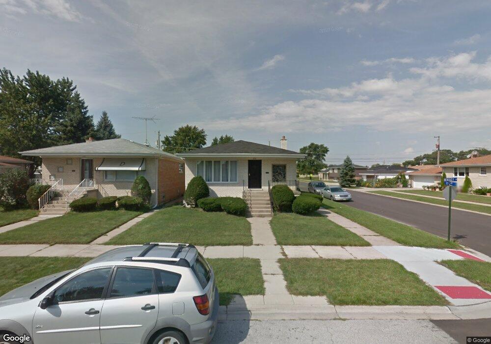
638 Bensley Ave Calumet City, IL 60409
Estimated Value: $183,733 - $254,000
3
Beds
2
Baths
1,259
Sq Ft
$173/Sq Ft
Est. Value
About This Home
This home is located at 638 Bensley Ave, Calumet City, IL 60409 and is currently estimated at $217,933, approximately $173 per square foot. 638 Bensley Ave is a home located in Cook County with nearby schools including Diekman Elementary School, Carol Moseley Braun School, and Creative Communications Academy.
Ownership History
Date
Name
Owned For
Owner Type
Purchase Details
Closed on
Sep 14, 2011
Sold by
Burks Yvonne R
Bought by
Chicago Title Land Trust Company and Trust #8002357704
Current Estimated Value
Purchase Details
Closed on
Jul 14, 2000
Sold by
Camadeca Maybelle
Bought by
Burks Yvonne
Home Financials for this Owner
Home Financials are based on the most recent Mortgage that was taken out on this home.
Original Mortgage
$112,100
Interest Rate
8.27%
Create a Home Valuation Report for This Property
The Home Valuation Report is an in-depth analysis detailing your home's value as well as a comparison with similar homes in the area
Home Values in the Area
Average Home Value in this Area
Purchase History
| Date | Buyer | Sale Price | Title Company |
|---|---|---|---|
| Chicago Title Land Trust Company | -- | Chicago Title Land Trust Co | |
| Burks Yvonne | $118,000 | Professional National Title |
Source: Public Records
Mortgage History
| Date | Status | Borrower | Loan Amount |
|---|---|---|---|
| Previous Owner | Burks Yvonne | $112,100 |
Source: Public Records
Tax History Compared to Growth
Tax History
| Year | Tax Paid | Tax Assessment Tax Assessment Total Assessment is a certain percentage of the fair market value that is determined by local assessors to be the total taxable value of land and additions on the property. | Land | Improvement |
|---|---|---|---|---|
| 2024 | $6,047 | $13,000 | $2,330 | $10,670 |
| 2023 | $6,052 | $13,000 | $2,330 | $10,670 |
| 2022 | $6,052 | $11,068 | $2,013 | $9,055 |
| 2021 | $5,768 | $11,066 | $2,012 | $9,054 |
| 2020 | $5,413 | $11,066 | $2,012 | $9,054 |
| 2019 | $6,276 | $8,502 | $1,694 | $6,808 |
| 2018 | $6,250 | $8,502 | $1,694 | $6,808 |
| 2017 | $5,991 | $8,502 | $1,694 | $6,808 |
| 2016 | $5,653 | $8,474 | $1,588 | $6,886 |
| 2015 | $3,812 | $8,474 | $1,588 | $6,886 |
| 2014 | $3,745 | $8,474 | $1,588 | $6,886 |
| 2013 | $4,434 | $10,095 | $1,588 | $8,507 |
Source: Public Records
Map
Nearby Homes
- 615 Hoxie Ave
- 605 Hoxie Ave
- 627 Paxton Ave
- 605 Saginaw Ave
- 1758 Memorial Dr
- 618 Marquette Ave
- 508 Hoxie Ave
- 518 Crandon Ave
- 602 Merrill Ave
- 1863 Michigan City Rd Unit 1W
- 519 Paxton Ave
- 1225 Memorial Dr
- 648 Muskegon Ave
- 678 Muskegon Ave
- 452 Yates Ave
- 513 Merrill Ave
- 1918 Stonegate Dr
- 669 Chappel Ave Unit 2C
- 453 Hoxie Ave
- 558 Muskegon Ave
- 642 Bensley Ave
- 650 Bensley Ave
- 622 Bensley Ave
- 631 Yates Ave
- 633 Yates Ave
- 637 Yates Ave
- 658 Bensley Ave
- 621 Yates Ave
- 645 Yates Ave
- 614 Bensley Ave
- 633 Bensley Ave
- 635 Bensley Ave
- 619 Yates Ave
- 639 Bensley Ave
- 647 Yates Ave
- 621 Bensley Ave
- 662 Bensley Ave
- 610 Bensley Ave
- 647 Bensley Ave
- 651 Yates Ave