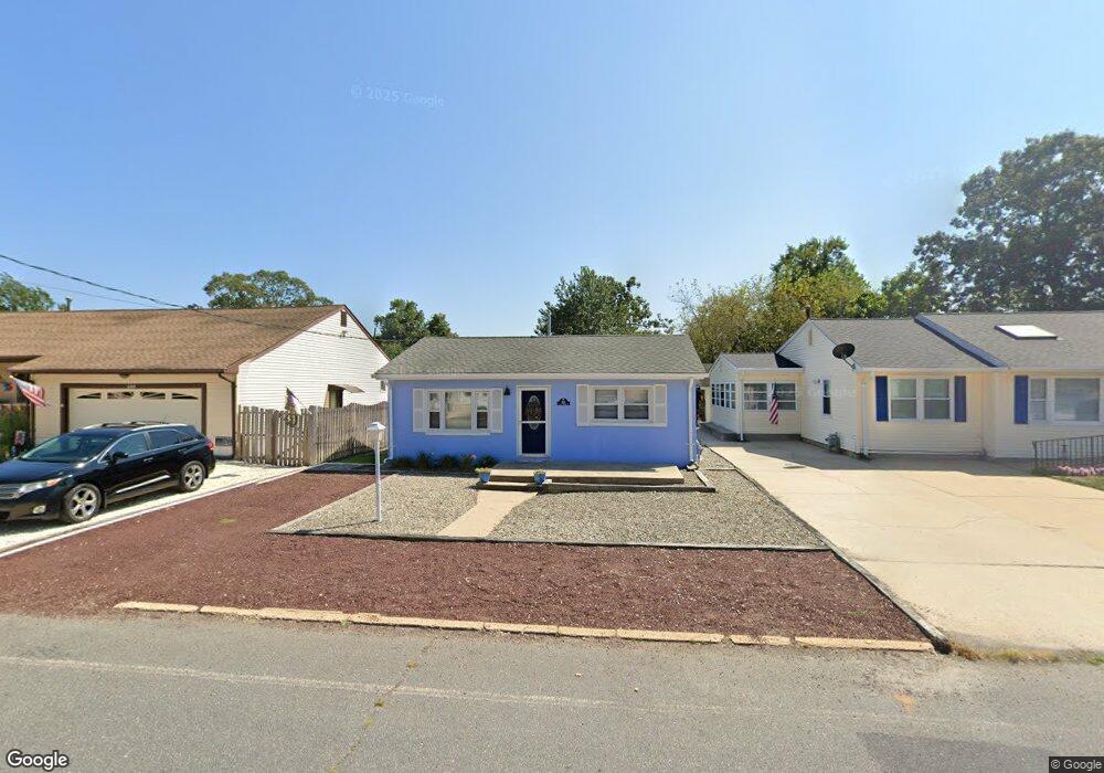
638 E Long Branch Ave Ocean Gate, NJ 08740
Estimated Value: $331,695 - $382,000
2
Beds
1
Bath
816
Sq Ft
$426/Sq Ft
Est. Value
About This Home
This home is located at 638 E Long Branch Ave, Ocean Gate, NJ 08740 and is currently estimated at $347,424, approximately $425 per square foot. 638 E Long Branch Ave is a home located in Ocean County with nearby schools including Ocean Gate Elementary School, Central Regional Middle School, and Central Regional High School.
Ownership History
Date
Name
Owned For
Owner Type
Purchase Details
Closed on
Oct 14, 2013
Sold by
Mitchell Irene A
Bought by
Independent Enterprise Llc
Current Estimated Value
Purchase Details
Closed on
Jun 20, 2005
Sold by
Dudley Jessica
Bought by
Mitchell Robert J and Mitchell Irene A
Home Financials for this Owner
Home Financials are based on the most recent Mortgage that was taken out on this home.
Original Mortgage
$108,000
Interest Rate
5.82%
Mortgage Type
Fannie Mae Freddie Mac
Purchase Details
Closed on
Jan 25, 2001
Sold by
Sutera Rose
Bought by
Dudley Jessica
Home Financials for this Owner
Home Financials are based on the most recent Mortgage that was taken out on this home.
Original Mortgage
$37,740
Interest Rate
7.14%
Create a Home Valuation Report for This Property
The Home Valuation Report is an in-depth analysis detailing your home's value as well as a comparison with similar homes in the area
Home Values in the Area
Average Home Value in this Area
Purchase History
| Date | Buyer | Sale Price | Title Company |
|---|---|---|---|
| Independent Enterprise Llc | $55,000 | None Available | |
| Mitchell Robert J | $144,900 | First American Title Ins Co | |
| Dudley Jessica | $60,500 | -- | |
| Dudley Jessica | $60,500 | -- |
Source: Public Records
Mortgage History
| Date | Status | Borrower | Loan Amount |
|---|---|---|---|
| Previous Owner | Mitchell Robert J | $108,000 | |
| Previous Owner | Dudley Jessica | $37,740 |
Source: Public Records
Tax History
| Year | Tax Paid | Tax Assessment Tax Assessment Total Assessment is a certain percentage of the fair market value that is determined by local assessors to be the total taxable value of land and additions on the property. | Land | Improvement |
|---|---|---|---|---|
| 2025 | $4,443 | $244,000 | $146,000 | $98,000 |
| 2024 | $3,523 | $244,000 | $146,000 | $98,000 |
| 2023 | $3,245 | $116,700 | $60,700 | $56,000 |
| 2022 | $3,245 | $116,700 | $60,700 | $56,000 |
| 2021 | $3,107 | $116,700 | $60,700 | $56,000 |
| 2020 | $3,131 | $116,700 | $60,700 | $56,000 |
| 2019 | $3,055 | $116,700 | $60,700 | $56,000 |
| 2018 | $2,949 | $116,700 | $60,700 | $56,000 |
| 2017 | $2,927 | $116,700 | $60,700 | $56,000 |
| 2016 | $2,904 | $116,700 | $60,700 | $56,000 |
| 2015 | $2,631 | $129,100 | $100,000 | $29,100 |
| 2014 | $2,643 | $129,100 | $100,000 | $29,100 |
Source: Public Records
Map
Nearby Homes
- 409 Newport Ave
- 639 E Bayview Ave
- 521 E Point Pleasant Ave
- 318 E Cape May Ave
- 375 E Barnegat Ave
- 32 E Long Branch Ave
- 207 Ocean Gate Ave
- 54 Beach Ave
- 131 Veeder Ln
- 24 W Point Pleasant Ave
- 36 W Point Pleasant Ave
- 51 Good Luck Dr
- 553 Ocean Gate Dr
- 61 Yardarm Ct
- 4 Drake Place
- 117 W Arverne Ave
- 71 Ronald Ave S
- 0 Jane Ave
- 59 Top Sail Ct
- 3 Sheila Ct
- 630 E Long Branch Ave
- 644 E Long Branch Ave
- 648 E Long Branch Ave
- 635 E Point Pleasant Ave
- 647 E Point Pleasant Ave
- 628 E Long Branch Ave
- 602 Narragansette Ave
- 647 E Long Branch Ave
- 631 E Point Pleasant Ave
- 608 Narragansette Ave
- 635 E Long Branch Ave
- 624 E Long Branch Ave
- 651 E Point Pleasant Ave
- 518 Narragansette Ave
- 625 E Long Branch Ave
- 514 Narragansette Ave
- 619 E Point Pleasant Ave
- 614 E Long Branch Ave
- 510 Narragansette Ave
- 510 Narragansette Ave Unit WINTER
Your Personal Tour Guide
Ask me questions while you tour the home.