Estimated Value: $314,000 - $368,000
--
Bed
--
Bath
1,800
Sq Ft
$193/Sq Ft
Est. Value
About This Home
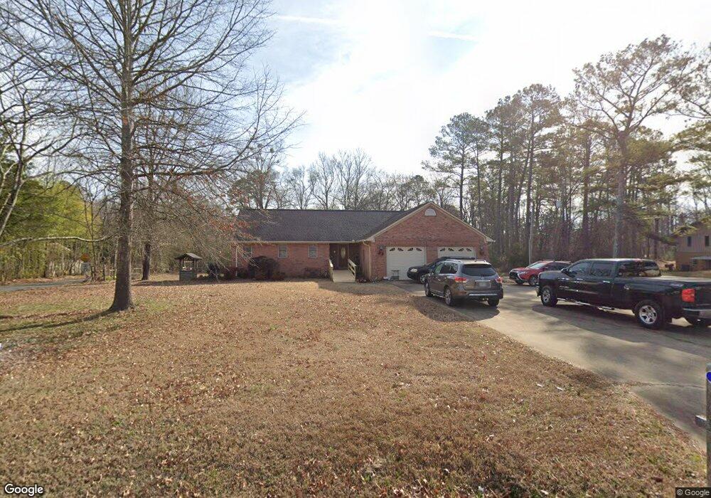
This home is located at 638 Old Dalton Rd NE, Rome, GA 30165 and is currently estimated at $347,767, approximately $193 per square foot. 638 Old Dalton Rd NE is a home located in Floyd County with nearby schools including Armuchee Middle School, Armuchee High School, and Unity Christian School.
Ownership History
Date
Name
Owned For
Owner Type
Purchase Details
Closed on
Nov 30, 2021
Sold by
Williams Gene
Bought by
Williams Michael Eugene
Current Estimated Value
Purchase Details
Closed on
Jan 6, 1994
Sold by
Gilbreath Gene W
Bought by
Williams Gene
Purchase Details
Closed on
Nov 30, 1990
Sold by
Battle Mary Linda
Bought by
Gilbreath Gene W
Purchase Details
Closed on
Jun 22, 1971
Sold by
Stansell Geo E
Bought by
Battle Mary Linda
Purchase Details
Closed on
Jan 1, 1966
Sold by
Copeland J B
Bought by
Stansell Geo E
Purchase Details
Closed on
Jan 1, 1943
Bought by
Copeland J B
Create a Home Valuation Report for This Property
The Home Valuation Report is an in-depth analysis detailing your home's value as well as a comparison with similar homes in the area
Home Values in the Area
Average Home Value in this Area
Purchase History
| Date | Buyer | Sale Price | Title Company |
|---|---|---|---|
| Williams Michael Eugene | -- | -- | |
| Williams Gene | $26,500 | -- | |
| Gilbreath Gene W | -- | -- | |
| Battle Mary Linda | $8,000 | -- | |
| Stansell Geo E | $2,000 | -- | |
| Copeland J B | -- | -- |
Source: Public Records
Tax History Compared to Growth
Tax History
| Year | Tax Paid | Tax Assessment Tax Assessment Total Assessment is a certain percentage of the fair market value that is determined by local assessors to be the total taxable value of land and additions on the property. | Land | Improvement |
|---|---|---|---|---|
| 2024 | $4,794 | $162,238 | $18,251 | $143,987 |
| 2023 | $4,642 | $156,520 | $16,592 | $139,928 |
| 2022 | $3,913 | $131,891 | $13,713 | $118,178 |
| 2021 | $3,410 | $112,981 | $12,505 | $100,476 |
| 2020 | $3,089 | $101,486 | $10,874 | $90,612 |
| 2019 | $2,852 | $94,966 | $10,874 | $84,092 |
| 2018 | $2,650 | $88,068 | $10,356 | $77,712 |
| 2017 | $2,137 | $70,884 | $9,589 | $61,295 |
| 2016 | $2,236 | $73,292 | $9,560 | $63,732 |
| 2015 | $1,349 | $73,292 | $9,560 | $63,732 |
| 2014 | $1,349 | $73,292 | $9,560 | $63,732 |
Source: Public Records
Map
Nearby Homes
- 4 Sleepy Oaks Trail NE
- 109 Royal Oak Dr NE
- 100 Royal Oak Dr NE
- The Pearson Plan at Southbend
- The Harrington Plan at Southbend
- The Landen Plan at Southbend
- The Benson II Plan at Southbend
- The Caldwell Plan at Southbend
- The Bradley Plan at Southbend
- The McGinnis Plan at Southbend
- The Crawford Plan at Southbend
- 24 Sleepy Oaks Trail NE
- 10 Oak View Dr NE
- KERRY Plan at Northberry
- BELHAVEN Plan at Northberry
- CALI Plan at Northberry
- ROBIE Plan at Northberry
- ARIA Plan at Northberry
- 3 Coggins Place NE
- 3 Coggins Place NE
- 0 Reece Dr NE Unit 8224486
- 0 Reece Dr NE Unit 5878758
- 0 Reece Dr NE Unit 8318926
- 0 Reece Dr NE Unit 8068372
- 7 Reece Dr NE
- 2 Honeytree Trail NE
- 657 Old Dalton Rd NE
- 4 Honeytree Trail NE
- 684 Old Dalton Rd NE
- 684 Old Dalton Rd NE
- 1 Honeytree Trail NE
- 673 Old Dalton Rd NE Unit 1,2
- 673 Old Dalton Rd NE
- 6 Honeytree Trail NE
- 3 Honeytree Trail NE
- 0 Sessler Dr NE Unit 7159282
- 0 Sessler Dr NE Unit 8124019
- 8 Honeytree Trail NE
- 51 Sessler Dr NE
- 36 Glen View Dr NE