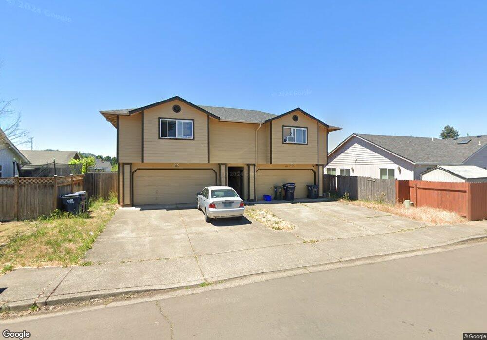
638 S 41st St Springfield, OR 97478
East Springfield NeighborhoodEstimated Value: $408,000 - $476,000
2
Beds
2
Baths
1,299
Sq Ft
$347/Sq Ft
Est. Value
About This Home
This home is located at 638 S 41st St, Springfield, OR 97478 and is currently estimated at $450,119, approximately $346 per square foot. 638 S 41st St is a home located in Lane County with nearby schools including Douglas Gardens Elementary School, Agnes Stewart Middle School, and Springfield High School.
Ownership History
Date
Name
Owned For
Owner Type
Purchase Details
Closed on
Apr 8, 2021
Sold by
Leuallen Eric and Leuallen Erin
Bought by
Track Town Holdings Llc
Current Estimated Value
Home Financials for this Owner
Home Financials are based on the most recent Mortgage that was taken out on this home.
Original Mortgage
$70,000
Outstanding Balance
$63,333
Interest Rate
3.13%
Mortgage Type
New Conventional
Estimated Equity
$386,786
Purchase Details
Closed on
Mar 24, 2017
Sold by
Henry Edwin Leroy
Bought by
Harris David A and Harris Darla J
Home Financials for this Owner
Home Financials are based on the most recent Mortgage that was taken out on this home.
Original Mortgage
$758,000
Interest Rate
4.17%
Mortgage Type
Commercial
Create a Home Valuation Report for This Property
The Home Valuation Report is an in-depth analysis detailing your home's value as well as a comparison with similar homes in the area
Home Values in the Area
Average Home Value in this Area
Purchase History
| Date | Buyer | Sale Price | Title Company |
|---|---|---|---|
| Track Town Holdings Llc | $660,000 | Cascade Title Co | |
| Harris David A | $999,990 | Cascade Title Company |
Source: Public Records
Mortgage History
| Date | Status | Borrower | Loan Amount |
|---|---|---|---|
| Open | Track Town Holdings Llc | $70,000 | |
| Closed | Track Town Holdings Llc | $450,000 | |
| Previous Owner | Harris David A | $758,000 |
Source: Public Records
Tax History Compared to Growth
Tax History
| Year | Tax Paid | Tax Assessment Tax Assessment Total Assessment is a certain percentage of the fair market value that is determined by local assessors to be the total taxable value of land and additions on the property. | Land | Improvement |
|---|---|---|---|---|
| 2024 | $4,399 | $236,759 | -- | -- |
| 2023 | $4,399 | $229,864 | $0 | $0 |
| 2022 | $4,075 | $223,169 | $0 | $0 |
| 2021 | $4,001 | $216,669 | $0 | $0 |
| 2020 | $3,885 | $210,359 | $0 | $0 |
| 2019 | $3,768 | $204,233 | $0 | $0 |
| 2018 | $3,552 | $192,510 | $0 | $0 |
| 2017 | $3,415 | $192,510 | $0 | $0 |
| 2016 | $3,242 | $186,903 | $0 | $0 |
| 2015 | $3,211 | $185,771 | $0 | $0 |
| 2014 | $3,147 | $180,360 | $0 | $0 |
Source: Public Records
Map
Nearby Homes
- 4072 Forsythia St
- 4131 Forsythia St
- 4133 Bluebelle Way
- 0 Filbert Ln
- 4137 Bluebelle Way
- 455 S 38th St
- 4324 Forsythia St
- 3720 Virginia Ave
- 443 S 43rd St
- 647 S 44th St
- 848 S 44th St
- 225 41st St Unit 36
- 4457 Aster St
- 3818 Longridge Dr
- 4187 Richland St
- 4217 Cole Way
- 4459 Glacier St
- 187 37th St
- 154 37th St
- 349 40th St