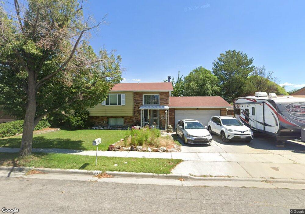
638 Sir Philip Dr Salt Lake City, UT 84116
Jordan Meadows NeighborhoodEstimated Value: $429,000 - $476,000
4
Beds
4
Baths
1,002
Sq Ft
$450/Sq Ft
Est. Value
About This Home
This home is located at 638 Sir Philip Dr, Salt Lake City, UT 84116 and is currently estimated at $451,173, approximately $450 per square foot. 638 Sir Philip Dr is a home located in Salt Lake County with nearby schools including Meadowlark School, Northwest Middle School, and West High.
Ownership History
Date
Name
Owned For
Owner Type
Purchase Details
Closed on
Jun 30, 2020
Sold by
Coleman Leslie D and Leslie D Coleman Living Trust
Bought by
Johnson Jeremiah A and Johnson Jami Nacole
Current Estimated Value
Home Financials for this Owner
Home Financials are based on the most recent Mortgage that was taken out on this home.
Original Mortgage
$120,000
Interest Rate
3.2%
Mortgage Type
New Conventional
Purchase Details
Closed on
Jul 2, 2019
Sold by
Coleman Leslie D
Bought by
Coleman Leslie D and Leslie D Coleman Living Trust
Purchase Details
Closed on
Feb 5, 2018
Sold by
Coleman Leslie D
Bought by
Coleman Leslie D and Leslie D Coleman Living Trust
Purchase Details
Closed on
Aug 16, 2017
Sold by
Coleman Leslie D
Bought by
Coleman Leslie D
Create a Home Valuation Report for This Property
The Home Valuation Report is an in-depth analysis detailing your home's value as well as a comparison with similar homes in the area
Home Values in the Area
Average Home Value in this Area
Purchase History
| Date | Buyer | Sale Price | Title Company |
|---|---|---|---|
| Johnson Jeremiah A | -- | Backman Title Services | |
| Coleman Leslie D | -- | None Available | |
| Coleman Leslie D | -- | None Available | |
| Coleman Leslie D | -- | None Available |
Source: Public Records
Mortgage History
| Date | Status | Borrower | Loan Amount |
|---|---|---|---|
| Closed | Johnson Jeremiah A | $120,000 |
Source: Public Records
Tax History Compared to Growth
Tax History
| Year | Tax Paid | Tax Assessment Tax Assessment Total Assessment is a certain percentage of the fair market value that is determined by local assessors to be the total taxable value of land and additions on the property. | Land | Improvement |
|---|---|---|---|---|
| 2025 | $2,035 | $426,100 | $110,700 | $315,400 |
| 2024 | $2,035 | $388,200 | $104,800 | $283,400 |
| 2023 | $2,035 | $348,700 | $100,800 | $247,900 |
| 2022 | $2,041 | $352,200 | $98,800 | $253,400 |
| 2021 | $1,793 | $280,100 | $71,300 | $208,800 |
| 2020 | $1,753 | $260,700 | $63,700 | $197,000 |
| 2019 | $1,793 | $250,900 | $61,000 | $189,900 |
| 2018 | $1,438 | $195,900 | $64,300 | $131,600 |
| 2017 | $1,532 | $195,600 | $64,300 | $131,300 |
| 2016 | $113 | $178,300 | $61,800 | $116,500 |
| 2015 | $1,350 | $155,100 | $56,300 | $98,800 |
| 2014 | -- | $147,500 | $55,000 | $92,500 |
Source: Public Records
Map
Nearby Homes
- 1978 Sir Robert Dr
- 555 N Starcrest Dr Unit B15
- 1860 W 500 N Unit 13
- 1860 W 500 N Unit 20
- 1860 W 500 N Unit 7
- 825 Star Crest Dr W
- 475 N Redwood Rd #58 Rd
- 475 N Redwood Rd Unit 49
- 548 N Redwood Rd
- 949 Libby Way
- 558 N Redwood Rd Unit 1
- 558 N Redwood Rd Unit 3
- 768 N Redwood Rd Unit 19
- 768 N Redwood Rd Unit 1
- 1711 W 400 N Unit 1719
- 1827 Omni Ave
- 1004 N Sir Michael Dr
- 1989 Sir Timothy Ave
- 261 N Redwood Rd
- 261 N Redwood Rd Unit 1
- 648 Sir Philip Dr
- 628 Sir Philip Dr
- 637 N Sir Michael Dr
- 637 Sir Michael Dr
- 627 N Sir Michael Dr
- 647 Sir Michael Dr
- 627 Sir Michael Dr
- 000 Sir Michael Dr
- 658 Sir Philip Dr
- 658 N Sir Philip Dr
- 618 Sir Philip Dr
- 631 Sir Philip Dr
- 631 N Sir Philip Dr
- 639 Sir Philip Dr W
- 623 Sir Philip Dr
- 623 N Sir Philip Dr
- 639 Sir Philip Dr
- 639 N Sir Philip Dr
- 639 N Sir Philip Dr Unit 1990
- 657 Sir Michael Dr