Estimated Value: $548,000 - $580,000
3
Beds
4
Baths
2,182
Sq Ft
$257/Sq Ft
Est. Value
About This Home
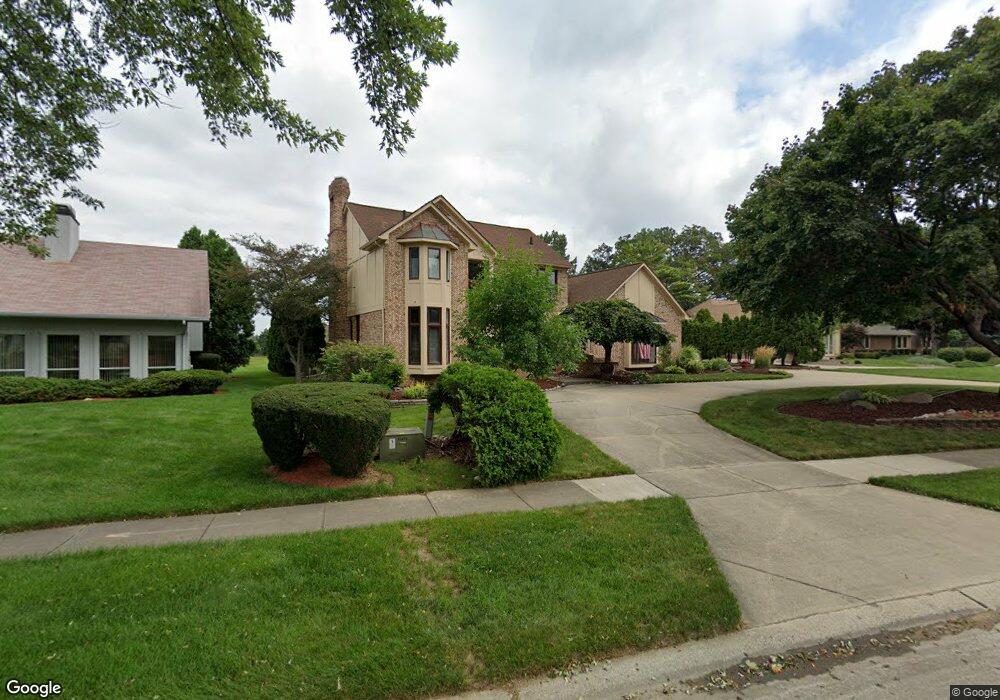
This home is located at 6380 Denton Dr, Troy, MI 48098 and is currently estimated at $561,808, approximately $257 per square foot. 6380 Denton Dr is a home located in Oakland County with nearby schools including Hamilton Elementary School, Smith Middle School, and Troy High School.
Ownership History
Date
Name
Owned For
Owner Type
Purchase Details
Closed on
Jun 15, 2022
Sold by
Kowalski Michael J and Kowalski Rochelle C
Bought by
Kowalski Michael J and Kowalski Michael J
Current Estimated Value
Purchase Details
Closed on
Aug 17, 2020
Sold by
Kowalski Michael J and Kowalski Rochelle C
Bought by
Kowalski Michael J and Kowalski Rochelle C
Purchase Details
Closed on
Nov 1, 2018
Sold by
Kowalski Michael J and Kowalski Rochelle C
Bought by
Kowalski Michael J and Kowalski Rochelle C
Purchase Details
Closed on
Dec 4, 1998
Sold by
Korchmar David
Bought by
Kowalski Michael J
Home Financials for this Owner
Home Financials are based on the most recent Mortgage that was taken out on this home.
Original Mortgage
$218,000
Interest Rate
6.83%
Purchase Details
Closed on
Aug 12, 1998
Sold by
Donald Gene Boggia Tr
Bought by
Korchmar David
Create a Home Valuation Report for This Property
The Home Valuation Report is an in-depth analysis detailing your home's value as well as a comparison with similar homes in the area
Home Values in the Area
Average Home Value in this Area
Purchase History
| Date | Buyer | Sale Price | Title Company |
|---|---|---|---|
| Kowalski Michael J | -- | None Listed On Document | |
| Kowalski Michael J | -- | None Available | |
| Kowalski Michael J | -- | None Available | |
| Kowalski Michael J | -- | -- | |
| Korchmar David | -- | -- |
Source: Public Records
Mortgage History
| Date | Status | Borrower | Loan Amount |
|---|---|---|---|
| Previous Owner | Kowalski Michael J | $218,000 |
Source: Public Records
Tax History Compared to Growth
Tax History
| Year | Tax Paid | Tax Assessment Tax Assessment Total Assessment is a certain percentage of the fair market value that is determined by local assessors to be the total taxable value of land and additions on the property. | Land | Improvement |
|---|---|---|---|---|
| 2022 | $5,175 | $210,970 | $0 | $0 |
| 2015 | $5,428 | $172,920 | $0 | $0 |
| 2014 | -- | $157,570 | $0 | $0 |
| 2011 | -- | $137,500 | $0 | $0 |
Source: Public Records
Map
Nearby Homes
- 6481 Basswood Dr
- 6768 Merrick Dr Unit 12
- 6817 Woodcrest Dr
- 6460 Elmoor Dr
- 1220 Autumn Dr Unit 76
- 1222 Autumn Dr Unit 75
- 1615 Redbud Dr
- 5840 Northfield Pkwy
- 6572 Forest Park Dr
- 5768 Northfield Pkwy
- 1755 South Blvd W
- 538 Scone Dr
- 6952 Granger Dr
- 5717 Whitfield Dr
- 1618 Fleetwood Dr
- 2530 South Blvd W
- 3970 Cone Ave
- 5681 Houghten Dr
- 3938 Somerset Cir
- 2119 Cattail Cir Unit 24
- 6374 Denton Dr
- 6386 Denton Dr
- 6392 Denton Dr
- 6383 Denton Dr
- 6368 Denton Dr
- 6521 Hill Top Dr
- 6514 Hill Top Dr
- 6391 Denton Dr
- 6398 Denton Dr
- 1195 Country Dr
- 1211 Country Dr
- 6362 Denton Dr
- 6535 Hill Top Dr
- 6356 Denton Dr
- 6347 Denton Dr
- 6397 Denton Dr
- 6380 Elsey Dr
- 6404 Denton Dr
- 1179 Country Dr
- 6528 Hill Top Dr