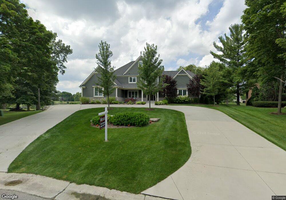
6380 Muirfield Ct Unit Bldg-Unit Bloomfield Hills, MI 48301
Estimated Value: $2,260,000 - $3,005,000
5
Beds
7
Baths
4,800
Sq Ft
$540/Sq Ft
Est. Value
About This Home
This home is located at 6380 Muirfield Ct Unit Bldg-Unit, Bloomfield Hills, MI 48301 and is currently estimated at $2,592,411, approximately $540 per square foot. 6380 Muirfield Ct Unit Bldg-Unit is a home located in Oakland County with nearby schools including Conant Elementary School, South Hills Middle School, and Bloomfield Hills High School.
Ownership History
Date
Name
Owned For
Owner Type
Purchase Details
Closed on
Jan 18, 2019
Sold by
Karen O Gonnan Martin and Gorman Karen O
Bought by
Lewis Damel and Lewis Razili
Current Estimated Value
Home Financials for this Owner
Home Financials are based on the most recent Mortgage that was taken out on this home.
Original Mortgage
$1,488,000
Outstanding Balance
$1,308,255
Interest Rate
4.6%
Mortgage Type
New Conventional
Estimated Equity
$1,284,156
Purchase Details
Closed on
Oct 29, 2015
Sold by
Palmer Jeffrey W and Palmer Jennifer
Bought by
Ogorman Martin and Ogorman Karen
Home Financials for this Owner
Home Financials are based on the most recent Mortgage that was taken out on this home.
Original Mortgage
$418,000
Interest Rate
3.82%
Mortgage Type
New Conventional
Purchase Details
Closed on
Feb 17, 2014
Sold by
Mentag Paul J and Wilhelmi Susan
Bought by
Larkin William B and Larkin Mary Catherine
Create a Home Valuation Report for This Property
The Home Valuation Report is an in-depth analysis detailing your home's value as well as a comparison with similar homes in the area
Home Values in the Area
Average Home Value in this Area
Purchase History
| Date | Buyer | Sale Price | Title Company |
|---|---|---|---|
| Lewis Damel | $1,860,000 | Bankers Title Settlement Ser | |
| Ogorman Martin | -- | Attorney | |
| Larkin William B | -- | None Available |
Source: Public Records
Mortgage History
| Date | Status | Borrower | Loan Amount |
|---|---|---|---|
| Open | Lewis Damel | $1,488,000 | |
| Previous Owner | Ogorman Martin | $418,000 |
Source: Public Records
Tax History Compared to Growth
Tax History
| Year | Tax Paid | Tax Assessment Tax Assessment Total Assessment is a certain percentage of the fair market value that is determined by local assessors to be the total taxable value of land and additions on the property. | Land | Improvement |
|---|---|---|---|---|
| 2024 | $19,537 | $1,253,550 | $0 | $0 |
| 2023 | $18,856 | $1,139,600 | $0 | $0 |
| 2022 | $35,174 | $962,510 | $0 | $0 |
| 2021 | $34,921 | $912,410 | $0 | $0 |
| 2020 | $18,118 | $952,350 | $0 | $0 |
| 2019 | $33,786 | $959,020 | $0 | $0 |
| 2018 | $33,742 | $899,830 | $0 | $0 |
| 2017 | $33,500 | $863,400 | $0 | $0 |
| 2016 | $33,621 | $857,190 | $0 | $0 |
| 2015 | -- | $214,740 | $0 | $0 |
| 2014 | -- | $0 | $0 | $0 |
Source: Public Records
Map
Nearby Homes
- 4456 W Maple Rd
- 6701 Franklin Rd
- 6572 Spruce Dr
- 4200 Surrey Cross
- 6750 Wing Lake Rd
- 750 Trailwood Path Unit B
- 450 Billingsgate Ct Unit C
- 1760 Trailwood Path
- 6041 Eastmoor Rd
- 6660 Woodbank Dr
- 4603 Hedgewood Dr
- 6720 Castle Dr
- 4088 Cranbrook Ct Unit 34
- 4665 W Maple Rd
- 4597 Broughton Dr
- 5897 Sutters Ln
- 7100 Wing Lake Rd
- 7005 Cathedral Dr
- 6940 Castle Dr
- 6952 Sandalwood Dr
- 6380 Muirfield Ct
- 6372 Muirfield Ct
- 6388 Muirfield Ct
- 6394 Muirfield Ct
- 6360 Muirfield Ct
- 6405 Navajo Ct
- 6350 Muirfield Ct
- 6265 Dakota Cir
- 6279 Dakota Cir
- 6379 Muirfield Dr Unit Bldg-Unit
- 6379 Muirfield Dr
- 6351 Muirfield Dr
- 6293 Dakota Cir
- 4360 Prestwick Ln
- 6251 Dakota Cir
- 6400 Navajo Ct
- 6307 Dakota Cir
- 6380 Wing Lake Rd
- 6388 Wing Lake Rd
- 6321 Dakota Cir