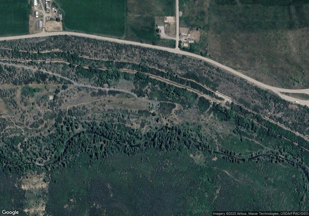
63817 Highway 330 E Collbran, CO 81624
Estimated Value: $473,000 - $642,000
3
Beds
3
Baths
1,896
Sq Ft
$287/Sq Ft
Est. Value
About This Home
This home is located at 63817 Highway 330 E, Collbran, CO 81624 and is currently estimated at $544,390, approximately $287 per square foot. 63817 Highway 330 E is a home located in Mesa County with nearby schools including Plateau Valley Elementary School, Plateau Valley Middle School, and Plateau Valley High School.
Ownership History
Date
Name
Owned For
Owner Type
Purchase Details
Closed on
Oct 31, 2017
Sold by
Oakley Eric C
Bought by
Plateau Creek Llc
Current Estimated Value
Purchase Details
Closed on
Oct 22, 1998
Sold by
Oakley Eric C
Bought by
Bair Thomas E
Purchase Details
Closed on
Nov 17, 1994
Sold by
Bair Tom
Bought by
Plateau Creek Llc
Purchase Details
Closed on
Nov 9, 1994
Sold by
Goss Roger R
Bought by
Plateau Creek Llc
Purchase Details
Closed on
Apr 21, 1993
Sold by
Goss Roger R
Bought by
Plateau Creek Llc
Purchase Details
Closed on
Mar 4, 1993
Sold by
Goss Ann G
Bought by
Plateau Creek Llc
Purchase Details
Closed on
Aug 17, 1992
Sold by
Kentrek Inc
Bought by
Plateau Creek Llc
Create a Home Valuation Report for This Property
The Home Valuation Report is an in-depth analysis detailing your home's value as well as a comparison with similar homes in the area
Home Values in the Area
Average Home Value in this Area
Purchase History
| Date | Buyer | Sale Price | Title Company |
|---|---|---|---|
| Plateau Creek Llc | -- | None Available | |
| Bair Thomas E | -- | -- | |
| Plateau Creek Llc | $18,000 | -- | |
| Plateau Creek Llc | $117,900 | -- | |
| Plateau Creek Llc | $125,700 | -- | |
| Plateau Creek Llc | -- | -- | |
| Plateau Creek Llc | $90,000 | -- |
Source: Public Records
Tax History Compared to Growth
Tax History
| Year | Tax Paid | Tax Assessment Tax Assessment Total Assessment is a certain percentage of the fair market value that is determined by local assessors to be the total taxable value of land and additions on the property. | Land | Improvement |
|---|---|---|---|---|
| 2024 | $651 | $11,630 | $200 | $11,430 |
| 2023 | $651 | $11,630 | $200 | $11,430 |
| 2022 | $677 | $15,230 | $200 | $15,030 |
| 2021 | $752 | $15,670 | $210 | $15,460 |
| 2020 | $618 | $13,340 | $210 | $13,130 |
| 2019 | $549 | $13,340 | $210 | $13,130 |
| 2018 | $619 | $12,390 | $200 | $12,190 |
| 2017 | $598 | $12,390 | $200 | $12,190 |
| 2016 | $674 | $13,900 | $180 | $13,720 |
| 2015 | $649 | $13,900 | $180 | $13,720 |
| 2014 | $659 | $14,050 | $170 | $13,880 |
Source: Public Records
Map
Nearby Homes
- 62495 Highway 330 E
- TBD E Highway 330
- 6645 64 6 10 Rd
- 14495 Scott Loop
- 14495 Scott Loop Unit 23
- 900 Thistle Ct
- 18842 Kimball Creek Rd
- 58892 Highway 330 E
- 18842 58 6 10 Rd
- 14600 N Ouray Ct
- 19106 Kimball Creek Rd
- 14250 S Ouray Ct
- 528 Oakbrush Cir
- 58590 Pe 3 10 Rd
- 57374 Highway 330
- TBD H Oe Rd
- TBD 56 1 2 Rd
- 57191 Me Rd
- 17617 64 3/10 Rd
- 17617 64 3 10 Rd
- 63791 Highway 330 E
- 64006 Highway 330 E
- 17856 64 3 10 Rd
- 17865 64 3/10 Rd
- 63850 Highway 330 E
- TBD Not Assigned Unit 62
- TBD Not Assigned
- 63517 Highway 330 E
- 0 Hwy 330 Hwy Unit 6355233
- 0 Hwy 330 Hwy Unit 9894704
- 0 Hwy 330 Hwy Unit 658487
- 0 Hwy 330 Hwy Unit 643871
- 0 Hwy 330 Hwy Unit 647520
- 0 Hwy 330 Hwy Unit 723419
- 0 Hwy 330 Hwy Unit 731418
- 0 Hwy 330 Hwy Unit 737800
- 0 Hwy 330 Hwy Unit 720505
- 0 Hwy 330 Hwy Unit 723112
