Estimated Value: $255,652 - $289,000
3
Beds
2
Baths
1,164
Sq Ft
$232/Sq Ft
Est. Value
About This Home
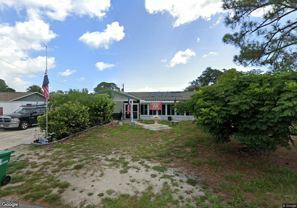
This home is located at 6385 Lookout Dr, Cocoa, FL 32927 and is currently estimated at $269,913, approximately $231 per square foot. 6385 Lookout Dr is a home located in Brevard County with nearby schools including Challenger 7 Elementary School, Space Coast Junior/Senior High School, and East Atlantic Prep of Brevard County.
Ownership History
Date
Name
Owned For
Owner Type
Purchase Details
Closed on
Nov 11, 2005
Sold by
Smith Todd David and Smith Marjorie
Bought by
Smith Todd David and Smith Marjorie
Current Estimated Value
Home Financials for this Owner
Home Financials are based on the most recent Mortgage that was taken out on this home.
Original Mortgage
$140,536
Outstanding Balance
$76,342
Interest Rate
5.9%
Estimated Equity
$193,571
Purchase Details
Closed on
Dec 15, 2000
Sold by
Kenfield Tonya Lynn and Smith Tonya Lynn
Bought by
Smith Todd David
Create a Home Valuation Report for This Property
The Home Valuation Report is an in-depth analysis detailing your home's value as well as a comparison with similar homes in the area
Home Values in the Area
Average Home Value in this Area
Purchase History
| Date | Buyer | Sale Price | Title Company |
|---|---|---|---|
| Smith Todd David | -- | K E L Title Ins Agency Inc | |
| Smith Todd David | -- | -- |
Source: Public Records
Mortgage History
| Date | Status | Borrower | Loan Amount |
|---|---|---|---|
| Open | Smith Todd David | $140,536 |
Source: Public Records
Tax History Compared to Growth
Tax History
| Year | Tax Paid | Tax Assessment Tax Assessment Total Assessment is a certain percentage of the fair market value that is determined by local assessors to be the total taxable value of land and additions on the property. | Land | Improvement |
|---|---|---|---|---|
| 2025 | $1,001 | $70,950 | -- | -- |
| 2024 | $982 | $68,960 | -- | -- |
| 2023 | $982 | $66,960 | $0 | $0 |
| 2022 | $930 | $65,010 | $0 | $0 |
| 2021 | $931 | $63,120 | $0 | $0 |
| 2020 | $886 | $62,250 | $0 | $0 |
| 2019 | $833 | $60,860 | $0 | $0 |
| 2018 | $834 | $59,730 | $0 | $0 |
| 2017 | $834 | $58,510 | $0 | $0 |
| 2016 | $840 | $57,310 | $18,000 | $39,310 |
| 2015 | $846 | $56,920 | $15,000 | $41,920 |
| 2014 | $851 | $56,470 | $11,000 | $45,470 |
Source: Public Records
Map
Nearby Homes
- 6410 Lookout Dr
- 0 Fay Blvd Unit 1011912
- 6575 Dallas Ave
- 780 Alcazar Ave
- 0000 Birch Dr
- 4300 Fay Blvd
- 1108 Vineland St
- 6037 Anne Ave
- 641 Lindsay Ave
- 520 Arabella Ln
- 995 Barclay Dr
- 1015 Hibiscus St
- 672 Altura Dr
- 961 Kaufman St
- 1164 Aron St
- 4200 Lee Hall Place
- 973 Kaufman St
- 6198 Aires Ave
- 522 Clearview Dr
- 6839 Ackerman Ave
- 6375 Lookout Dr
- 6395 W Lookout
- 6390 Manila Dr
- 6380 Manila Dr
- 6400 Manila Dr
- 6365 Lookout Dr
- 6405 Lookout Dr
- 6370 Lookout Dr
- 6370 Manila Dr
- 6380 Lookout Dr
- 6410 Manila Dr
- 6360 Lookout
- 6355 Lookout Dr
- 6415 Lookout Dr
- 6420 Manila Dr
- 6360 Manila Dr
- 6350 Lookout Dr
- 6405 Manila Dr
- 6395 Manila Dr
- 6355 Wien Ln