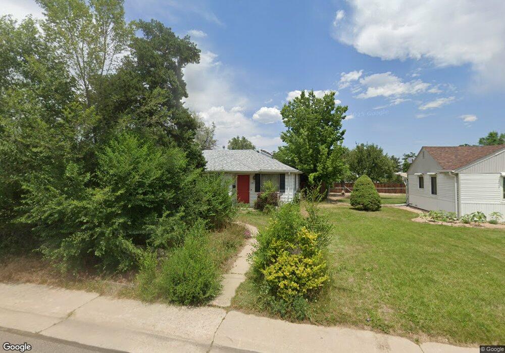
6385 W 45th Ave Wheat Ridge, CO 80033
Barths NeighborhoodEstimated Value: $522,000 - $604,000
3
Beds
1
Bath
1,497
Sq Ft
$374/Sq Ft
Est. Value
About This Home
This home is located at 6385 W 45th Ave, Wheat Ridge, CO 80033 and is currently estimated at $559,520, approximately $373 per square foot. 6385 W 45th Ave is a home located in Jefferson County with nearby schools including Stevens Elementary School, Everitt Middle School, and Wheat Ridge High School.
Ownership History
Date
Name
Owned For
Owner Type
Purchase Details
Closed on
Apr 24, 2012
Sold by
The Carol A Scott Trust
Bought by
Scott Carol A
Current Estimated Value
Home Financials for this Owner
Home Financials are based on the most recent Mortgage that was taken out on this home.
Original Mortgage
$110,850
Outstanding Balance
$76,962
Interest Rate
4.02%
Mortgage Type
New Conventional
Estimated Equity
$482,559
Purchase Details
Closed on
Feb 17, 2010
Sold by
Scott Carol
Bought by
The Carol A Scott Trust
Create a Home Valuation Report for This Property
The Home Valuation Report is an in-depth analysis detailing your home's value as well as a comparison with similar homes in the area
Home Values in the Area
Average Home Value in this Area
Purchase History
| Date | Buyer | Sale Price | Title Company |
|---|---|---|---|
| Scott Carol A | -- | Chicago Title Co | |
| The Carol A Scott Trust | -- | None Available |
Source: Public Records
Mortgage History
| Date | Status | Borrower | Loan Amount |
|---|---|---|---|
| Open | Scott Carol A | $110,850 |
Source: Public Records
Tax History Compared to Growth
Tax History
| Year | Tax Paid | Tax Assessment Tax Assessment Total Assessment is a certain percentage of the fair market value that is determined by local assessors to be the total taxable value of land and additions on the property. | Land | Improvement |
|---|---|---|---|---|
| 2024 | $2,254 | $32,475 | $14,513 | $17,962 |
| 2023 | $2,254 | $32,475 | $14,513 | $17,962 |
| 2022 | $1,802 | $27,191 | $15,426 | $11,765 |
| 2021 | $1,827 | $27,974 | $15,870 | $12,104 |
| 2020 | $1,603 | $25,516 | $14,544 | $10,972 |
| 2019 | $1,582 | $25,516 | $14,544 | $10,972 |
| 2018 | $1,324 | $22,059 | $9,124 | $12,935 |
| 2017 | $1,196 | $22,059 | $9,124 | $12,935 |
| 2016 | $945 | $18,955 | $6,092 | $12,863 |
| 2015 | $725 | $18,955 | $6,092 | $12,863 |
| 2014 | $725 | $15,824 | $5,158 | $10,666 |
Source: Public Records
Map
Nearby Homes
- 4730 Otis St
- 4295 Harlan St
- 4730 Pierce St
- 4541 Reed St
- 7010 W 44th Ave
- 6920 W 47th Place
- 6920 W 48th Ave Unit 6920
- 4125 Pierce St
- 4835 Harlan St Unit 14-17
- 4420 Teller St
- 4095 Quay St
- 5926 W 41st Ave Unit 10
- 6105 W 49th Place
- 4045 Fenton Ct
- 4963 Harlan St
- 4015 Fenton Ct
- 4635 Teller St
- 4020 Fenton Ct
- 4144 Depew St
- 6455 W 38th Ave
- 6365 W 45th Ave
- 6380 W 45th Place
- 6405 W 45th Ave
- 6360 W 45th Place
- 6335 W 45th Ave
- 6400 W 45th Place
- 6320 W 45th Ave
- 6330 W 45th Place
- 6425 W 45th Ave
- 6400 W 45th Ave
- 6305 W 45th Ave
- 6430 W 45th Place
- 6302 W 45th Ave
- 6420 W 45th Ave
- 6300 W 45th Place
- 6445 W 45th Ave
- 6445R W 45th Ave
- 6285 W 45th Ave
- 6460 W 45th Place
- 6385 W 45th Place