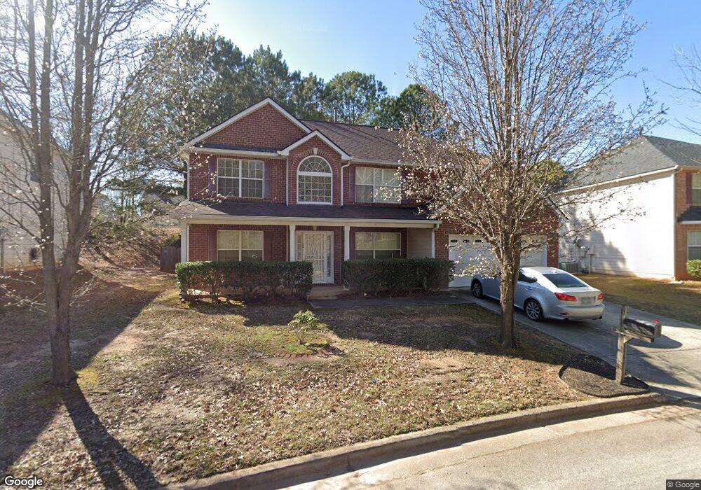
6387 Dekeon Dr Atlanta, GA 30349
Estimated Value: $321,052 - $350,000
4
Beds
3
Baths
3,078
Sq Ft
$109/Sq Ft
Est. Value
About This Home
This home is located at 6387 Dekeon Dr, Atlanta, GA 30349 and is currently estimated at $336,013, approximately $109 per square foot. 6387 Dekeon Dr is a home located in Fulton County with nearby schools including Wolf Creek Elementary, Renaissance Middle School, and Langston Hughes High School.
Ownership History
Date
Name
Owned For
Owner Type
Purchase Details
Closed on
Mar 4, 2022
Sold by
Beecham Kwamina
Bought by
Dortch Kathy
Current Estimated Value
Purchase Details
Closed on
Sep 22, 2006
Sold by
Legacy Communities Of Cooks La
Bought by
Beecham Kwamina
Home Financials for this Owner
Home Financials are based on the most recent Mortgage that was taken out on this home.
Original Mortgage
$152,130
Interest Rate
6.36%
Mortgage Type
New Conventional
Create a Home Valuation Report for This Property
The Home Valuation Report is an in-depth analysis detailing your home's value as well as a comparison with similar homes in the area
Home Values in the Area
Average Home Value in this Area
Purchase History
| Date | Buyer | Sale Price | Title Company |
|---|---|---|---|
| Dortch Kathy | $307,000 | -- | |
| Beecham Kwamina | $202,900 | -- |
Source: Public Records
Mortgage History
| Date | Status | Borrower | Loan Amount |
|---|---|---|---|
| Previous Owner | Beecham Kwamina | $152,130 |
Source: Public Records
Tax History Compared to Growth
Tax History
| Year | Tax Paid | Tax Assessment Tax Assessment Total Assessment is a certain percentage of the fair market value that is determined by local assessors to be the total taxable value of land and additions on the property. | Land | Improvement |
|---|---|---|---|---|
| 2025 | $3,735 | $122,800 | $22,400 | $100,400 |
| 2023 | $3,466 | $122,800 | $22,400 | $100,400 |
| 2022 | $4,354 | $111,040 | $18,240 | $92,800 |
| 2021 | $3,582 | $89,480 | $18,360 | $71,120 |
| 2020 | $3,163 | $77,720 | $12,560 | $65,160 |
| 2019 | $3,114 | $78,840 | $14,840 | $64,000 |
| 2018 | $2,656 | $66,720 | $8,240 | $58,480 |
| 2017 | $1,841 | $45,160 | $10,080 | $35,080 |
| 2016 | $1,841 | $45,160 | $10,080 | $35,080 |
| 2015 | $1,846 | $45,160 | $10,080 | $35,080 |
| 2014 | $1,947 | $45,160 | $10,080 | $35,080 |
Source: Public Records
Map
Nearby Homes
- 4270 Holliday Rd
- 4185 Post Oak Grove
- 4466 Estate St
- 4369 Estate St
- 4247 Butternut Place
- 4224 Butternut Place
- 6474 E Stubbs Rd
- 6639 Overlook Ridge
- 6724 Overlook Ridge
- 6669 Overlook Ridge
- 6476 Snowden Dr
- 4327 Shamrock Dr
- 6390 E Stubbs Rd
- 6640 E Stubbs Rd
- 6445 Marsham Dr
- 4180 W Stubbs Rd
- 6300 E Stubbs Rd
- 4145 Stonewall Tell Rd
- 3930 Demooney Rd
- 3985 Demooney Rd
- 6377 Dekeon Dr
- 6397 Dekeon Dr
- 4274 Holliday Rd
- 6367 Dekeon Dr
- 4278 Holliday Rd
- 6407 Dekeon Dr
- 4266 Holliday Rd
- 4282 Holliday Rd
- 4262 Holliday Rd
- 6357 Dekeon Dr
- 6362 Dekeon Dr
- 4286 Musior Place
- 4258 Holliday Rd
- 6427 Dekeon Dr
- 6402 Dekeon Dr
- 6347 Dekeon Dr
- 4254 Holliday Rd
- 6412 Dekeon Dr
- 6337 Dekeon Dr
- 4273 Holliday Rd Unit N/a