Estimated Value: $194,000 - $299,000
3
Beds
1
Bath
1,548
Sq Ft
$149/Sq Ft
Est. Value
About This Home
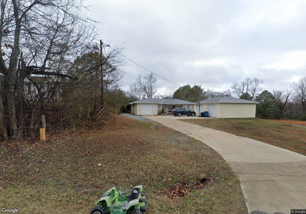
This home is located at 6388 Simpson Point Rd, Grant, AL 35747 and is currently estimated at $230,038, approximately $148 per square foot. 6388 Simpson Point Rd is a home located in Marshall County with nearby schools including Kate Duncan Smith DAR Elementary School, Claysville Jr High School, and Kate Duncan Smith DAR Middle School.
Ownership History
Date
Name
Owned For
Owner Type
Purchase Details
Closed on
May 10, 2019
Sold by
Naler Ronnie and Naler Bettye W
Bought by
Soverns Robert Daniel and Soverns Kayla Danielle
Current Estimated Value
Home Financials for this Owner
Home Financials are based on the most recent Mortgage that was taken out on this home.
Original Mortgage
$105,000
Outstanding Balance
$91,939
Interest Rate
4%
Mortgage Type
New Conventional
Estimated Equity
$138,099
Purchase Details
Closed on
Jul 23, 2010
Sold by
Click Lendol Hollis
Bought by
Naler Ronnie and Sisco Samantha
Home Financials for this Owner
Home Financials are based on the most recent Mortgage that was taken out on this home.
Original Mortgage
$55,100
Interest Rate
4.7%
Mortgage Type
New Conventional
Create a Home Valuation Report for This Property
The Home Valuation Report is an in-depth analysis detailing your home's value as well as a comparison with similar homes in the area
Home Values in the Area
Average Home Value in this Area
Purchase History
| Date | Buyer | Sale Price | Title Company |
|---|---|---|---|
| Soverns Robert Daniel | $105,000 | None Available | |
| Naler Ronnie | -- | None Available |
Source: Public Records
Mortgage History
| Date | Status | Borrower | Loan Amount |
|---|---|---|---|
| Open | Soverns Robert Daniel | $105,000 | |
| Previous Owner | Naler Ronnie | $55,100 |
Source: Public Records
Tax History Compared to Growth
Tax History
| Year | Tax Paid | Tax Assessment Tax Assessment Total Assessment is a certain percentage of the fair market value that is determined by local assessors to be the total taxable value of land and additions on the property. | Land | Improvement |
|---|---|---|---|---|
| 2024 | $576 | $14,200 | $0 | $0 |
| 2023 | $540 | $14,000 | $0 | $0 |
| 2022 | $524 | $13,780 | $0 | $0 |
| 2021 | $501 | $13,160 | $0 | $0 |
| 2020 | $411 | $10,760 | $0 | $0 |
| 2017 | $87 | $15,620 | $0 | $0 |
| 2015 | -- | $5,820 | $0 | $0 |
| 2014 | -- | $5,820 | $0 | $0 |
Source: Public Records
Map
Nearby Homes
- 3.1 Acres Cherokee Ridge Rd
- 10.3 Acres Cherokee Ridge Rd
- 244 Cherokee Ridge Rd
- 89 Bearden Dr
- 2333 White Elephant Rd
- 1169 Honeycomb Rd
- 2216 White Elephant Rd
- 773 Honeycomb Valley Rd
- 885 Honeycomb Rd
- 90 Hummingbird Ln
- .80 Honeycomb Rd
- 8500 Simpson Point Rd
- 135 Honeycomb Valley Rd
- 3346 Cathedral Caverns Hwy
- 6.7+/- Acres Simpson Point Rd
- 1520 White Elephant Rd
- 15 Shin Point Rd
- 204 Payton Ln
- Lots 14/15 Whitaker Dr
- 355 AND 375 Whitaker Dr
- 6380 Simpson Point Rd
- 6406 Simpson Point Rd
- 0 Simpson Point Rd Unit 823108
- 6436 Simpson Point Rd
- 6458 Simpson Point Rd
- 6250 Simpson Point Rd
- 6250 Simpson Point Rd
- 6431 Simpson Point Rd
- 95 Sinks Rd
- 220 Parks Rd
- 6515 Simpson Point Rd
- 101 Parks Rd
- 205 Sinks Rd
- 254 Parks Rd
- 421 Parks Rd
- 218 Sinks Rd
- 212 Sinks Rd
- 423 Parks Rd
- 5850 Simpson Point Rd
- 27 Anderson Ln