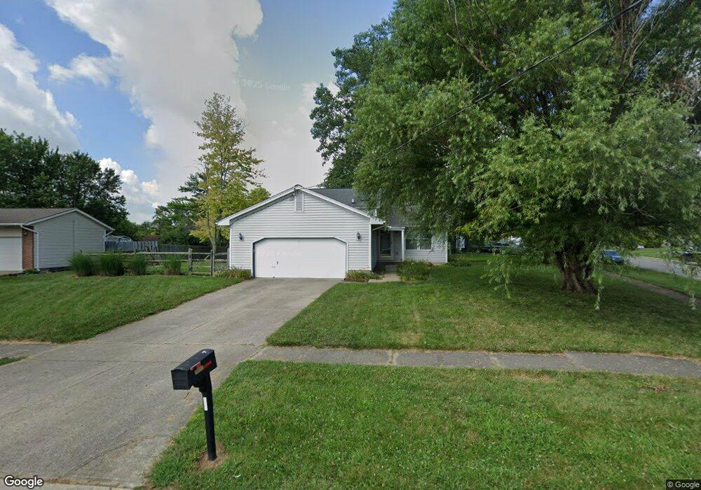
6389 Galloway Dr Liberty Township, OH 45044
Estimated Value: $246,000 - $329,000
3
Beds
2
Baths
988
Sq Ft
$296/Sq Ft
Est. Value
About This Home
This home is located at 6389 Galloway Dr, Liberty Township, OH 45044 and is currently estimated at $291,972, approximately $295 per square foot. 6389 Galloway Dr is a home located in Butler County with nearby schools including Independence Elementary School, Liberty Junior School, and Lakota East High School.
Ownership History
Date
Name
Owned For
Owner Type
Purchase Details
Closed on
May 16, 2003
Sold by
Poe Michael and Poe Elaine
Bought by
Ribar Kenneth P and Ribar Andrea R
Current Estimated Value
Home Financials for this Owner
Home Financials are based on the most recent Mortgage that was taken out on this home.
Original Mortgage
$115,600
Outstanding Balance
$50,827
Interest Rate
5.95%
Mortgage Type
Purchase Money Mortgage
Estimated Equity
$241,145
Purchase Details
Closed on
Oct 1, 1988
Purchase Details
Closed on
Aug 1, 1988
Create a Home Valuation Report for This Property
The Home Valuation Report is an in-depth analysis detailing your home's value as well as a comparison with similar homes in the area
Home Values in the Area
Average Home Value in this Area
Purchase History
| Date | Buyer | Sale Price | Title Company |
|---|---|---|---|
| Ribar Kenneth P | $136,000 | -- | |
| -- | $71,400 | -- | |
| -- | $14,900 | -- |
Source: Public Records
Mortgage History
| Date | Status | Borrower | Loan Amount |
|---|---|---|---|
| Open | Ribar Kenneth P | $115,600 |
Source: Public Records
Tax History Compared to Growth
Tax History
| Year | Tax Paid | Tax Assessment Tax Assessment Total Assessment is a certain percentage of the fair market value that is determined by local assessors to be the total taxable value of land and additions on the property. | Land | Improvement |
|---|---|---|---|---|
| 2024 | $3,067 | $78,270 | $13,590 | $64,680 |
| 2023 | $3,029 | $81,810 | $13,590 | $68,220 |
| 2022 | $2,915 | $58,990 | $13,590 | $45,400 |
| 2021 | $2,899 | $58,990 | $13,590 | $45,400 |
| 2020 | $2,974 | $58,990 | $13,590 | $45,400 |
| 2019 | $5,217 | $54,160 | $17,480 | $36,680 |
| 2018 | $3,049 | $54,160 | $17,480 | $36,680 |
| 2017 | $3,084 | $54,160 | $17,480 | $36,680 |
| 2016 | $2,847 | $49,300 | $17,480 | $31,820 |
| 2015 | $2,833 | $49,300 | $17,480 | $31,820 |
| 2014 | $2,680 | $49,300 | $17,480 | $31,820 |
| 2013 | $2,680 | $44,810 | $13,030 | $31,780 |
Source: Public Records
Map
Nearby Homes
- 6405 Cincinnati Dayton Rd
- 6335 Gem Stone Dr
- 6681 Cincinnati Dayton Rd
- 6703 Cincinnati Dayton Rd
- 7241 Stonebrook Ct
- 7232 Eaglestone Ct
- 7644 Millikin Rd
- 8091 Green Lake Dr
- 7162 Wyandot Ln
- 7798 Derbyshire Ct
- 6821 Cincinnati Dayton Rd
- 7109 Maple Creek Dr
- 7147 Wilhelmina Dr
- 5933 Old Pebble Path
- 5913 Stones Throw Way
- 7120 Shady Brook Bend
- 7108 Shady Brook Bend
- 7113 Shady Brook Bend
- 8319 Verbena Ln
- 8334 Verbena Ln
- 6397 Galloway Dr
- 7649 Kimball Dr
- 7649 Kimball Ct
- 6405 Galloway Dr
- 6418 Sandric Ln
- 6373 Galloway Dr
- 6388 Galloway Dr
- 7654 Kimball Dr
- 6396 Galloway Dr
- 7654 Kimball Ct
- 6380 Galloway Dr
- 6413 Galloway Dr
- 7644 Kimball Dr
- 6404 Galloway Dr
- 6426 Sandric Ln
- 7644 Kimball Ct
- 6372 Galloway Dr
- 6412 Galloway Dr
- 6421 Galloway Dr
- 6378 Sandric Ln