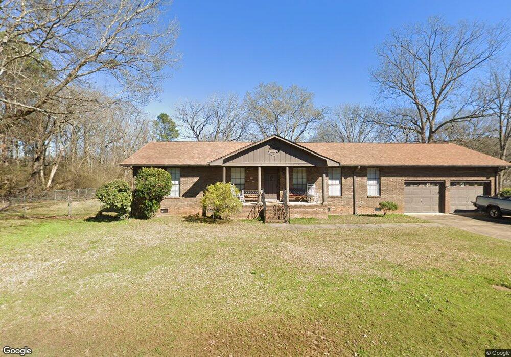
639 6th Ave Birmingham, AL 35217
Estimated Value: $76,000 - $99,979
3
Beds
1
Bath
1,327
Sq Ft
$65/Sq Ft
Est. Value
About This Home
This home is located at 639 6th Ave, Birmingham, AL 35217 and is currently estimated at $85,995, approximately $64 per square foot. 639 6th Ave is a home located in Jefferson County with nearby schools including Fultondale Elementary School, Fultondale High School, and St. Barnabas Regional School.
Ownership History
Date
Name
Owned For
Owner Type
Purchase Details
Closed on
Jan 12, 2007
Sold by
Deutsche Bank National Trust Co
Bought by
Wright Ronnie
Current Estimated Value
Purchase Details
Closed on
Oct 18, 2002
Sold by
Dinkins Randy and Dinkins Charles Leroy
Bought by
Berry Marcie
Home Financials for this Owner
Home Financials are based on the most recent Mortgage that was taken out on this home.
Original Mortgage
$48,450
Interest Rate
9.75%
Purchase Details
Closed on
Aug 4, 2000
Sold by
Dinkins Randy and Dinkins Charles
Bought by
Gamble Timothy T
Create a Home Valuation Report for This Property
The Home Valuation Report is an in-depth analysis detailing your home's value as well as a comparison with similar homes in the area
Home Values in the Area
Average Home Value in this Area
Purchase History
| Date | Buyer | Sale Price | Title Company |
|---|---|---|---|
| Wright Ronnie | $6,000 | None Available | |
| Berry Marcie | $57,000 | -- | |
| Gamble Timothy T | -- | -- |
Source: Public Records
Mortgage History
| Date | Status | Borrower | Loan Amount |
|---|---|---|---|
| Previous Owner | Berry Marcie | $48,450 | |
| Closed | Berry Marcie | $8,550 |
Source: Public Records
Tax History Compared to Growth
Tax History
| Year | Tax Paid | Tax Assessment Tax Assessment Total Assessment is a certain percentage of the fair market value that is determined by local assessors to be the total taxable value of land and additions on the property. | Land | Improvement |
|---|---|---|---|---|
| 2024 | $1,011 | $13,940 | -- | -- |
| 2022 | $792 | $10,920 | $3,060 | $7,860 |
| 2021 | $792 | $10,920 | $3,060 | $7,860 |
| 2020 | $792 | $10,920 | $3,060 | $7,860 |
| 2019 | $792 | $10,920 | $0 | $0 |
| 2018 | $686 | $9,460 | $0 | $0 |
| 2017 | $686 | $9,460 | $0 | $0 |
| 2016 | $686 | $9,460 | $0 | $0 |
| 2015 | $686 | $9,460 | $0 | $0 |
| 2014 | $649 | $9,340 | $0 | $0 |
| 2013 | $649 | $9,340 | $0 | $0 |
Source: Public Records
Map
Nearby Homes
- 17 5th St
- 1024 Timberline Trail
- 1005 Timberline Trail
- 646 Valley Crest Dr
- 555 Eastbrook Dr
- 1100 Vail Cir
- 551 Eastbrook Dr
- 2417 Pine Cone Cir
- 2438 Cedar Hill Dr
- 517 Eastbrook Dr
- 1105 Eastbrook Ln
- 1109 Eastbrook Ln
- 1101 Eastbrook Ln
- 13 Polaris Cir
- 9700 Bates Ave
- 9924 Miller Ave
- 2016 Cedar St
- 2024 Cedar St
- 9601 Bryant Ave
- 1109 Moonglow Cir