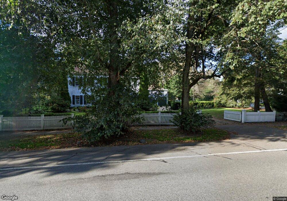
639 Boston Post Rd Weston, MA 02493
Estimated Value: $3,140,611 - $4,617,000
7
Beds
6
Baths
6,004
Sq Ft
$595/Sq Ft
Est. Value
About This Home
This home is located at 639 Boston Post Rd, Weston, MA 02493 and is currently estimated at $3,571,403, approximately $594 per square foot. 639 Boston Post Rd is a home located in Middlesex County with nearby schools including Country Elementary School, Woodland Elementary School, and Weston Middle School.
Ownership History
Date
Name
Owned For
Owner Type
Purchase Details
Closed on
Nov 5, 1999
Sold by
693 Boston Post Rd Rt and Farrelly Peter
Bought by
Constable Philip and Constable Melinda
Current Estimated Value
Purchase Details
Closed on
May 5, 1999
Sold by
Wilson Deborahs and Wilson Michael W
Bought by
639 Boston Post Rd Rt and Farrelly Peter
Purchase Details
Closed on
Aug 13, 1991
Sold by
Lovejoy Frederick H
Bought by
Wilson Michael W
Create a Home Valuation Report for This Property
The Home Valuation Report is an in-depth analysis detailing your home's value as well as a comparison with similar homes in the area
Home Values in the Area
Average Home Value in this Area
Purchase History
| Date | Buyer | Sale Price | Title Company |
|---|---|---|---|
| Constable Philip | $1,481,250 | -- | |
| 639 Boston Post Rd Rt | $1,485,000 | -- | |
| Wilson Michael W | $850,000 | -- | |
| Wilson Michael W | $850,000 | -- |
Source: Public Records
Mortgage History
| Date | Status | Borrower | Loan Amount |
|---|---|---|---|
| Open | Wilson Michael W | $625,000 | |
| Closed | Wilson Michael W | $500,000 |
Source: Public Records
Tax History Compared to Growth
Tax History
| Year | Tax Paid | Tax Assessment Tax Assessment Total Assessment is a certain percentage of the fair market value that is determined by local assessors to be the total taxable value of land and additions on the property. | Land | Improvement |
|---|---|---|---|---|
| 2025 | $28,722 | $2,587,600 | $1,043,700 | $1,543,900 |
| 2024 | $28,072 | $2,524,500 | $1,043,700 | $1,480,800 |
| 2023 | $27,627 | $2,333,400 | $1,043,700 | $1,289,700 |
| 2022 | $25,484 | $1,989,400 | $989,000 | $1,000,400 |
| 2021 | $24,694 | $1,902,500 | $945,200 | $957,300 |
| 2020 | $23,548 | $1,835,400 | $945,200 | $890,200 |
| 2019 | $23,037 | $1,829,800 | $945,200 | $884,600 |
| 2018 | $22,891 | $1,829,800 | $945,200 | $884,600 |
| 2017 | $22,690 | $1,829,800 | $945,200 | $884,600 |
| 2016 | $22,248 | $1,829,600 | $945,200 | $884,400 |
| 2015 | $21,659 | $1,763,800 | $903,800 | $860,000 |
Source: Public Records
Map
Nearby Homes
- 8 Jericho Rd Unit 8
- 24 Jericho Rd Unit 24
- 52 Jericho Rd Unit 52
- 19 Warren Ln
- 23 Pine Summit Cir Unit 23
- 1 Pine Summit Cir
- 51 Church St
- 180 Ash St
- 226 Ash St
- 167 Conant Rd
- 180 Highland St
- 120 Church St
- 9 Atlas Ln
- 1 Aberdeen Rd
- 154 Newton St
- 42 Westerly Rd
- 3 Idlewile Ln
- 3 October Ln
- 60 Rolling Ln
- 19 Old Connecticut Path
- 633 Boston Post Rd
- 643 Boston Post Rd
- 647 Boston Post Rd
- 646 Boston Post Rd
- 640 Boston Post Rd
- 649 Boston Post Rd
- 625 Boston Post Rd
- 650 Boston Post Rd
- 651 Boston Post Rd
- 10 Fiske Ln
- 654 Boston Post Rd
- 655 Boston Post Rd
- 12 Jones Rd
- 9 Jones Rd
- 642 Boston Post Rd
- 16 Jones Rd
- 657 Boston Post Rd
- 42 Concord Rd
- 335 Old Boston Post Rd
- 18 Jones Rd