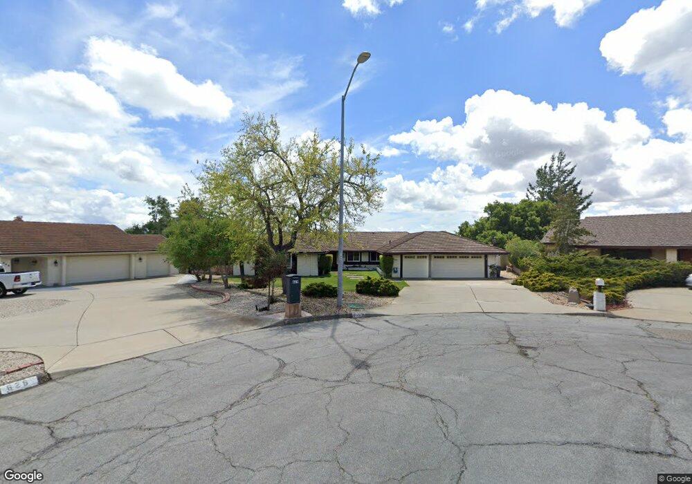
639 Burning Tree Way Lompoc, CA 93436
Estimated Value: $931,843 - $1,010,000
4
Beds
3
Baths
2,554
Sq Ft
$379/Sq Ft
Est. Value
About This Home
This home is located at 639 Burning Tree Way, Lompoc, CA 93436 and is currently estimated at $967,461, approximately $378 per square foot. 639 Burning Tree Way is a home located in Santa Barbara County with nearby schools including Buena Vista Elementary School and Cabrillo High School.
Ownership History
Date
Name
Owned For
Owner Type
Purchase Details
Closed on
Dec 2, 2019
Sold by
Foss Nathan Andrew and Foss Sara Lynn Calhoun
Bought by
Foss Nathan Andrew and Foss Sara Lynn Calhoun
Current Estimated Value
Purchase Details
Closed on
Feb 23, 2011
Sold by
Calhoun Jeffrey E and Calhoun Gloria A
Bought by
Foss Nathan Andrew and Foss Sara Lynn Calhoun
Home Financials for this Owner
Home Financials are based on the most recent Mortgage that was taken out on this home.
Original Mortgage
$459,675
Interest Rate
5.02%
Mortgage Type
VA
Purchase Details
Closed on
Nov 9, 2000
Sold by
Calhoun Jeffrey E and Calhoun Gloria A
Bought by
Calhoun Jeffrey E and Calhoun Gloria A
Create a Home Valuation Report for This Property
The Home Valuation Report is an in-depth analysis detailing your home's value as well as a comparison with similar homes in the area
Home Values in the Area
Average Home Value in this Area
Purchase History
| Date | Buyer | Sale Price | Title Company |
|---|---|---|---|
| Foss Nathan Andrew | -- | None Available | |
| Foss Nathan Andrew | $450,000 | Fidelity National Title Co | |
| Calhoun Jeffrey E | -- | -- |
Source: Public Records
Mortgage History
| Date | Status | Borrower | Loan Amount |
|---|---|---|---|
| Previous Owner | Foss Nathan Andrew | $459,675 |
Source: Public Records
Tax History
| Year | Tax Paid | Tax Assessment Tax Assessment Total Assessment is a certain percentage of the fair market value that is determined by local assessors to be the total taxable value of land and additions on the property. | Land | Improvement |
|---|---|---|---|---|
| 2025 | $6,583 | $576,514 | $224,198 | $352,316 |
| 2023 | $6,583 | $554,129 | $215,493 | $338,636 |
| 2022 | $6,479 | $543,265 | $211,268 | $331,997 |
| 2021 | $6,551 | $532,614 | $207,126 | $325,488 |
| 2020 | $7,336 | $600,546 | $300,273 | $300,273 |
| 2019 | $7,224 | $588,772 | $294,386 | $294,386 |
| 2018 | $7,119 | $577,228 | $288,614 | $288,614 |
| 2017 | $6,615 | $541,000 | $211,000 | $330,000 |
| 2016 | $5,780 | $492,000 | $192,000 | $300,000 |
| 2014 | $5,311 | $446,000 | $174,000 | $272,000 |
Source: Public Records
Map
Nearby Homes
- 649 Burning Tree Way
- 4173 Oakwood Ct
- 4166 Oakwood Ct
- 4473 Greenbrier Rd
- 0 Oak Hill Dr Unit 24-783
- 73 Stanford Cir
- 384 Falcon Crest Dr
- 240 Oak Hill Dr
- 372 Falcon Crest Dr
- 6 Stanford Cir
- 131 Deneb Place
- 18 Galaxy Way
- 113 Gemini Ave
- 259 Burton Mesa Blvd Unit A
- 4447 Falcon Dr
- 3939 Mesa Circle Dr
- 3922 Mesa Circle Dr
- 3825 Saturn Ave Unit 1
- 3770 Rucker Rd
- 3838 Via Mitad
- 629 Burning Tree Way
- 659 Burning Tree Way
- 619 Burning Tree Way
- 609 Burning Tree Way
- 679 Saint Andrews Way
- 0 Saint Andrews Way
- 628 Saint Andrews Way
- 689 Saint Andrews Way
- 648 Saint Andrews Way
- 699 Saint Andrews Way
- 490 Oak Hill Dr
- 668 Saint Andrews Way
- 480 Oak Hill Dr
- 410 Oak Hill Terrace
- 470 Oak Hill Dr
- 408 Oak Hill Terrace
- 409 Oak Hill Terrace
- 460 Oak Hill Dr
- 411 Oak Hill Terrace
Your Personal Tour Guide
Ask me questions while you tour the home.