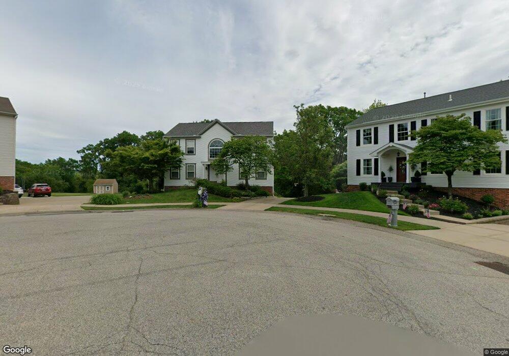
639 Fieldstone Dr Coraopolis, PA 15108
Estimated Value: $435,000 - $447,000
4
Beds
3
Baths
2,496
Sq Ft
$177/Sq Ft
Est. Value
About This Home
This home is located at 639 Fieldstone Dr, Coraopolis, PA 15108 and is currently estimated at $441,192, approximately $176 per square foot. 639 Fieldstone Dr is a home located in Allegheny County with nearby schools including Moon Area High School.
Ownership History
Date
Name
Owned For
Owner Type
Purchase Details
Closed on
Sep 12, 2008
Sold by
Deleonardis Jeffrey P
Bought by
Relyea Lanson D
Current Estimated Value
Home Financials for this Owner
Home Financials are based on the most recent Mortgage that was taken out on this home.
Original Mortgage
$217,550
Outstanding Balance
$144,839
Interest Rate
6.54%
Mortgage Type
New Conventional
Estimated Equity
$296,353
Purchase Details
Closed on
Jan 11, 2002
Sold by
Maronda Homes Inc
Bought by
Deleonardis Jeffrey P and Deleonardis Carol M
Create a Home Valuation Report for This Property
The Home Valuation Report is an in-depth analysis detailing your home's value as well as a comparison with similar homes in the area
Home Values in the Area
Average Home Value in this Area
Purchase History
| Date | Buyer | Sale Price | Title Company |
|---|---|---|---|
| Relyea Lanson D | $229,000 | -- | |
| Deleonardis Jeffrey P | $178,825 | -- |
Source: Public Records
Mortgage History
| Date | Status | Borrower | Loan Amount |
|---|---|---|---|
| Open | Relyea Lanson D | $217,550 |
Source: Public Records
Tax History Compared to Growth
Tax History
| Year | Tax Paid | Tax Assessment Tax Assessment Total Assessment is a certain percentage of the fair market value that is determined by local assessors to be the total taxable value of land and additions on the property. | Land | Improvement |
|---|---|---|---|---|
| 2025 | $5,839 | $186,800 | $45,400 | $141,400 |
| 2024 | $5,839 | $186,800 | $45,400 | $141,400 |
| 2023 | $5,631 | $186,800 | $45,400 | $141,400 |
| 2022 | $5,631 | $186,800 | $45,400 | $141,400 |
| 2021 | $5,929 | $186,800 | $45,400 | $141,400 |
| 2020 | $5,490 | $186,800 | $45,400 | $141,400 |
| 2019 | $5,340 | $186,800 | $45,400 | $141,400 |
| 2018 | $861 | $182,100 | $45,400 | $136,700 |
| 2017 | $4,922 | $182,100 | $45,400 | $136,700 |
| 2016 | $861 | $182,100 | $45,400 | $136,700 |
| 2015 | $861 | $182,100 | $45,400 | $136,700 |
| 2014 | $4,793 | $182,100 | $45,400 | $136,700 |
Source: Public Records
Map
Nearby Homes
- 7011 Weeping Willow Dr
- Somerset Plan at Victoria Ridge
- Rockford Plan at Victoria Ridge
- Birmingham Plan at Victoria Ridge
- Eisenhower Plan at Victoria Ridge
- Carlisle Plan at Victoria Ridge
- Truman Plan at Victoria Ridge
- Chattanooga Plan at Victoria Ridge
- Cleveland Plan at Victoria Ridge
- 347 Ranchero Dr
- 121 Victoria Dr
- 134 Becks Run Rd
- 110 Victoria Dr
- 001 Spring Run Road Extension
- 116 Mesa Dr
- 106 Victoria Dr
- 208 Lochinver Dr
- 103 Victoria Dr
- Bristol Plan at Victoria Ridge
- Galen Plan at Victoria Ridge
- 640 Fieldstone Dr
- 637 Fieldstone Dr
- 635 Fieldstone Dr
- 638 Fieldstone Dr
- 636 Fieldstone Dr
- 633 Fieldstone Dr
- 634 Fieldstone Dr
- 4054 Turnwood Ln
- 631 Fieldstone Dr
- 546 Flaugherty Run Rd
- 629 Fieldstone Dr
- 4061 Turnwood Ln
- 4052 Turnwood Ln
- 628 Fieldstone Dr
- 626 Fieldstone Dr
- 627 Fieldstone Dr
- 624 Fieldstone Dr
- 4059 Turnwood Ln
- 4050 Turnwood Ln
- 622 Fieldstone Dr