Estimated Value: $127,000 - $140,000
--
Bed
2
Baths
836
Sq Ft
$156/Sq Ft
Est. Value
About This Home
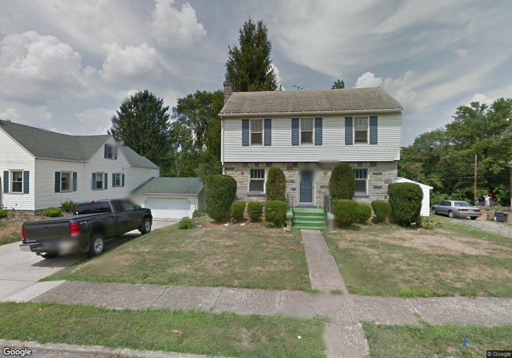
This home is located at 639 Kerr Ave, Cadiz, OH 43907 and is currently estimated at $130,723, approximately $156 per square foot. 639 Kerr Ave is a home located in Harrison County with nearby schools including Harrison Central Elementary School and Harrison Central Junior/Senior High School.
Ownership History
Date
Name
Owned For
Owner Type
Purchase Details
Closed on
Jun 24, 2021
Sold by
Paxton Lloyd Jack
Bought by
Spike Richard J and Spiker Joan J
Current Estimated Value
Purchase Details
Closed on
May 23, 2016
Sold by
Ray Rick E
Bought by
Donley Jessica E
Home Financials for this Owner
Home Financials are based on the most recent Mortgage that was taken out on this home.
Original Mortgage
$78,551
Interest Rate
4.37%
Mortgage Type
FHA
Purchase Details
Closed on
Mar 9, 2012
Sold by
Fleagane James J
Bought by
Ray Rick E
Home Financials for this Owner
Home Financials are based on the most recent Mortgage that was taken out on this home.
Original Mortgage
$51,656
Interest Rate
4.4%
Mortgage Type
FHA
Purchase Details
Closed on
Sep 8, 1995
Create a Home Valuation Report for This Property
The Home Valuation Report is an in-depth analysis detailing your home's value as well as a comparison with similar homes in the area
Home Values in the Area
Average Home Value in this Area
Purchase History
| Date | Buyer | Sale Price | Title Company |
|---|---|---|---|
| Spike Richard J | -- | Ohio Real Title | |
| Donley Jessica E | $80,000 | Northwest Title | |
| Ray Rick E | $53,000 | None Available | |
| -- | $43,500 | -- |
Source: Public Records
Mortgage History
| Date | Status | Borrower | Loan Amount |
|---|---|---|---|
| Previous Owner | Donley Jessica E | $78,551 | |
| Previous Owner | Ray Rick E | $51,656 |
Source: Public Records
Tax History Compared to Growth
Tax History
| Year | Tax Paid | Tax Assessment Tax Assessment Total Assessment is a certain percentage of the fair market value that is determined by local assessors to be the total taxable value of land and additions on the property. | Land | Improvement |
|---|---|---|---|---|
| 2024 | $1,447 | $36,410 | $6,790 | $29,620 |
| 2023 | $1,447 | $36,410 | $6,790 | $29,620 |
| 2022 | $1,255 | $29,550 | $5,070 | $24,480 |
| 2021 | $1,214 | $29,550 | $5,070 | $24,480 |
| 2020 | $1,210 | $29,550 | $5,070 | $24,480 |
| 2019 | $1,037 | $25,040 | $4,300 | $20,740 |
| 2018 | $1,037 | $25,040 | $4,300 | $20,740 |
| 2017 | $1,049 | $25,040 | $4,300 | $20,740 |
| 2016 | $1,014 | $22,580 | $3,990 | $18,590 |
| 2015 | $1,013 | $22,580 | $3,990 | $18,590 |
| 2014 | $825 | $21,690 | $3,630 | $18,060 |
| 2013 | $825 | $21,690 | $3,630 | $18,060 |
Source: Public Records
Map
Nearby Homes
- 608 Kerr Ave
- 388 N Main St
- 254 S Buffalo St
- 413 Saint Clair Ave
- 419 Saint Clair Ave
- 265 Old Steubenville Pike
- 545 E Market St
- 102 Cadiz Ave
- 273 Old Steubenville Pike
- 0 N Main St Unit 5153554
- 804 E Market St
- 0 E Market St
- 390 Oak Park Rd
- 0 Brewer Rd
- 78791 Kanoski Rd
- 39000 Lees Run Rd
- 77900 Slater Rd
- 85200 Merryman Rd
- 315 Euclid Ave
- 103 Lake St