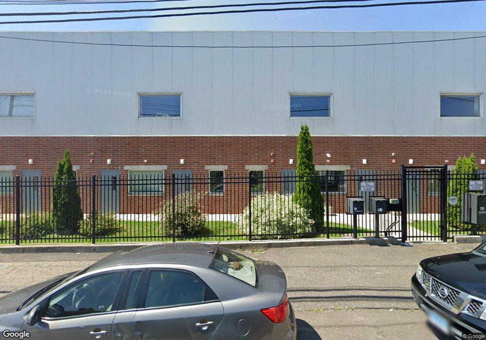
639 N Washington Ave Bridgeport, CT 06604
The Hollow Neighborhood
--
Bed
--
Bath
9,375
Sq Ft
10,454
Sq Ft Lot
About This Home
This home is located at 639 N Washington Ave, Bridgeport, CT 06604. 639 N Washington Ave is a home located in Fairfield County with nearby schools including Read School, Harding High School, and Achievement First Bridgeport Academy Elementary School.
Ownership History
Date
Name
Owned For
Owner Type
Purchase Details
Closed on
Apr 3, 2013
Sold by
Marini Frank
Bought by
639 N Washington Ave L
Home Financials for this Owner
Home Financials are based on the most recent Mortgage that was taken out on this home.
Original Mortgage
$600,000
Interest Rate
3.58%
Mortgage Type
Commercial
Purchase Details
Closed on
Oct 5, 1988
Sold by
R B F Realty Co
Bought by
Marini Frank
Home Financials for this Owner
Home Financials are based on the most recent Mortgage that was taken out on this home.
Original Mortgage
$215,000
Interest Rate
10.64%
Mortgage Type
Commercial
Create a Home Valuation Report for This Property
The Home Valuation Report is an in-depth analysis detailing your home's value as well as a comparison with similar homes in the area
Home Values in the Area
Average Home Value in this Area
Purchase History
| Date | Buyer | Sale Price | Title Company |
|---|---|---|---|
| 639 N Washington Ave L | -- | -- | |
| 639 N Washington Ave L | -- | -- | |
| Marini Frank | $315,000 | -- |
Source: Public Records
Mortgage History
| Date | Status | Borrower | Loan Amount |
|---|---|---|---|
| Open | Marini Frank | $612,350 | |
| Closed | Marini Frank | $600,000 | |
| Previous Owner | Marini Frank | $215,000 |
Source: Public Records
Tax History Compared to Growth
Tax History
| Year | Tax Paid | Tax Assessment Tax Assessment Total Assessment is a certain percentage of the fair market value that is determined by local assessors to be the total taxable value of land and additions on the property. | Land | Improvement |
|---|---|---|---|---|
| 2025 | $28,730 | $661,220 | $105,340 | $555,880 |
| 2024 | $28,730 | $661,220 | $105,340 | $555,880 |
| 2023 | $28,730 | $661,220 | $105,340 | $555,880 |
| 2022 | $28,730 | $661,220 | $105,340 | $555,880 |
| 2021 | $28,730 | $661,220 | $105,340 | $555,880 |
| 2020 | $32,197 | $596,350 | $69,060 | $527,290 |
| 2019 | $32,197 | $596,350 | $69,060 | $527,290 |
| 2018 | $32,424 | $596,350 | $69,060 | $527,290 |
| 2017 | $32,424 | $596,350 | $69,060 | $527,290 |
| 2016 | $32,424 | $596,350 | $69,060 | $527,290 |
| 2015 | $26,958 | $638,810 | $69,060 | $569,750 |
| 2014 | $6,273 | $148,660 | $69,060 | $79,600 |
Source: Public Records
Map
Nearby Homes
- 639 N Washington Ave
- 98 Lindley St Unit 104
- 88 Lindley St Unit 90
- 68 Lindley St Unit 70
- 108 Lindley St Unit 114
- 118 Lindley St Unit 124
- 126 Lindley St
- 729 N Washington Ave
- 73 River St
- 95 River St
- 142 Merriam St
- 144 Merriam St Unit 146
- 742 N Washington Ave
- 140 Merriam St Unit 142
- 106 Merriam St Unit 110
- 116 Merriam St Unit 120
- 124 Merriam St Unit 126
- 36 River St
- 143 Merriam St Unit 145
- 133 Merriam St Unit 135