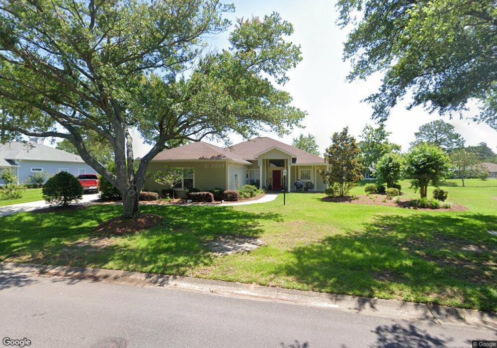
639 Pinehurst Dr Gulf Shores, AL 36542
Estimated Value: $450,000 - $709,000
3
Beds
2
Baths
2,045
Sq Ft
$258/Sq Ft
Est. Value
About This Home
This home is located at 639 Pinehurst Dr, Gulf Shores, AL 36542 and is currently estimated at $527,516, approximately $257 per square foot. 639 Pinehurst Dr is a home located in Baldwin County with nearby schools including Gulf Shores Elementary School, Gulf Shores Middle School, and Gulf Shores High School.
Ownership History
Date
Name
Owned For
Owner Type
Purchase Details
Closed on
Apr 25, 2013
Sold by
Russell Earl E and Russell Beverl Ann
Bought by
Russell Earl E and Russell Beverly Ann
Current Estimated Value
Purchase Details
Closed on
May 17, 2011
Sold by
Ochsner Dolores P
Bought by
Russell Earl E and Russell Beverly Ann
Home Financials for this Owner
Home Financials are based on the most recent Mortgage that was taken out on this home.
Original Mortgage
$168,000
Outstanding Balance
$109,744
Interest Rate
3.62%
Mortgage Type
New Conventional
Estimated Equity
$417,772
Create a Home Valuation Report for This Property
The Home Valuation Report is an in-depth analysis detailing your home's value as well as a comparison with similar homes in the area
Home Values in the Area
Average Home Value in this Area
Purchase History
| Date | Buyer | Sale Price | Title Company |
|---|---|---|---|
| Russell Earl E | -- | None Available | |
| Russell Earl E | $210,000 | Slt |
Source: Public Records
Mortgage History
| Date | Status | Borrower | Loan Amount |
|---|---|---|---|
| Open | Russell Earl E | $168,000 |
Source: Public Records
Tax History Compared to Growth
Tax History
| Year | Tax Paid | Tax Assessment Tax Assessment Total Assessment is a certain percentage of the fair market value that is determined by local assessors to be the total taxable value of land and additions on the property. | Land | Improvement |
|---|---|---|---|---|
| 2024 | $1,024 | $39,340 | $14,000 | $25,340 |
| 2023 | $809 | $31,260 | $8,260 | $23,000 |
| 2022 | $739 | $28,600 | $0 | $0 |
| 2021 | $670 | $25,740 | $0 | $0 |
| 2020 | $665 | $25,820 | $0 | $0 |
| 2019 | $612 | $23,820 | $0 | $0 |
| 2018 | $569 | $22,200 | $0 | $0 |
| 2017 | $549 | $21,440 | $0 | $0 |
| 2016 | $535 | $20,900 | $0 | $0 |
| 2015 | -- | $20,000 | $0 | $0 |
| 2014 | -- | $18,180 | $0 | $0 |
| 2013 | -- | $17,700 | $0 | $0 |
Source: Public Records
Map
Nearby Homes
- 630 Pinehurst Dr
- 3660 Ancient Oaks Cir
- 21081 Live Oak Cir
- 3691 Cypress Cir
- 3606 Ancient Oaks Cir
- 619 Saint Andrews Dr
- 604 Saint Andrews Dr
- 601 Willow Point Ct
- 603 Estates Dr
- 0 Ancient Oaks Cir Unit 6
- 501 Cotton Creek Dr Unit 506
- 501 Cotton Creek Dr Unit 1302
- 501 Cotton Creek Dr Unit 1301
- 501 Cotton Creek Dr Unit 505
- 341 Olde Park Ct
- 3677 Ashton Ct
- 3695 Olde Park Rd
- 3687 Olde Park Rd
- 3658 Prestwick Cir
- 3659 Prestwick Cir
- 643 Pinehurst Dr
- 635 Pinehurst Dr
- 644 Pinehurst Dr
- 646 Pinehurst Dr
- 732 Saint Andrews Dr E
- 640 Pinehurst Dr
- 3664 Pinehurst Cir
- 3662 Pinehurst Cir
- 633 Pinehurst Dr
- 3660 Pinehurst Cir
- 728 Saint Andrews Dr E
- 631 Pinehurst Dr
- 701 Saint Andrews Dr E
- 638 Pinehurst Dr
- 701 St Andrews Dr
- 3650 Pinehurst Cir
- 703 Saint Andrews Dr E
- 254 Pinehurst Dr
- 607 Saint Andrews Dr E
- 709 Saint Andrews Dr E