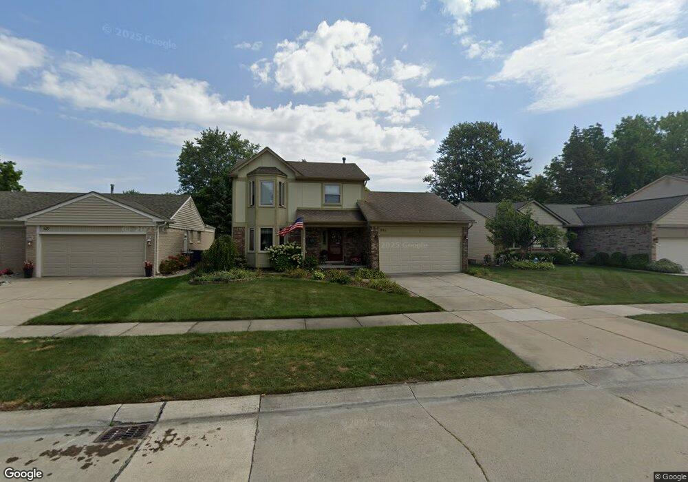
639 Sutten Dr Canton, MI 48188
Estimated Value: $351,266 - $401,000
--
Bed
3
Baths
1,703
Sq Ft
$222/Sq Ft
Est. Value
About This Home
This home is located at 639 Sutten Dr, Canton, MI 48188 and is currently estimated at $377,567, approximately $221 per square foot. 639 Sutten Dr is a home located in Wayne County with nearby schools including Canton High School, Salem High School, and Plymouth High School.
Ownership History
Date
Name
Owned For
Owner Type
Purchase Details
Closed on
May 26, 2016
Sold by
Toll Mi Vi Limited Partnership
Bought by
Derderain Ryan and Derderain Carrie
Current Estimated Value
Purchase Details
Closed on
Feb 28, 1995
Sold by
Cieslowski Larry J
Bought by
Braun Robin
Home Financials for this Owner
Home Financials are based on the most recent Mortgage that was taken out on this home.
Original Mortgage
$124,200
Interest Rate
8.91%
Mortgage Type
New Conventional
Create a Home Valuation Report for This Property
The Home Valuation Report is an in-depth analysis detailing your home's value as well as a comparison with similar homes in the area
Home Values in the Area
Average Home Value in this Area
Purchase History
| Date | Buyer | Sale Price | Title Company |
|---|---|---|---|
| Derderain Ryan | $2,044 | None Available | |
| Braun Robin | $138,000 | -- |
Source: Public Records
Mortgage History
| Date | Status | Borrower | Loan Amount |
|---|---|---|---|
| Previous Owner | Braun Robin | $124,200 |
Source: Public Records
Tax History Compared to Growth
Tax History
| Year | Tax Paid | Tax Assessment Tax Assessment Total Assessment is a certain percentage of the fair market value that is determined by local assessors to be the total taxable value of land and additions on the property. | Land | Improvement |
|---|---|---|---|---|
| 2025 | $1,887 | $182,100 | $0 | $0 |
| 2024 | $1,887 | $158,400 | $0 | $0 |
| 2023 | $1,799 | $151,400 | $0 | $0 |
| 2022 | $1,713 | $131,000 | $0 | $0 |
| 2021 | $3,845 | $126,800 | $0 | $0 |
| 2020 | $3,796 | $119,700 | $0 | $0 |
| 2019 | $3,729 | $116,840 | $0 | $0 |
| 2018 | $1,529 | $111,720 | $0 | $0 |
| 2017 | $3,822 | $109,300 | $0 | $0 |
| 2016 | $3,392 | $110,400 | $0 | $0 |
| 2015 | $8,401 | $95,950 | $0 | $0 |
| 2013 | $8,221 | $85,810 | $0 | $0 |
| 2010 | -- | $87,530 | $37,757 | $49,773 |
Source: Public Records
Map
Nearby Homes
- 41567 SiMcOe Dr
- 41191 Southwind Dr
- 41109 Southwind Dr
- 41878 Ravenwood St
- 42437 Majestic Ct
- 625 Kings Way
- 678 Kings Way
- 42075 Gloria Dr
- 829 Glenulline Dr
- 42272 Beechwood Ct
- 42384 Beechwood Ct
- 41659 Metaline Dr
- 42473 Lilley Pointe Dr Unit 39
- 631 Tyler Ln
- 41928 Old Bridge Rd
- 42540 Lilley Pointe Dr
- 42789 Lilley Pointe Dr Unit 146
- 41481 Cumberland Dr
- 170 Cherry Hill Pointe Dr
- 41441 Cumberland Dr
- 647 Sutten Dr
- 629 Sutten Dr
- 657 Sutten Dr
- 621 Sutten Dr
- 576 Stonehenge Dr
- 604 Stonehenge Dr
- 652 Stonehenge Dr
- 544 Stonehenge Dr
- 665 Sutten Dr
- 611 Sutten Dr
- 630 Sutten Dr
- 650 Sutten Dr
- 662 Stonehenge Dr
- 512 Stonehenge Dr
- 620 Sutten Dr
- 675 Sutten Dr
- 601 Sutten Dr Unit Bldg-Unit
- 601 Sutten Dr
- 660 Sutten Dr
- 610 Sutten Dr