Estimated Value: $128,000 - $164,000
3
Beds
1
Bath
1,599
Sq Ft
$93/Sq Ft
Est. Value
About This Home
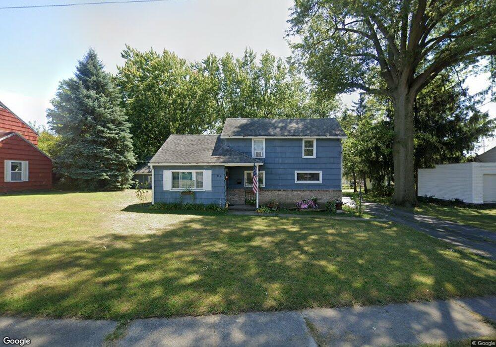
This home is located at 639 W Ashton Ave, Lima, OH 45801 and is currently estimated at $148,888, approximately $93 per square foot. 639 W Ashton Ave is a home located in Allen County with nearby schools including Independence Elementary School, Lima North Middle School, and Lima West Middle School.
Ownership History
Date
Name
Owned For
Owner Type
Purchase Details
Closed on
Feb 18, 2025
Sold by
Phalen Properties Llc
Bought by
Backstop Properties Llc
Current Estimated Value
Purchase Details
Closed on
Feb 7, 2018
Bought by
Phalen Properties Llc
Purchase Details
Closed on
Jun 10, 2016
Sold by
Hullibarger David J and Hullibarger Deana M
Bought by
Phalen Properties Llc
Purchase Details
Closed on
Feb 19, 1993
Sold by
Basinger Jon W
Bought by
Basinger Theresa A
Purchase Details
Closed on
May 10, 1990
Bought by
Basinger Jon W
Create a Home Valuation Report for This Property
The Home Valuation Report is an in-depth analysis detailing your home's value as well as a comparison with similar homes in the area
Home Values in the Area
Average Home Value in this Area
Purchase History
| Date | Buyer | Sale Price | Title Company |
|---|---|---|---|
| Backstop Properties Llc | -- | None Listed On Document | |
| Phalen Properties Llc | -- | -- | |
| Phalen Properties Llc | $33,000 | None Available | |
| Basinger Theresa A | -- | -- | |
| Basinger Jon W | $54,000 | -- |
Source: Public Records
Tax History Compared to Growth
Tax History
| Year | Tax Paid | Tax Assessment Tax Assessment Total Assessment is a certain percentage of the fair market value that is determined by local assessors to be the total taxable value of land and additions on the property. | Land | Improvement |
|---|---|---|---|---|
| 2024 | $1,642 | $45,050 | $9,940 | $35,110 |
| 2023 | $1,284 | $30,450 | $6,720 | $23,730 |
| 2022 | $1,291 | $30,450 | $6,720 | $23,730 |
| 2021 | $1,371 | $30,450 | $6,720 | $23,730 |
| 2020 | $1,254 | $24,540 | $6,510 | $18,030 |
| 2019 | $1,254 | $24,540 | $6,510 | $18,030 |
| 2018 | $1,160 | $23,600 | $5,570 | $18,030 |
| 2017 | $1,125 | $21,810 | $5,570 | $16,240 |
| 2016 | $1,112 | $21,810 | $5,570 | $16,240 |
| 2015 | $758 | $21,810 | $5,570 | $16,240 |
| 2014 | $758 | $22,970 | $5,360 | $17,610 |
| 2013 | $738 | $22,970 | $5,360 | $17,610 |
Source: Public Records
Map
Nearby Homes
- 1116 Belvidere Ave
- 765 W O'Connor Ave
- 576 Cortlandt Ave
- 849 Runyan Ave
- 608 W O'Connor Ave
- 676 Cortlandt Ave
- 610 W Robb Ave
- 638 Hazel Ave
- 939 N West St
- 648 Hazel Ave
- 631 Hazel Ave
- 340 W Robb Ave
- 416 Hazel Ave
- 708 N Metcalf St
- 222 W Grand Ave
- 0 Sherman Ave
- 612 N Metcalf St
- 618 Woodward Ave
- 606 N West St
- 1023 Leland Ave