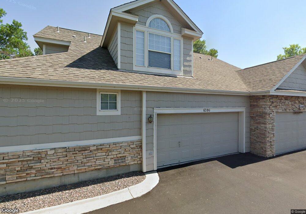
6390 Deframe Way Arvada, CO 80004
Ralston Valley NeighborhoodEstimated Value: $537,127 - $602,000
2
Beds
2
Baths
2,277
Sq Ft
$249/Sq Ft
Est. Value
About This Home
This home is located at 6390 Deframe Way, Arvada, CO 80004 and is currently estimated at $566,282, approximately $248 per square foot. 6390 Deframe Way is a home located in Jefferson County with nearby schools including Magnolia Avenue Elementary School, Drake Junior High School, and Faith Christian Academy.
Ownership History
Date
Name
Owned For
Owner Type
Purchase Details
Closed on
Oct 1, 2018
Sold by
Degroat Gary and Esatte Of Shelia A Degroat
Bought by
The Bart J Burns And Mary L Burns Trust
Current Estimated Value
Purchase Details
Closed on
Nov 25, 1997
Sold by
Village Homes Of Colorado Inc
Bought by
Degroat Shelia A
Home Financials for this Owner
Home Financials are based on the most recent Mortgage that was taken out on this home.
Original Mortgage
$151,200
Interest Rate
7.3%
Create a Home Valuation Report for This Property
The Home Valuation Report is an in-depth analysis detailing your home's value as well as a comparison with similar homes in the area
Home Values in the Area
Average Home Value in this Area
Purchase History
| Date | Buyer | Sale Price | Title Company |
|---|---|---|---|
| The Bart J Burns And Mary L Burns Trust | $406,000 | First American Title Insuran | |
| Degroat Shelia A | $189,000 | Land Title |
Source: Public Records
Mortgage History
| Date | Status | Borrower | Loan Amount |
|---|---|---|---|
| Previous Owner | Degroat Shelia A | $151,200 |
Source: Public Records
Tax History Compared to Growth
Tax History
| Year | Tax Paid | Tax Assessment Tax Assessment Total Assessment is a certain percentage of the fair market value that is determined by local assessors to be the total taxable value of land and additions on the property. | Land | Improvement |
|---|---|---|---|---|
| 2024 | $2,441 | $25,164 | $7,147 | $18,017 |
| 2023 | $2,441 | $25,164 | $7,147 | $18,017 |
| 2022 | $2,267 | $23,146 | $3,446 | $19,700 |
| 2021 | $2,304 | $23,812 | $3,545 | $20,267 |
| 2020 | $2,246 | $23,272 | $6,006 | $17,266 |
| 2019 | $2,215 | $23,272 | $6,006 | $17,266 |
| 2018 | $1,289 | $20,367 | $3,679 | $16,688 |
| 2017 | $1,180 | $20,367 | $3,679 | $16,688 |
| 2016 | $1,244 | $21,037 | $4,974 | $16,063 |
| 2015 | $1,183 | $21,037 | $4,974 | $16,063 |
| 2014 | $1,183 | $19,645 | $4,012 | $15,633 |
Source: Public Records
Map
Nearby Homes
- 6332 Coors Ln
- 6312 Deframe Way
- 13812 W 64th Place
- 13618 W 62nd Dr
- 6537 Coors St
- 13432 W 65th Place
- 13553 W 65th Place
- 13245 W 63rd Cir
- 6254 Devinney Cir
- 13155 W 63rd Place
- 6060 Deframe Ct
- 6416 Zang Ct
- 13168 W 62nd Dr
- 12924 W 64th Dr Unit B
- 12912 W 61st Cir
- 6615 Zang St
- 6616 Zang Cir
- 12976 W 61st Cir
- 6003 Yank Ct
- 6762 Beech Dr
- 6388 Deframe Way
- 6392 Deframe Way
- 6378 Deframe Way
- 6394 Deframe Way
- 6376 Deframe Way
- 6383 Deframe Way
- 6393 Deframe Way
- 6395 Deframe Way
- 6385 Deframe Way
- 6379 Deframe Way
- 6396 Deframe Way
- 6381 Deframe Way
- 6377 Deframe Way
- 6375 Deframe Way
- 6372 Deframe Way
- 6398 Deframe Way
- 6387 Deframe Way
- 6399 Deframe Way
- 13674 W 63rd Cir
- 6389 Deframe Way