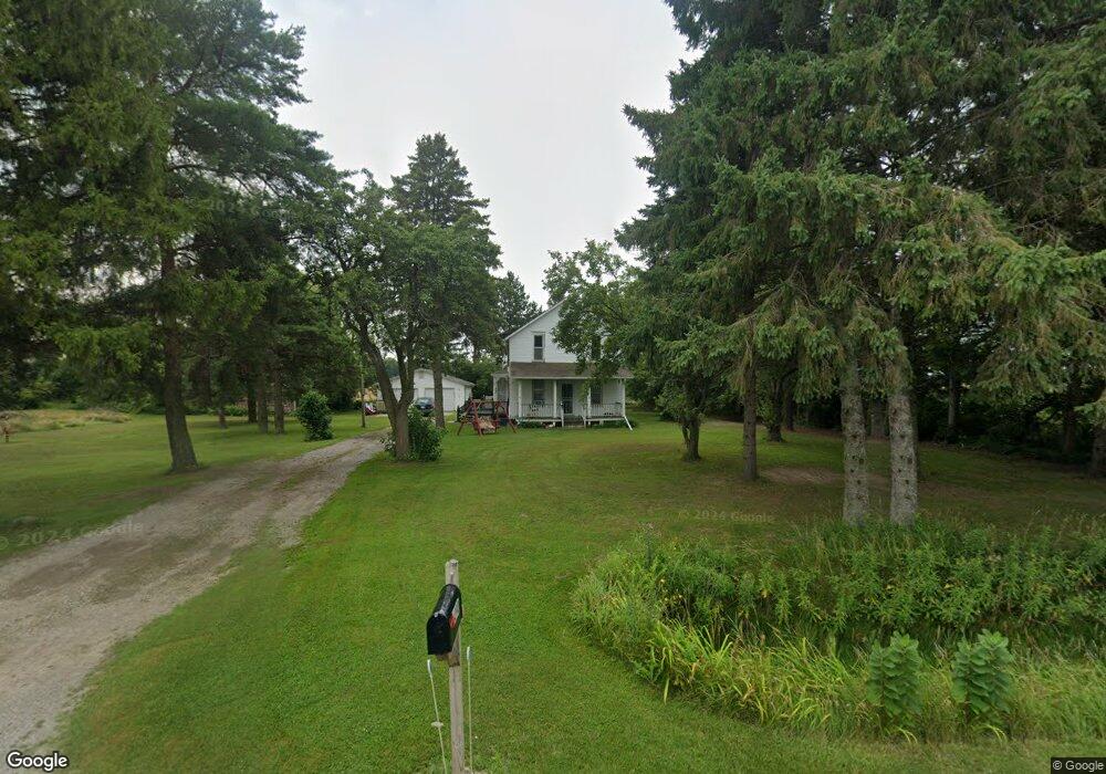
6390 King Rd Bridgeport, MI 48722
Estimated Value: $168,000 - $259,000
3
Beds
2
Baths
1,929
Sq Ft
$107/Sq Ft
Est. Value
About This Home
This home is located at 6390 King Rd, Bridgeport, MI 48722 and is currently estimated at $206,748, approximately $107 per square foot. 6390 King Rd is a home located in Saginaw County with nearby schools including Thomas White School, Iuka Elementary School, and Martin G. Atkins Elementary School.
Ownership History
Date
Name
Owned For
Owner Type
Purchase Details
Closed on
Jan 31, 2023
Sold by
Baker Brian
Bought by
Rodriguez Matthew
Current Estimated Value
Purchase Details
Closed on
Dec 6, 2012
Sold by
Rodriguez Matthew J
Bought by
Baker Brian C
Purchase Details
Closed on
Jun 27, 2012
Sold by
Fannie Mae
Bought by
Rodriguez Matthew James
Purchase Details
Closed on
Mar 1, 2011
Sold by
Hsbc Mortgage Corporation
Bought by
Fannie Mae
Purchase Details
Closed on
Jan 28, 2011
Sold by
Allen Jeffrey M
Bought by
Hsbc Mortgage Corporation
Purchase Details
Closed on
Mar 9, 2006
Create a Home Valuation Report for This Property
The Home Valuation Report is an in-depth analysis detailing your home's value as well as a comparison with similar homes in the area
Home Values in the Area
Average Home Value in this Area
Purchase History
| Date | Buyer | Sale Price | Title Company |
|---|---|---|---|
| Rodriguez Matthew | -- | -- | |
| Baker Brian C | -- | -- | |
| Rodriguez Matthew James | $20,000 | Service Link Hopewell Campus | |
| Fannie Mae | -- | -- | |
| Hsbc Mortgage Corporation | $110,539 | -- | |
| -- | $105,000 | -- |
Source: Public Records
Tax History Compared to Growth
Tax History
| Year | Tax Paid | Tax Assessment Tax Assessment Total Assessment is a certain percentage of the fair market value that is determined by local assessors to be the total taxable value of land and additions on the property. | Land | Improvement |
|---|---|---|---|---|
| 2025 | $2,602 | $67,900 | $0 | $0 |
| 2024 | $463 | $65,700 | $0 | $0 |
| 2023 | $441 | $58,100 | $0 | $0 |
| 2022 | $2,231 | $52,100 | $0 | $0 |
| 2021 | $2,088 | $46,100 | $0 | $0 |
| 2020 | $2,042 | $42,600 | $0 | $0 |
| 2019 | $1,969 | $40,100 | $4,700 | $35,400 |
| 2018 | $384 | $40,400 | $0 | $0 |
| 2017 | $1,816 | $38,900 | $0 | $0 |
| 2016 | $1,898 | $38,000 | $0 | $0 |
| 2014 | -- | $33,400 | $0 | $28,700 |
| 2013 | -- | $33,300 | $0 | $0 |
Source: Public Records
Map
Nearby Homes
- 5205 Baker Rd
- 5885 McGrandy Rd
- 4694 King Rd
- 4719 Baker Rd
- 6605 Bridgeport Hwy
- 4051 Old King Rd
- 3800 Jim Dr
- 4705 Weiss Rd
- 3927 State St
- 6412 Tin Lizzy Ln
- 3838 Sherman St
- 5400 Maple Rd
- 6250 Dixie Hwy
- 3780 Mack Rd
- Parcel E W Rolling Hills Dr
- Parcel B W Rolling Hills Dr
- Parcel D W Rolling Hills Dr
- Parcel F W Rolling Hills Dr
- Parcel C W Rolling Hills Dr
- 1579 Joy St