Estimated Value: $192,000 - $239,000
Studio
--
Bath
1,756
Sq Ft
$123/Sq Ft
Est. Value
About This Home
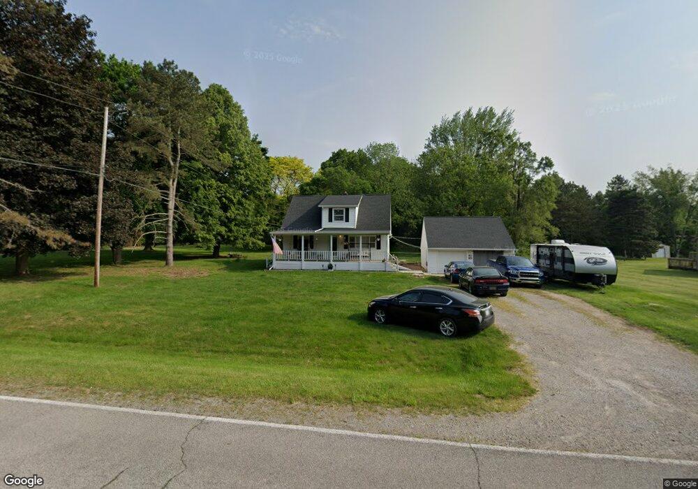
This home is located at 6391 Lucas Rd, Flint, MI 48506 and is currently estimated at $216,736, approximately $123 per square foot. 6391 Lucas Rd is a home located in Genesee County with nearby schools including Weston Elementary School, Leota Fiedler Elementary School, and Kate Dowdall Elementary School.
Ownership History
Date
Name
Owned For
Owner Type
Purchase Details
Closed on
Mar 26, 2025
Sold by
Ruhstorfer Donald and Ruhstorfer Betty
Bought by
Latsch Gerad and Latsch Angella
Current Estimated Value
Home Financials for this Owner
Home Financials are based on the most recent Mortgage that was taken out on this home.
Original Mortgage
$120,000
Outstanding Balance
$118,538
Interest Rate
6.65%
Mortgage Type
New Conventional
Estimated Equity
$98,198
Purchase Details
Closed on
Mar 20, 2014
Sold by
Ruhstorfer Donald and Ruhstorfer Betty
Bought by
Ruhstorfer Donald and Ruhstorfer Betty
Create a Home Valuation Report for This Property
The Home Valuation Report is an in-depth analysis detailing your home's value as well as a comparison with similar homes in the area
Home Values in the Area
Average Home Value in this Area
Purchase History
| Date | Buyer | Sale Price | Title Company |
|---|---|---|---|
| Latsch Gerad | -- | Vantage Point Title | |
| Ruhstorfer Donald | -- | None Available |
Source: Public Records
Mortgage History
| Date | Status | Borrower | Loan Amount |
|---|---|---|---|
| Open | Latsch Gerad | $120,000 |
Source: Public Records
Tax History
| Year | Tax Paid | Tax Assessment Tax Assessment Total Assessment is a certain percentage of the fair market value that is determined by local assessors to be the total taxable value of land and additions on the property. | Land | Improvement |
|---|---|---|---|---|
| 2025 | $1,673 | $122,000 | $0 | $0 |
| 2024 | $456 | $113,300 | $0 | $0 |
| 2023 | $435 | $98,400 | $0 | $0 |
| 2022 | $1,368 | $90,000 | $0 | $0 |
| 2021 | $1,356 | $81,800 | $0 | $0 |
| 2020 | $398 | $73,400 | $0 | $0 |
| 2019 | $392 | $65,400 | $0 | $0 |
| 2018 | $1,287 | $56,500 | $0 | $0 |
| 2017 | $1,233 | $57,100 | $0 | $0 |
| 2016 | $1,223 | $52,600 | $0 | $0 |
| 2015 | $1,083 | $47,900 | $0 | $0 |
| 2014 | $362 | $41,400 | $0 | $0 |
| 2012 | -- | $30,200 | $30,200 | $0 |
Source: Public Records
Map
Nearby Homes
- 5412 E Stanley Rd
- 6076 E Carpenter Rd
- 254 Green Valley Rd
- 7368 Vassar Rd
- 312 Black Oak Ct
- 6478 Oxbow Ln
- 18 Timber Ct
- 475 White Willow Dr
- 6274 Cree Ct
- 654 Basswood Ct
- 649 Basswood Ct
- 5131 E Carpenter Rd
- 5492 N Genesee Rd
- 6065 N Genesee Rd
- 0 N Genesee Rd Unit 50142777
- 1240 N Irish Rd
- 6312 Tamara Dr
- 4455 Burgundy Dr
- 5165 N Irish Rd
- 5177 N Irish Rd
Your Personal Tour Guide
Ask me questions while you tour the home.