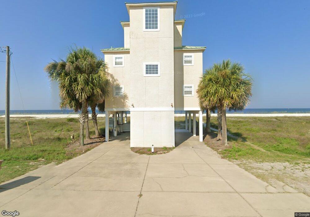
6391 W Highway 98 Port St. Joe, FL 32456
Saint Joe Beach NeighborhoodEstimated Value: $1,485,000 - $2,143,000
3
Beds
3
Baths
2,491
Sq Ft
$722/Sq Ft
Est. Value
About This Home
This home is located at 6391 W Highway 98, Port St. Joe, FL 32456 and is currently estimated at $1,797,931, approximately $721 per square foot. 6391 W Highway 98 is a home located in Gulf County.
Ownership History
Date
Name
Owned For
Owner Type
Purchase Details
Closed on
Jun 25, 2007
Sold by
Newman George Stephens
Bought by
The Ausmac Group Llc
Current Estimated Value
Purchase Details
Closed on
Apr 17, 2001
Sold by
Rozier Charles R
Bought by
Newman George Stephens
Home Financials for this Owner
Home Financials are based on the most recent Mortgage that was taken out on this home.
Original Mortgage
$400,000
Interest Rate
6.98%
Purchase Details
Closed on
Nov 8, 2000
Sold by
Reynoldsd B K
Bought by
Rozier Charles R
Purchase Details
Closed on
Jan 13, 2000
Sold by
Northwest Florida Housing Corp
Bought by
Reynolds B K
Create a Home Valuation Report for This Property
The Home Valuation Report is an in-depth analysis detailing your home's value as well as a comparison with similar homes in the area
Home Values in the Area
Average Home Value in this Area
Purchase History
| Date | Buyer | Sale Price | Title Company |
|---|---|---|---|
| The Ausmac Group Llc | $1,200,000 | Attorney | |
| The Ausmac Group Llc | $1,200,000 | Attorney | |
| Newman George Stephens | $320,000 | -- | |
| Rozier Charles R | $275,000 | -- | |
| Reynolds B K | $275,000 | -- |
Source: Public Records
Mortgage History
| Date | Status | Borrower | Loan Amount |
|---|---|---|---|
| Previous Owner | Newman George Stephens | $400,000 |
Source: Public Records
Tax History Compared to Growth
Tax History
| Year | Tax Paid | Tax Assessment Tax Assessment Total Assessment is a certain percentage of the fair market value that is determined by local assessors to be the total taxable value of land and additions on the property. | Land | Improvement |
|---|---|---|---|---|
| 2024 | $14,446 | $1,596,360 | $1,085,000 | $511,360 |
| 2023 | $13,951 | $1,464,743 | $945,000 | $519,743 |
| 2022 | $12,426 | $1,213,974 | $700,000 | $513,974 |
| 2021 | $10,431 | $872,914 | $532,000 | $340,914 |
| 2020 | $9,374 | $743,784 | $532,000 | $211,784 |
| 2019 | $7,905 | $561,784 | $350,000 | $211,784 |
| 2018 | $10,352 | $725,302 | $0 | $0 |
| 2017 | $9,896 | $729,948 | $0 | $0 |
| 2016 | $8,903 | $598,913 | $0 | $0 |
| 2015 | $9,180 | $602,349 | $0 | $0 |
| 2014 | $8,705 | $605,785 | $0 | $0 |
Source: Public Records
Map
Nearby Homes
- 130 Pine St
- 132 Pine St
- 130 Atlantic St
- 138 Atlantic St
- Lot 16 Bay St
- 6626 W Highway 98
- 227 Bay St
- 8135 Americus Ave
- 253 Canal St
- 14/15 Atlantic St
- 6535 Alabama Ave
- 288 Sea Tern Ln
- 264 Sea Tern Ln
- 270 Sea Tern Ln
- 274 Sea Tern Ln
- 278 Sea Tern Ln
- 282 Sea Tern Ln
- 217 Gulf St
- 6824 W Highway 98
- TBD Selma St
- 6426 W Highway 98
- 6408 W Highway 98
- 6336 W Highway 98
- 6414 W Highway 98
- 6330 W Highway 98
- 6330 Hwy 98
- 112 Canal St
- 6324 W Highway 98
- 6420 W Highway 98
- 119 Canal St
- 6318 W Highway 98
- 118 Canal St
- 6428 W Highway 98
- 6312 W Highway 98
- 6501 W Highway 98
- 130 Canal St
- 6312 W Highway 98
- 6303 W Highway 98
- 124 Bay St
- 117 Pine St