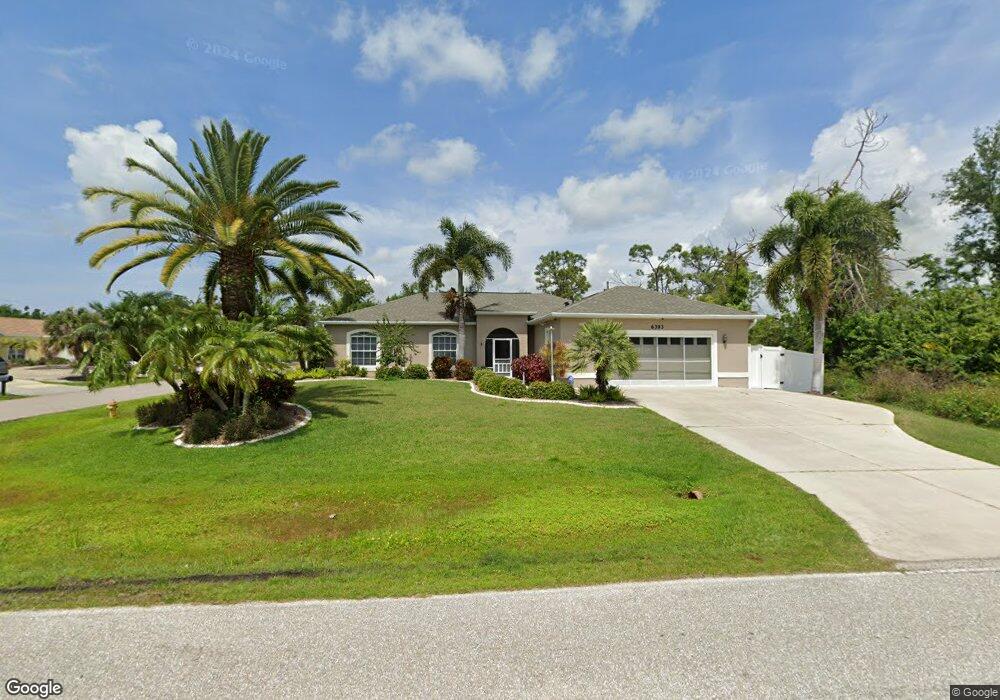
6393 David Blvd Unit A & B Port Charlotte, FL 33981
Gulf Cove NeighborhoodEstimated Value: $339,000 - $489,000
4
Beds
4
Baths
922
Sq Ft
$434/Sq Ft
Est. Value
About This Home
This home is located at 6393 David Blvd Unit A & B, Port Charlotte, FL 33981 and is currently estimated at $399,688, approximately $433 per square foot. 6393 David Blvd Unit A & B is a home located in Charlotte County with nearby schools including Myakka River Elementary School, L.A. Ainger Middle School, and Lemon Bay High School.
Ownership History
Date
Name
Owned For
Owner Type
Purchase Details
Closed on
Mar 29, 2013
Sold by
Brooks Bryan and Brooks Beth
Bought by
Bonner Joseph and Bonner Diane
Current Estimated Value
Purchase Details
Closed on
Apr 26, 2012
Sold by
Charette Donald T and Charette Joanne F
Bought by
Bonner Joseph and Bonner Diane
Purchase Details
Closed on
Sep 30, 2004
Sold by
Holley Frank
Bought by
Charette Donald L and Charette Joanne F
Home Financials for this Owner
Home Financials are based on the most recent Mortgage that was taken out on this home.
Original Mortgage
$160,000
Interest Rate
6%
Mortgage Type
Purchase Money Mortgage
Purchase Details
Closed on
Jun 18, 2004
Sold by
Holley Frank and Wise Donald A
Bought by
Holley Frank
Purchase Details
Closed on
Oct 9, 2003
Sold by
Real Est Related Inc
Bought by
Holley Frank and Wise Donald A
Create a Home Valuation Report for This Property
The Home Valuation Report is an in-depth analysis detailing your home's value as well as a comparison with similar homes in the area
Home Values in the Area
Average Home Value in this Area
Purchase History
| Date | Buyer | Sale Price | Title Company |
|---|---|---|---|
| Bonner Joseph | $5,000 | Fidelity Natl Title Fl Inc | |
| Bonner Joseph | $150,000 | Suncoast One Title Inc | |
| Charette Donald L | $35,000 | Westco Title Services Inc | |
| Holley Frank | -- | Westco Title Services Inc | |
| Holley Frank | -- | -- | |
| Holley Frank | $6,800 | -- |
Source: Public Records
Mortgage History
| Date | Status | Borrower | Loan Amount |
|---|---|---|---|
| Previous Owner | Charette Donald L | $160,000 |
Source: Public Records
Tax History Compared to Growth
Tax History
| Year | Tax Paid | Tax Assessment Tax Assessment Total Assessment is a certain percentage of the fair market value that is determined by local assessors to be the total taxable value of land and additions on the property. | Land | Improvement |
|---|---|---|---|---|
| 2023 | $4,345 | $237,093 | $0 | $0 |
| 2022 | $4,147 | $230,187 | $0 | $0 |
| 2021 | $4,149 | $223,483 | $0 | $0 |
| 2020 | $4,160 | $220,397 | $0 | $0 |
| 2019 | $4,046 | $215,442 | $18,743 | $196,699 |
| 2018 | $3,796 | $212,650 | $17,850 | $194,800 |
| 2017 | $3,385 | $174,188 | $5,780 | $168,408 |
| 2016 | $3,283 | $158,188 | $0 | $0 |
| 2015 | $3,032 | $143,807 | $0 | $0 |
| 2014 | $2,849 | $130,734 | $0 | $0 |
Source: Public Records
Map
Nearby Homes
- 6361 David Blvd
- 12361 Prudential Ave
- 12393 Prudential Ave
- 5227 Dayton Ln
- 5413 Dayton Ln
- 12405 Fairwind Ave
- 5321 Crestline Terrace
- 6312 David Blvd
- 5236 Wentworth Rd
- 5266 Crestline Terrace
- 12400 Prudential Ave
- 12376 Prudential Ave
- 5163 Cannon St
- 5479 Brussels Terrace
- 5180 Montego Ln
- 6529 David Blvd
- 4755 Gillot Blvd
- 5129 Rilke Ln
- 5388 Gulfport and Others Terrace
- 5289 Gillot Blvd
- 6393 David Blvd
- 6385 David Blvd
- 12327 Prudential Ave
- 6377 David Blvd
- 5243 Dayton Ln
- 5235 Dayton Ln
- 6392 David Blvd
- 6384 David Blvd
- 6408 David Blvd
- 5259 Dayton Ln
- 6369 David Blvd
- 6376 David Blvd
- 12353 Prudential Ave
- 5284 White Ave
- 6361 David Blvd Unit 19
- 5315 Wentworth Rd
- 5276 White Ave
- 5312 White Ave
- 5267 Dayton Ln