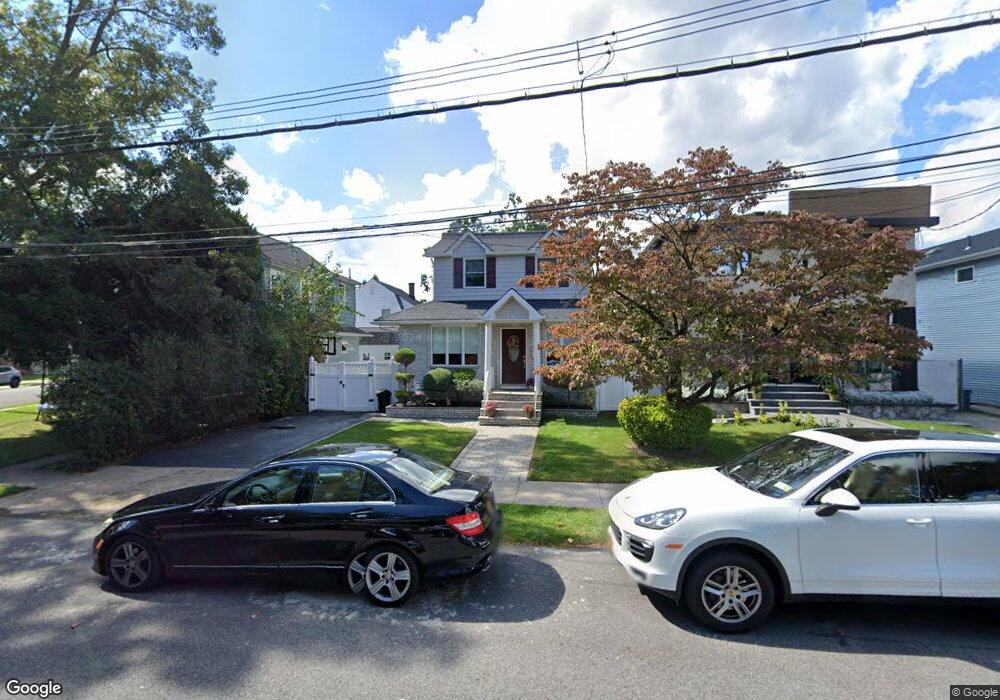
64 Colon Ave Staten Island, NY 10308
Great Kills NeighborhoodEstimated Value: $589,915 - $876,000
--
Bed
4
Baths
1,054
Sq Ft
$656/Sq Ft
Est. Value
About This Home
This home is located at 64 Colon Ave, Staten Island, NY 10308 and is currently estimated at $691,479, approximately $656 per square foot. 64 Colon Ave is a home located in Richmond County with nearby schools including P.S. 32 The Gifford School, Myra S. Barnes Intermediate School 24, and New Dorp High School.
Ownership History
Date
Name
Owned For
Owner Type
Purchase Details
Closed on
Feb 20, 2002
Sold by
Scotto Thomas and Scotto Anthony
Bought by
Licciardello Anthony M and Licciardello Josephine
Current Estimated Value
Home Financials for this Owner
Home Financials are based on the most recent Mortgage that was taken out on this home.
Original Mortgage
$160,000
Interest Rate
7.05%
Mortgage Type
Purchase Money Mortgage
Create a Home Valuation Report for This Property
The Home Valuation Report is an in-depth analysis detailing your home's value as well as a comparison with similar homes in the area
Home Values in the Area
Average Home Value in this Area
Purchase History
| Date | Buyer | Sale Price | Title Company |
|---|---|---|---|
| Licciardello Anthony M | $180,000 | -- |
Source: Public Records
Mortgage History
| Date | Status | Borrower | Loan Amount |
|---|---|---|---|
| Previous Owner | Licciardello Anthony M | $160,000 |
Source: Public Records
Tax History Compared to Growth
Tax History
| Year | Tax Paid | Tax Assessment Tax Assessment Total Assessment is a certain percentage of the fair market value that is determined by local assessors to be the total taxable value of land and additions on the property. | Land | Improvement |
|---|---|---|---|---|
| 2025 | $5,819 | $35,700 | $10,606 | $25,094 |
| 2024 | $5,831 | $35,700 | $10,006 | $25,694 |
| 2023 | $5,535 | $28,656 | $8,721 | $19,935 |
| 2022 | $5,112 | $31,620 | $11,760 | $19,860 |
| 2021 | $5,388 | $30,960 | $11,760 | $19,200 |
| 2020 | $5,383 | $28,680 | $11,760 | $16,920 |
| 2019 | $5,002 | $29,760 | $11,760 | $18,000 |
| 2018 | $4,570 | $23,880 | $11,760 | $12,120 |
| 2017 | $4,294 | $22,536 | $11,297 | $11,239 |
| 2016 | $4,195 | $22,536 | $11,154 | $11,382 |
| 2015 | $3,744 | $22,366 | $9,114 | $13,252 |
| 2014 | $3,744 | $21,100 | $9,743 | $11,357 |
Source: Public Records
Map
Nearby Homes
- 17 Wilson Ave
- 21 Wilson Ave
- 68 Margaret St
- 12 Saccheri Ct
- 67 Wilson Ave
- 221 B Katan Ave
- 4157 Amboy Rd Unit H
- 52 Pleasant St
- 28 N Rhett Ave
- 4189 Amboy Rd Unit 1B
- 108 Giffords Ln
- 43 Fern Ave
- 4219 Amboy Rd Unit 4
- 151 Abingdon Ave
- 15 Woodland Ave
- 63 Genesee Ave
- 114 Holly Ave
- 96 Genesee Ave
- 223 Abingdon Ave
- 107 Oakdale St