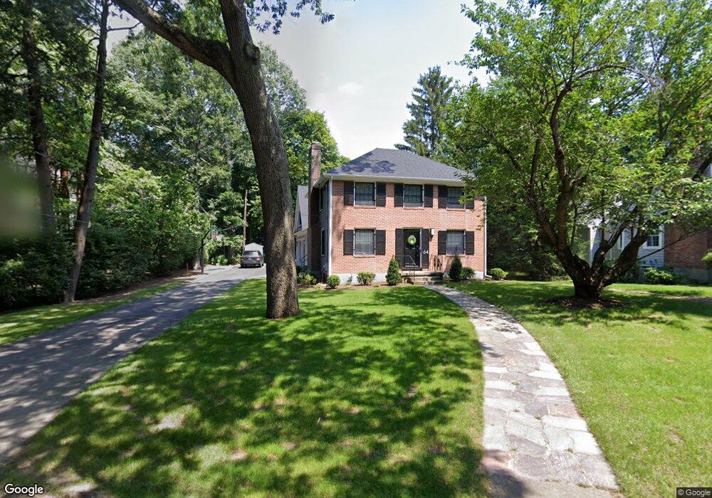
64 Columbine Rd Milton, MA 02186
Columbine Cliffs NeighborhoodEstimated Value: $1,584,000 - $2,002,000
4
Beds
3
Baths
2,344
Sq Ft
$748/Sq Ft
Est. Value
About This Home
This home is located at 64 Columbine Rd, Milton, MA 02186 and is currently estimated at $1,753,183, approximately $747 per square foot. 64 Columbine Rd is a home located in Norfolk County with nearby schools including Milton High School, St. Mary of the Hills School, and Saint John Paul II Catholic Academy.
Ownership History
Date
Name
Owned For
Owner Type
Purchase Details
Closed on
Apr 13, 2021
Sold by
Deal Andrew F and Deal Cynthia C
Bought by
Andrew F Deal T
Current Estimated Value
Purchase Details
Closed on
Jul 1, 2005
Sold by
Annunziato Carla and Bird Trevor H
Bought by
Deal Andrew F and Deal Cynthia C
Home Financials for this Owner
Home Financials are based on the most recent Mortgage that was taken out on this home.
Original Mortgage
$275,000
Interest Rate
5.73%
Mortgage Type
Purchase Money Mortgage
Purchase Details
Closed on
Dec 23, 2002
Sold by
Bolden Michael C and Bolden Tracey A
Bought by
Annunziato Carla and Bird Trevor H
Home Financials for this Owner
Home Financials are based on the most recent Mortgage that was taken out on this home.
Original Mortgage
$456,000
Interest Rate
6.16%
Mortgage Type
Purchase Money Mortgage
Purchase Details
Closed on
Jun 7, 1994
Sold by
Narnell Peter R and Narnell Kathleen B
Bought by
Bolden Michael C and Bolden Tracey A
Create a Home Valuation Report for This Property
The Home Valuation Report is an in-depth analysis detailing your home's value as well as a comparison with similar homes in the area
Home Values in the Area
Average Home Value in this Area
Purchase History
| Date | Buyer | Sale Price | Title Company |
|---|---|---|---|
| Andrew F Deal T | -- | None Available | |
| Deal Andrew F | $787,500 | -- | |
| Annunziato Carla | $570,000 | -- | |
| Bolden Michael C | $290,000 | -- |
Source: Public Records
Mortgage History
| Date | Status | Borrower | Loan Amount |
|---|---|---|---|
| Previous Owner | Bolden Michael C | $320,000 | |
| Previous Owner | Deal Andrew F | $275,000 | |
| Previous Owner | Deal Andrew F | $312,000 | |
| Previous Owner | Annunziato Carla | $456,000 | |
| Previous Owner | Bolden Michael C | $327,000 |
Source: Public Records
Tax History Compared to Growth
Tax History
| Year | Tax Paid | Tax Assessment Tax Assessment Total Assessment is a certain percentage of the fair market value that is determined by local assessors to be the total taxable value of land and additions on the property. | Land | Improvement |
|---|---|---|---|---|
| 2025 | $17,396 | $1,568,600 | $667,200 | $901,400 |
| 2024 | $16,784 | $1,537,000 | $635,600 | $901,400 |
| 2023 | $16,275 | $1,427,600 | $605,200 | $822,400 |
| 2022 | $15,524 | $1,244,900 | $605,200 | $639,700 |
| 2021 | $15,260 | $1,162,200 | $553,000 | $609,200 |
| 2020 | $15,134 | $1,153,500 | $552,900 | $600,600 |
| 2019 | $11,533 | $875,000 | $536,800 | $338,200 |
| 2018 | $10,298 | $745,700 | $415,300 | $330,400 |
| 2017 | $9,636 | $710,600 | $395,500 | $315,100 |
| 2016 | $8,840 | $654,800 | $346,100 | $308,700 |
| 2015 | $8,463 | $607,100 | $296,600 | $310,500 |
Source: Public Records
Map
Nearby Homes
- 15 Cantwell Rd
- 32 Columbine Rd
- 333 Eliot St
- 290 Central Ave
- 20 Herrick Dr
- 15 Fairfax Rd
- 390 Central Ave
- 214 Brook Rd
- 4 School St
- 27 Hawthorn Rd
- 438 Central Ave Unit 2
- 131 Eliot St Unit 312
- 131 Eliot St Unit 408
- 131 Eliot St Unit 305
- 10 Briarcliff Terrace
- 137 Thacher St Unit 137
- 96 Houston Ave
- 24 Constitution Rd
- 19 Lantern Ln
- 128 Blue Hills Pkwy
- 68 Columbine Rd
- 72 Columbine Rd
- 60 Columbine Rd
- 57 Columbine Rd
- 78 Columbine Rd
- 54 Columbine Rd
- 51 Columbine Rd
- 23 Lancaster Ln
- 118 Allerton Rd
- 65 Columbine Rd
- 47 Avalon Rd
- 51 Avalon Rd
- 15 Lancaster Ln
- 16 Cantwell Rd
- 50 Columbine Rd
- 71 Columbine Rd
- 119 Allerton Rd
- 55 Avalon Rd
- 45 Avalon Rd
- 59 Avalon Rd