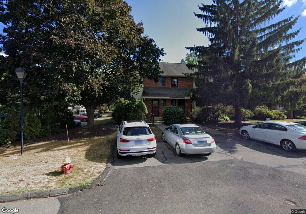
64 Danforth Ln West Hartford, CT 06110
Estimated Value: $289,000 - $312,699
2
Beds
2
Baths
1,278
Sq Ft
$238/Sq Ft
Est. Value
About This Home
This home is located at 64 Danforth Ln, West Hartford, CT 06110 and is currently estimated at $304,425, approximately $238 per square foot. 64 Danforth Ln is a home located in Hartford County with nearby schools including Webster Hill School, Sedgwick Middle School, and Conard High School.
Ownership History
Date
Name
Owned For
Owner Type
Purchase Details
Closed on
Feb 10, 2020
Sold by
Rigatti Steven J
Bought by
Bednarz Adam R
Current Estimated Value
Home Financials for this Owner
Home Financials are based on the most recent Mortgage that was taken out on this home.
Original Mortgage
$171,830
Outstanding Balance
$151,852
Interest Rate
3.5%
Mortgage Type
FHA
Estimated Equity
$152,573
Purchase Details
Closed on
Sep 10, 1996
Sold by
Haverty Timothy J
Bought by
Raymond Mary C
Create a Home Valuation Report for This Property
The Home Valuation Report is an in-depth analysis detailing your home's value as well as a comparison with similar homes in the area
Home Values in the Area
Average Home Value in this Area
Purchase History
| Date | Buyer | Sale Price | Title Company |
|---|---|---|---|
| Bednarz Adam R | $175,000 | None Available | |
| Raymond Mary C | $80,000 | -- |
Source: Public Records
Mortgage History
| Date | Status | Borrower | Loan Amount |
|---|---|---|---|
| Open | Bednarz Adam R | $171,830 | |
| Previous Owner | Raymond Mary C | $85,000 |
Source: Public Records
Tax History
| Year | Tax Paid | Tax Assessment Tax Assessment Total Assessment is a certain percentage of the fair market value that is determined by local assessors to be the total taxable value of land and additions on the property. | Land | Improvement |
|---|---|---|---|---|
| 2025 | $5,423 | $121,100 | $0 | $121,100 |
| 2024 | $5,129 | $121,100 | $0 | $121,100 |
| 2023 | $4,955 | $121,100 | $0 | $121,100 |
| 2022 | $4,926 | $121,100 | $0 | $121,100 |
| 2021 | $4,775 | $112,560 | $0 | $112,560 |
| 2020 | $4,781 | $114,380 | $0 | $114,380 |
| 2019 | $4,579 | $109,550 | $0 | $109,550 |
| 2018 | $4,492 | $109,550 | $0 | $109,550 |
| 2017 | $4,496 | $109,550 | $0 | $109,550 |
| 2016 | $4,137 | $104,720 | $0 | $104,720 |
| 2015 | $4,012 | $104,720 | $0 | $104,720 |
| 2014 | $3,913 | $104,720 | $0 | $104,720 |
Source: Public Records
Map
Nearby Homes
- 19 Vine Hill Rd
- 26 Schoolhouse Dr Unit 204
- 49 Park Place Cir Unit 49
- 106 Grove St
- 27 Burgoyne St Unit E
- 342 S Main St
- 28 Ashford Rd
- 25 Lewis Ln
- 575 S Main St
- 22 Crocker Ave
- 21 Echo Ln
- 38 Mildred Rd
- 574 Quaker Ln S
- 50 Hillcrest Ave
- 69 Edgemere Ave
- 16 Goodsell St
- 125 Newfield Ave
- 161 Abbotsford Ave
- 40 Quincy Ln
- 5 Brinley Ave
- 64 Danforth Ln Unit 64
- 66 Danforth Ln
- 66 Danforth Ln Unit 66
- 62 Danforth Ln
- 68 Danforth Ln
- 68 Danforth Ln Unit 68
- 60 Danforth Ln
- 60 Danforth Ln Unit 60
- 70 Danforth Ln
- 58 Danforth Ln
- 56 Danforth Ln
- 56 Danforth Ln Unit 56
- 54 Danforth Ln
- 52 Danforth Ln
- 40 Danforth Ln
- 48 Danforth Ln
- 46 Danforth Ln
- 46 Danforth Ln Unit 46
- 44 Danforth Ln
- 44 Danforth Ln Unit 44
Your Personal Tour Guide
Ask me questions while you tour the home.