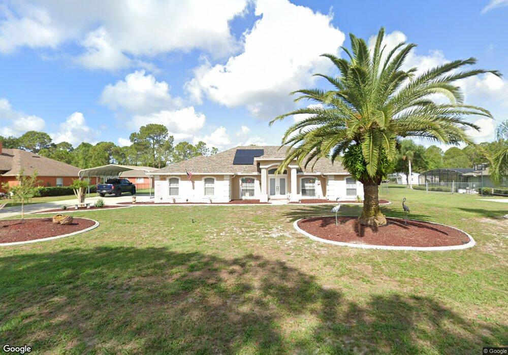
64 Dial Ave Debary, FL 32713
Estimated Value: $510,000 - $525,326
4
Beds
2
Baths
2,250
Sq Ft
$231/Sq Ft
Est. Value
About This Home
This home is located at 64 Dial Ave, Debary, FL 32713 and is currently estimated at $520,332, approximately $231 per square foot. 64 Dial Ave is a home located in Volusia County with nearby schools including Debary Elementary School, River Springs Middle School, and University High School.
Ownership History
Date
Name
Owned For
Owner Type
Purchase Details
Closed on
Jul 13, 2018
Sold by
Wren John E and Wren Brenda W
Bought by
Fehr Todd and Fehr Emily
Current Estimated Value
Home Financials for this Owner
Home Financials are based on the most recent Mortgage that was taken out on this home.
Original Mortgage
$299,669
Outstanding Balance
$256,562
Interest Rate
4.25%
Mortgage Type
FHA
Estimated Equity
$263,770
Purchase Details
Closed on
Jul 24, 2015
Sold by
Marchese Rosalie and Marchese Salvatore
Bought by
Wren John E and Wren Brenda W
Purchase Details
Closed on
Dec 10, 2001
Sold by
Camry Homes Inc
Bought by
Marchese Rosalie
Home Financials for this Owner
Home Financials are based on the most recent Mortgage that was taken out on this home.
Original Mortgage
$155,625
Interest Rate
6.5%
Create a Home Valuation Report for This Property
The Home Valuation Report is an in-depth analysis detailing your home's value as well as a comparison with similar homes in the area
Home Values in the Area
Average Home Value in this Area
Purchase History
We collect this data history from publicly available records. To have your information removed, we recommend requesting removal directly through your county’s website.
| Date | Buyer | Sale Price | Title Company |
|---|---|---|---|
| Fehr Todd | $310,000 | First American Title Insuran | |
| Wren John E | $275,000 | First American Title Ins Co | |
| Marchese Rosalie | $35,000 | -- |
Source: Public Records
Mortgage History
We collect this data history from publicly available records. To have your information removed, we recommend requesting removal directly through your county’s website.
| Date | Status | Borrower | Loan Amount |
|---|---|---|---|
| Open | Fehr Todd | $299,669 | |
| Previous Owner | Marchese Rosalie | $155,625 |
Source: Public Records
Tax History
| Year | Tax Paid | Tax Assessment Tax Assessment Total Assessment is a certain percentage of the fair market value that is determined by local assessors to be the total taxable value of land and additions on the property. | Land | Improvement |
|---|---|---|---|---|
| 2026 | $3,683 | $259,643 | -- | -- |
| 2025 | $3,683 | $252,817 | -- | -- |
| 2024 | $3,330 | $245,692 | -- | -- |
| 2023 | $3,330 | $238,536 | $0 | $0 |
| 2022 | $3,254 | $231,588 | $0 | $0 |
| 2021 | $3,367 | $224,843 | $0 | $0 |
| 2020 | $3,340 | $221,739 | $0 | $0 |
| 2019 | $3,414 | $211,247 | $0 | $0 |
| 2018 | $2,590 | $168,047 | $0 | $0 |
| 2017 | $2,634 | $164,591 | $0 | $0 |
| 2016 | $2,530 | $161,206 | $0 | $0 |
| 2015 | $1,928 | $153,937 | $0 | $0 |
| 2014 | $1,950 | $152,715 | $0 | $0 |
Source: Public Records
Map
Nearby Homes
- 73 Sanctuary Ave
- 0 Sanctuary Ave Unit MFRO6276050
- 205 Sher Ln
- 116 Traders Cove Blvd
- 104 Admiral Ln
- 116 Sher Ln
- 160 Deerpath Rd
- 299 Lazio Cir
- 101 Philippe Ct
- 168 Community Dr
- 13 Gracie Rd
- 127 Verde Way
- 135 Ancona Ave
- 163 Ancona Ave
- 175 Ancona Ave
- 162 Seminole Ave
- 114 San Lucia Dr
- 150 Catalina Dr
- 26 Canter Club Ct
- 281 Ancona Ave
Your Personal Tour Guide
Ask me questions while you tour the home.