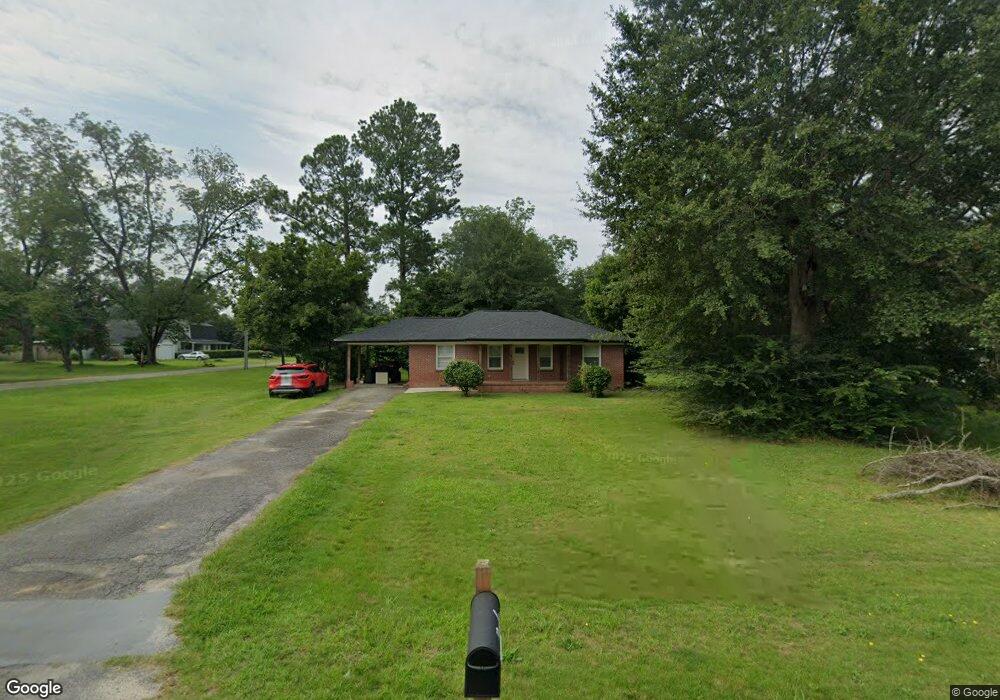
64 E Calhoun St Reynolds, GA 31076
Estimated Value: $80,000 - $91,564
--
Bed
--
Bath
1,148
Sq Ft
$75/Sq Ft
Est. Value
About This Home
This home is located at 64 E Calhoun St, Reynolds, GA 31076 and is currently estimated at $86,391, approximately $75 per square foot. 64 E Calhoun St is a home with nearby schools including Taylor County Upper Elementary School, Taylor County Primary School, and Taylor County Middle School.
Ownership History
Date
Name
Owned For
Owner Type
Purchase Details
Closed on
May 14, 2019
Sold by
Hinton James Kimble Estate
Bought by
Danley Christopher Ronald and Danley Brittany Nicole
Current Estimated Value
Home Financials for this Owner
Home Financials are based on the most recent Mortgage that was taken out on this home.
Original Mortgage
$55,541
Interest Rate
4.1%
Mortgage Type
Commercial
Purchase Details
Closed on
Sep 24, 2003
Sold by
Hinton Daniel Z
Bought by
Jinton James K
Create a Home Valuation Report for This Property
The Home Valuation Report is an in-depth analysis detailing your home's value as well as a comparison with similar homes in the area
Home Values in the Area
Average Home Value in this Area
Purchase History
| Date | Buyer | Sale Price | Title Company |
|---|---|---|---|
| Danley Christopher Ronald | $40,000 | -- | |
| Jinton James K | -- | -- |
Source: Public Records
Mortgage History
| Date | Status | Borrower | Loan Amount |
|---|---|---|---|
| Closed | Danley Christopher Ronald | $55,541 |
Source: Public Records
Tax History Compared to Growth
Tax History
| Year | Tax Paid | Tax Assessment Tax Assessment Total Assessment is a certain percentage of the fair market value that is determined by local assessors to be the total taxable value of land and additions on the property. | Land | Improvement |
|---|---|---|---|---|
| 2024 | $1,203 | $31,924 | $3,520 | $28,404 |
| 2023 | $1,033 | $25,484 | $3,520 | $21,964 |
| 2022 | $608 | $24,164 | $3,520 | $20,644 |
| 2021 | $586 | $22,764 | $3,520 | $19,244 |
| 2020 | $591 | $22,764 | $3,520 | $19,244 |
| 2019 | $573 | $21,844 | $3,520 | $18,324 |
| 2018 | $751 | $21,844 | $3,520 | $18,324 |
| 2017 | $587 | $22,906 | $5,700 | $17,206 |
| 2016 | $612 | $23,797 | $5,700 | $18,097 |
| 2015 | -- | $23,797 | $5,700 | $18,097 |
| 2014 | -- | $24,474 | $4,800 | $19,674 |
| 2013 | -- | $26,104 | $5,600 | $20,504 |
Source: Public Records
Map
Nearby Homes
- 29 Mimms St
- 46 E Calhoun St
- 25 W Marion St
- 67 N Collins St
- 9 Friar Tuck Rd
- 0 Briar Patch Way Unit 10546919
- 160 Underwood Rd
- 30 Potterville Main St
- 30 Pottervile Main St
- 296 Boxwood Rd
- Cummings Rd
- 708 Tommy Purvis Junior Rd
- 1800 Cummings Rd
- 246 Wilville Rd
- 000 Avera Rd
- Parcel 6 Carl Rogers Rd
- Parcel 13 Carl Rogers Rd
- Parcel 8 Carl Rogers Rd
- Parcel 5 Carl Rogers Rd
- Parcel 7 Carl Rogers Rd